Snow and Ice Outlook
Little to no accumulation
Snow
Started
Start
8:00 AM
Friday, 1/30
End
5:00 PM
Friday, 1/30
Snowfall Amount Probability
Upcoming Snow and Ice
Little to no accumulation
Snow
Upcoming
Start
2:00 AM
Monday, 2/2
End
7:00 AM
Monday, 2/2
See probabilities
Snowfall Amount Probability
Live Blog
Russia town buried by 8 feet of snow

Latest Entry
Russia's Kamchatka Peninsula buried in 8 feet of snow
6 days ago

EXPERT FORECAST NEW
Updated January 30, 2026
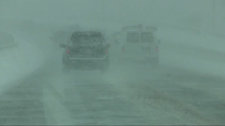
Chicago: More snow showers to bring slippery travel
In response to a new developing storm along the Atlantic coast and a fresh surge of Arctic air, lake-effect flurries, snow showers and heavy bands of snow will occur off Lake Michigan and affect the Chicago area. Snow will produce slippery roads and delays at the airports due to deicing operations through Saturday midday. Heavier snow is forecast to fall in northwestern Indiana, where bands of lake-effect snow will be most persistent. The lake-effect band has the potential to move into downtown Chicago for a time and higher snow totals are possible.
Snowfall Accumulation

Temperature and Wind

Risk to Life and Property
Rainfall
Max Sustained Winds
Max Wind Gusts
Storm Surge
Total snow accumulation
> 24in
> 1.2in
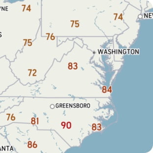
All values are displayed in Fahrenheit. Click on a point for location details.
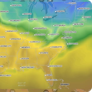
Temperature
-50°F
-20°
10°
40°
70°
100°
130°F
RealFeel®
°
RealFeel Shade™
°
Wind
at
mph
Wind Gusts
mph
Past 24 hr Precipitation
in
See full details
RealFeel®
°
RealFeel Shade™
°
Wind
at
mph
Wind Gusts
mph
Past 24 hr Precipitation
in
See full details
Wind (mph)
<20
20
30
40
50
60
70
>70
Today's Lifestyle Forecast
Snow Day Forecast
Find out how likely school facilities may be closed, due to inclement weather.
Glen Ellyn, IL
60137
Latest in Winter Weather
See More