Spring arrives Friday, and with it comes the next warmup for millions in Northeast, Midwest
Warm air to again surge into the Midwest and Northeast into this weekend with some cities nearing records, but another push of cooler Canadian air will return by early next week as the temperature ups-and-downs continue.
Bernie Rayno breaks down when spring will return to the eastern U.S.
Spring officially arrives Friday, March 20, and for more than 120 million people in the Midwest and Northeast, it should begin to feel like it, as the temperature roller-coaster ride in these regions continues with all its twists and turns.
Cold and warm air will trade places multiple times across the Midwest and Northeast in the coming weeks, a pattern typical of spring.
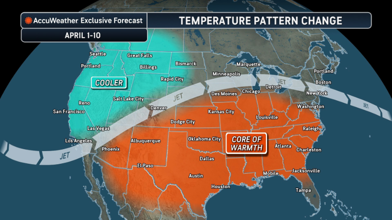
The next rebound in temperatures is already underway in parts of the Midwest and will spread to portions of the Northeast later this week into the weekend as the edge of a massive heat dome in the Southwest expands.
Minneapolis, Chicago and Detroit
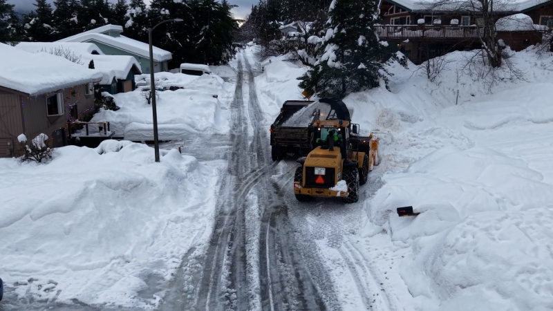
In the wake of the snowstorm that dumped from 1 to 3 feet of snow on parts of the Upper Midwest and delivered a new cold blast of air, temperatures failed to climb out of the teens in Minneapolis Monday and the 20s in Chicago and Detroit Tuesday.
A couple of nuisance clipper storms will affect parts of the Upper Midwest and interior Northeast into the end of the week.
Temperatures are forecast to trend upward across the region into Saturday, reaching the 70s in Minneapolis and mid-60s in Chicago and Detroit. The high in Minneapolis Saturday may challenge a record set in 1938.
Cincinnati and Nashville
Farther south, in Cincinnati, the high was only 26 Tuesday, nearly 20 degrees below the average. In Nashville, temperatures struggled to top 40 degrees Tuesday, compared to the historical average high of 63.

High temperatures in Cincinnati will trend upward into the 70s by Friday. In Nashville, temperatures this weekend are projected to feel more like midsummer, reaching well into the 80s. Highs on both weekend days in the country music capital may challenge records set in 1907.
Some resistance to warmth in the Northeast
Farther to the northeast, the warmup may run into obstacles such as stubborn chilly air lingering over eastern Canada, along with clouds and areas of rain and, in some locations, the cold waters of the North Atlantic. However, with a favorable shift in the breeze for a few hours, warmer air could reach the mid-Atlantic and New England coasts for a time this weekend.

Washington, D.C.
In Washington, D.C., temperatures are expected to rise to near 70 Friday and may approach 80 on Sunday, depending on sunshine and whether a breeze off the chilly Potomac interferes.
New York City
Around New York City, following the coldest day of the week Wednesday with highs in the 30s, temperatures are forecast to rise into the 50s Friday, may hit 60 Saturday and could climb well into the 60s Sunday, despite clouds and a few hours of rain.

Boston
Farther north, in Boston, the warmup will be tempered by lingering chilly air, clouds, spotty rain and the cold Atlantic, as mentioned previously. Temperatures will rebound to near 50 Friday but may be no higher than the 50s for both days of the weekend.
Next batch of cold Canadian air arrives

Later this weekend into early next week, another shift in the jet stream will allow a fresh surge of colder air to spill into the Midwest and Northeast. As colder air begins to push southward. Thunderstorms will erupt along part of the edge. Some of the storms in the Ohio Valley could be severe on Sunday.

The jet stream shift will also cause the heat dome in the Southwest to shrink a bit.
While this air mass may not be as cold as some recent Canadian intrusions, it will mark the end of the warming trend in the Midwest and Northeast and should trim building heat across parts of the Plains.

Additional back-and-forth swings between warm and chilly air will continue into April, especially across the Northeast, Midwest and interior Southeast.


Want next-level safety, ad-free? Unlock advanced, hyperlocal severe weather alerts when you subscribe to Premium+ on the AccuWeather app. AccuWeather Alerts™ are prompted by our expert meteorologists who monitor and analyze dangerous weather risks 24/7 to keep you and your family safer.
Report a Typo