Weekend storms to blast Northeast before pattern flip
Storms packing high winds and flash flooding will sweep away hot air across the Northeast this weekend and will usher in a new weather pattern into early August.
Hot and humid air will fuel thunderstorms across the Northeast before dry weather returns for the second half of the weekend.
A dangerous heat wave will continue this weekend across much of the northeastern United States, but the clock is ticking on the sweltering temperatures and humidity. A strong push of cool air will ignite downpours, gusty thunderstorms and even severe weather across the region this weekend, AccuWeather meteorologists say.
"The aggressive warmth and humidity in the Northeast in recent days will be erased in many areas by the second half of the weekend, bringing some much-needed relief to the region," AccuWeather Senior Meteorologist Courtney Travis said.
A batch of cool air with origins in central Canada will move into the Midwest and Northeast through the weekend. The leading edge of the cool air, marked by a cold front, will push southward across the region.

"After experiencing AccuWeather RealFeel® Temperatures in the upper 90s to low 100s on Saturday in metro areas such as New York City and Philadelphia, humidity levels will drop considerably by Sunday," Travis said. "This will bring RealFeel Temperatures back into the middle to upper 80s for Sunday afternoon."
Farther north and west, such as across New England, not only will AccuWeather RealFeel Temperatures plunge, but actual temperatures Saturday night will also drop into the 50s in some areas.
By Sunday evening, temperatures will slowly fall through the 70s in Philadelphia, New York City and Boston. Even in areas farther to the south, such as in Washington, D.C., lower humidity levels will result in a noticeable Sunday evening cooldown.

Multiple days with highs in the 70s and lows in the 50s are in store for the interior Northeast next week. Along much of the Interstate 95 corridor of the mid-Atlantic, highs in the 80s will be common, and in coastal New England, highs in the 70s to near 80 are likely next week.
Severe weather to rumble over Northeast Saturday
The relief from the heat will not come without some disruptions to travel and outdoor plans.
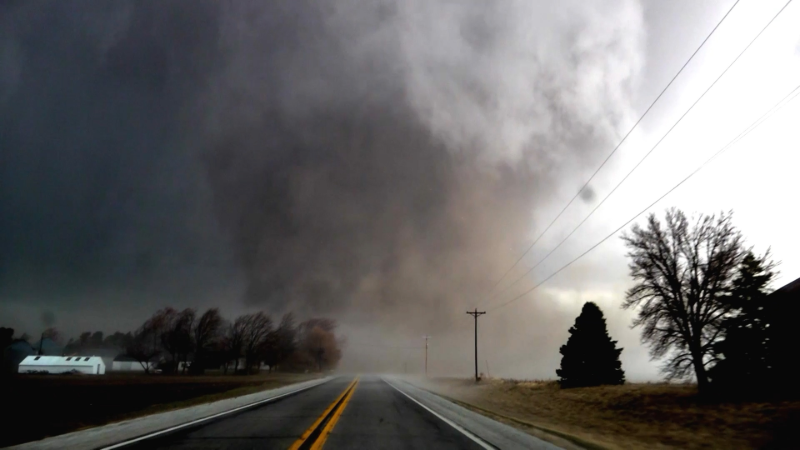
"The same cold front bringing in the cooler air will also produce widespread thunderstorms from New England to parts of the mid-Atlantic, central Appalachians and the Ohio Valley on Saturday," Travis said. "The storms will be severe in some communities with the potential for high winds and torrential downpours."

The storms are unlikely to organize into a solid line that advances across the entire region, meaning that some areas may be missed by potent thunderstorms and may only experience a brief shower or could miss out on the rain entirely.
Where thunderstorms can tap into the heat and high humidity, wind gusts of 60-70 mph will be strong enough to knock down trees and lead to power outages. The downpours may be intense enough to lead to flash flooding, especially in areas where the ground remains saturated from rain in recent weeks or in urban areas.

By Sunday, the main risk of thunderstorms and the potential for severe weather will focus on central and southern Virginia, southern West Virginia, part of the Delmarva Peninsula and North Carolina.
As weak ripples in the jet stream slice southeastward into early next week, brief bands of showers or thunderstorms may develop over the region, especially during the afternoon and evening hours. But even where these occur, much of the time will be free of rain from Sunday to Tuesday.
The return of wildfire smoke?
A side effect of a flow of air from Canada will be the return of smoke from wildfires in some locations.

On multiple occasions this summer and late this past spring, wildfire smoke from Canadian fires was so thick and low-flying that it brought poor visibility and dangerous air quality to the region.
Smoky conditions over the Midwest and parts of the Northeast next week may range from hazy sunshine overhead to the potential for low-level smoke and unhealthy air quality.
Want next-level safety, ad-free? Unlock advanced, hyperlocal severe weather alerts when you subscribe to Premium+ on the AccuWeather app. AccuWeather Alerts™ are prompted by our expert meteorologists who monitor and analyze dangerous weather risks 24/7 to keep you and your family safer.
Report a Typo


