Over 50 million at risk for severe weather on Wednesday
By
Ryan Adamson, AccuWeather meteorologist
Published Jul 22, 2020 10:24 AM EST
After some locations in the mid-Atlantic experienced thunderstorms with damaging winds on Tuesday, meteorologists caution that a much larger area will be at risk for severe thunderstorms into Wednesday evening.
A ripple in the atmosphere moving eastward already sparked heavy thunderstorms from parts of southern Ontario to western New York state, western Pennsylvania, central Ohio and Indiana during Wednesday morning. As this ripple continues to move eastward storms will build into the evening hours from eastern New York state and southwestern New England to West Virginia, eastern Kentucky and southern Ohio.
"A very humid air mass spreading out across the East into Wednesday evening is going to be a key ingredient which will cause some heavy thunderstorms to break out, especially in the central Appalachians and the mid-Atlantic region," said AccuWeather Senior Meteorologist Carl Babinski.
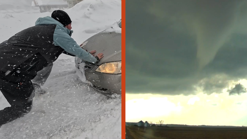
As the storms gain strength, they will primarily be capable of producing flooding downpours and damaging wind gusts. However, hail and even an isolated tornado is not out of the question along portions of the Interstate 76, 80 and 81 corridors.
A severe thunderstorm watch is in effect for a large portion of the Northeast through Wednesday evening, which includes the Interstate 95 corridor from Washington, D.C. through New York City.
More than 56 million are under a slight risk of severe weather on Wednesday, while another 35 million are under a marginal risk, according to the National Weather Service Storm Prediction Center.
CLICK HERE FOR THE FREE ACCUWEATHER APP
"By early Wednesday night, there will be several locations near the I-95 corridor that will get some much-needed relief from intense heat and humidity, but it will come at a price," Babinski noted. "Thunderstorms will be capable of producing damaging wind gusts, as well as a downpour that could cause flash flooding," he said.
After storms move through Washington, D.C., New York City and Philadelphia Wednesday evening, they are likely to weaken somewhat after sunset as they move up into eastern New England. However, any storm can still produce heavy rain well into the nighttime hours.
As a cold front moves eastward on Thursday, locations along the Interstate-95 corridor will again have the potential of severe weather.
Quieter weather is expected over the Northeast on Friday. Farther south, some locations in southern Virginia and North Carolina, may have to contend with thunderstorms, with the main hazard being heavy rain.
Keep checking back on AccuWeather.com and stay tuned to the AccuWeather Network on DirecTV, Frontier and Verizon Fios.
Report a Typo


News / Severe Weather
Over 50 million at risk for severe weather on Wednesday
By Ryan Adamson, AccuWeather meteorologist
Published Jul 22, 2020 10:24 AM EST
After some locations in the mid-Atlantic experienced thunderstorms with damaging winds on Tuesday, meteorologists caution that a much larger area will be at risk for severe thunderstorms into Wednesday evening.
A ripple in the atmosphere moving eastward already sparked heavy thunderstorms from parts of southern Ontario to western New York state, western Pennsylvania, central Ohio and Indiana during Wednesday morning. As this ripple continues to move eastward storms will build into the evening hours from eastern New York state and southwestern New England to West Virginia, eastern Kentucky and southern Ohio.
"A very humid air mass spreading out across the East into Wednesday evening is going to be a key ingredient which will cause some heavy thunderstorms to break out, especially in the central Appalachians and the mid-Atlantic region," said AccuWeather Senior Meteorologist Carl Babinski.
As the storms gain strength, they will primarily be capable of producing flooding downpours and damaging wind gusts. However, hail and even an isolated tornado is not out of the question along portions of the Interstate 76, 80 and 81 corridors.
A severe thunderstorm watch is in effect for a large portion of the Northeast through Wednesday evening, which includes the Interstate 95 corridor from Washington, D.C. through New York City.
More than 56 million are under a slight risk of severe weather on Wednesday, while another 35 million are under a marginal risk, according to the National Weather Service Storm Prediction Center.
CLICK HERE FOR THE FREE ACCUWEATHER APP
"By early Wednesday night, there will be several locations near the I-95 corridor that will get some much-needed relief from intense heat and humidity, but it will come at a price," Babinski noted. "Thunderstorms will be capable of producing damaging wind gusts, as well as a downpour that could cause flash flooding," he said.
After storms move through Washington, D.C., New York City and Philadelphia Wednesday evening, they are likely to weaken somewhat after sunset as they move up into eastern New England. However, any storm can still produce heavy rain well into the nighttime hours.
Related:
As a cold front moves eastward on Thursday, locations along the Interstate-95 corridor will again have the potential of severe weather.
Quieter weather is expected over the Northeast on Friday. Farther south, some locations in southern Virginia and North Carolina, may have to contend with thunderstorms, with the main hazard being heavy rain.
Keep checking back on AccuWeather.com and stay tuned to the AccuWeather Network on DirecTV, Frontier and Verizon Fios.
Report a Typo