Northeast braces for cold snap and dangerous winds
Cold, harsh winds, snow and possible power outages to sweep across northeastern United States into Monday.
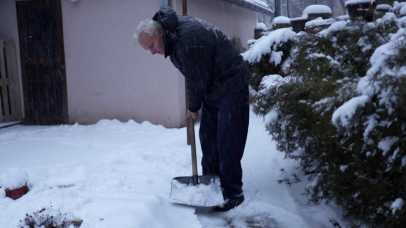
States on the East Coast and in the Northeast experienced heavy rain, flooding and periods of snow over the weekend.
As much colder air continues to move in behind the latest rainstorm to affect the Northeast this weekend, winds will howl, and snow flurries will fly.
As winds howl, trees may topple, power may flicker
Following areas of drenching rain and even thunderstorm on Saturday night, depending on location, the intensifying storm will continue to crank up the wind from the west and northwest into Monday. Winds may get strong enough to trigger power outages.
There have not been many strong wind events this past winter in the Northeast. In parts of the mid-Atlantic, this past winter may have had the least amount of wind since the winter of 1940-41, according to Climatologist Brian BrettSchneider, Ph.D.

Wind gusts frequented 40-50 mph from the central Great Lakes to the central Appalachians and mid-Atlantic coast on Sunday before expanding to New England by Sunday night.
The strong winds quickly eased around the central Great Lakes Sunday night, but will continue over the rest of the region on Monday. Wind gusts may be at their peak on Monday from the central Appalachians and the mid-Atlantic to New England.
It may take until Monday night and Tuesday before the harsh winds ease over the rest of the Northeast. Wind gusts may be strong enough to break tree limbs and knock over poorly rooted trees. The combination of wet soil conditions, thawed ground from the lack of cold this winter and branches gaining weight from the flow of sap may increase the number of trees that topple.
Rush of cold air to trigger flurries and squalls
Rain transitioned to snow over the higher ground and parts of the eastern Great Lakes, Alleghenies and New England Saturday night.

As colder air continued to drill in over the interior Northeast throughout the day and into the evening, snow picked up in intensity over the higher terrain of the central Appalachians and eastern Great Lakes. Accumulating snow ramped up quickly on grassy surfaces over higher elevations, where some roads also become slushy and slippery in spots.
"At least six inches of wet snow will accumulate on grassy areas over the ridges into Monday, mainly over the Adirondack, Green and White mountains," AccuWeather Senior Meteorologist Brett Anderson said. Up to a few inches of snow also fell on the Alleghenies from West Virginia to western Pennsylvania.
"The snow may provide a boost to ski resorts in the region following a week where a significant thaw has occurred," Anderson added. This includes areas in western New York and northern New England.

The snowfall was more spotty over the intermediate and lower elevations of the interior Northeast, and no accumulating snow occurred along Interstate 95 due to warm surfaces.
"As a strong disturbance at the middle levels of the atmosphere rolled through, it enhanced shower activity to the point of triggering squalls from the central Appalachians to parts of the mid-Atlantic and southern New England," AccuWeather Senior Meteorologist Dave Dombek said.
Snow squalls resulted in spotty quick coatings even at some lower elevations from central Pennsylvania to central New England from Sunday to Sunday night.

Where the atmosphere was a bit warmer, the squalls were in the form of mixed rain and wet snow closer to I-95 Sunday night, Dombek said.
By Monday morning, snow showers will quickly taper off for most locations, with the exception of some lingering snow in the higher elevations of northern New England. However, Monday will look and feel more like a midwinter day with AccuWeather RealFeel® Temperatures in the single digits and teens across the interior and the teens and 20s closer to the coast to begin the day.

As the cold winds ease, temperatures will rebound from west to east across the Great Lakes and Northeast from Tuesday to Wednesday.
Millions in the region will be looking forward to the extended stretch of dry weather that may last from Tuesday to Thursday over the Northeast.


Want next-level safety, ad-free? Unlock advanced, hyperlocal severe weather alerts when you subscribe to Premium+ on the AccuWeather app. AccuWeather Alerts™ are prompted by our expert meteorologists who monitor and analyze dangerous weather risks 24/7 to keep you and your family safer.
Report a Typo