Northwest US flooding rainstorms take a break, but not for long as Pineapple Express looms
Western Washington will get a much-needed break from torrential rain into this weekend. However, more rain is lurking over the Pacific and storms will return with a dreaded Pineapple Express forecast for this week.
U.S. Coast Guard aircrews rescued four people from a flooded home in Sumas, Washington, on Wednesday amid historic regional flooding. Teams from Air Stations Port Angeles and Astoria safely hoisted the individuals and transferred them to EMS.
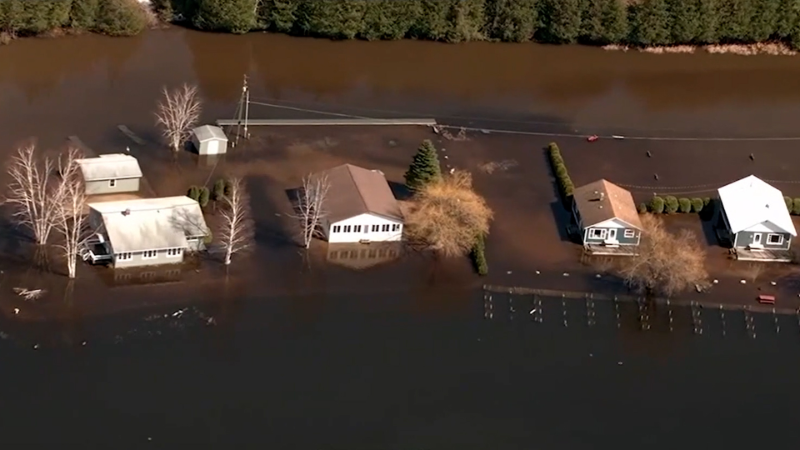
A series of storms with atmospheric rivers has delivered months' worth of rain in a matter of days, unleashing historic flooding and damaging mudslides in portions of western Washington.
A break from the heavy rain has begun, but another firehose of rain will douse the region this week. AccuWeather meteorologists warn that flooding may resume in Washington and expand farther south into Oregon and Northern California.

This image of a mudslide along Interstate 90 in King County, Washington, was captured on Dec. 10, 2025. (Photo by Trooper Rick Johnson)
As much as a foot and a half of rain earlier this week pushed multiple rivers to major flood stage and even record-high levels. Now that the rain has tapered off, rivers have receded somewhat in the lower, flatter elevations for the start of the weekend. Rivers have already receded over the higher and intermediate elevations, where the terrain is steep.
On Sunday, storms will track farther north and across British Columbia, providing a brief respite from the incredibly wet weather.

The tails of the storms will bring showers to western and northern Washington. While this will not be the type of rainfall that significantly exacerbates flooding problems, the saturated state of the ground has left some hillsides top-heavy and unstable. Mudslides and other debris flows will remain a possibility through the weekend.
Although a break in the storms is in progress, a resumption of heavy rain can rapidly escalate to major flooding and a high risk of mudslides early this week.

"There is an indication that a new atmospheric river will develop and extend all the way from near Hawaii to the coastal areas of the Northwest on Monday," AccuWeather Senior Meteorologist Brett Anderson said. "This setup is sometimes referred to as the Pineapple Express."
The period of heaviest rain may last only a day or two in portions of Washington before shifting slowly south into Oregon and then Northern California.
However, like the rain this past week in western Washington, the rain is likely to be heavy enough to expand the flooding and mudslide risk farther south.

From Monday to early Wednesday morning, many places will pick up another couple of inches of rain. More rainfall is expected in the upslope areas of the Cascades and on the Olympic Peninsula, with 2-4 inches possible. The AccuWeather Local StormMax™ for this event is 8 inches.
The southward press of colder air is expected to begin this week. Snow levels are likely to dip to and perhaps below pass levels in Washington and Oregon. This will lead to more wintry conditions in addition to the ongoing risk of flooding and mudslides in the Cascades and foothills.
The stormy conditions from Washington to Northern and Central California are likely to persist from this week to the days leading up to Christmas.

Want next-level safety, ad-free? Unlock advanced, hyperlocal severe weather alerts when you subscribe to Premium+ on the AccuWeather app. AccuWeather Alerts™ are prompted by our expert meteorologists who monitor and analyze dangerous weather risks 24/7 to keep you and your family safer.
Report a Typo


