All my Hurricane Katrina blogs
This blog entry contains 54 blog entries that I wrote about Hurricane Katrina (32 in 2005 and 22 follow-ups in the years since), all on one page. Each entry was originally a blog entry found at "Community.AccuWeather.com" where I had just started as the first weather blogger on AccuWeather.com. A screenshot of my blog on August 25, 2005 is shown below.

Times are in the UTC/GMT time zone, so subtract 5 hours for the local time on the East Coast where I was writing from. Most links no longer work and some images are missing.
You may be also interested in these additional Katrina entries I wrote for the 10th anniversary: AccuWeather 38below blog entries on Katrina, and the text blogs on Katrina from AccuWeather's Joe Bastardi, which also contains a transcript of the "Weather Point CounterPoint" video with AccuWeather's Ken Reeves and Dr. Joe Sobel following Hurricane Katrina (scroll down to the bottom of the Joe Bastardi link to see it).
=====================================================
Eyewall Lightning in Katrina
August 25, 2005 12:26 pm
I noticed on RadarPlus this morning that we've got some lightning in the eyewall again with Katrina, as we did with Dennis.

For what it's worth, according to the FAQ hurricanes generally have less than a dozen strokes per hour in the eyewall, with Andrew having 10 or less.
=====================================================
Tornadic Signature & Forecasts Move West
August 25, 2005 1:52 pm
The image below from RadarPlus shows some real nastiness in Katrina's eyewall -- strong rotation and even a momentary tornadic signature (or TVS, the red triangle). Now, bear in mind, the tornado detection algorithms may not work as well with hurricanes but at the very least, there is some brutal weather in that eyewall, so I hope the Miami area is ready.

Note also that model forecasts are trending further west into the Gulf (see Carl's Blog where he has borrowed the tracks from our AccuWeather.com Professional service):

=====================================================
Katrina - 95 mph Gust, Tornado, 20 in. of Rain
August 26, 2005 8:09 am
Just some quick morning stats for Hurricane Katrina.
WINDS & TORNADO: I have been impressed with the wind gusts from this storm. A lot of times you don't see speeds even close to what you'd expect for the storm's category. A 95 mph gust was reported by UM/RSMAS last night. Port Everglades had an unofficial gust to 92 mph and NWS Miami measured an 87 mph gust yesterday evening. Winds have been gusting into the upper 70's mph at the CMAN stations in South Florida overnight. There has been at least one tornado at Key West this morning -- a report has been filed of 11 private aircraft damaged at Marathon airport.
RAIN: 13.24" of rain was reported by Homestead AFB from the storm (you may recall their pounding during Andrew - picture, story). Doppler radar indicates that up to 24 inches may have fallen in the Miami area (see image below from RadarPlus).

DAMAGE & DEATHS: 1.8 million lost power. Several people, unfortunately, have been killed by this storm, mostly by falling trees. I think its quick development and supposed mediocre strength have contributed to this.
=====================================================
Dry Tortugas Station Is Back -- And Just In Time
August 26, 2005 9:22 am
The National Weather Service issued this statement yesterday noting that the C-MAN weather station at Dry Tortugas is back in operation, and just in time for Katrina, who is passing north of them today.
As of this morning, it had reported winds gusting to 37 knots and pressure of 29.55.
UPDATE: The buoy stopped transmitting after about 9 a.m. Eastern.

If you're wondering what Dry Tortugas is, it's not a medical condition, it's a group of tiny islands to the west of Key West (you didn't think there was anything TO the west of Key West did ya?).
The islands don't have any permanent inhabitants and basically consist of one National Park exhibit.
=====================================================
Dry Tortugas At 81 mph, Models Go West
August 26, 2005 8:56 pm
The Dry Tortugas weather station I told you about earlier started sending out observations again and is currently gusting up to 81 mph with pressure dipping below 29.00" Hg, a place on our barometers where most of us have never been. You can see a graph of the winds and pressure here, courtesy of the National Weather Service.
Models have continued to trend west with Katrina today and are now pointing towards New Orleans (see below). It's still early, of course, but westward likely means stronger (more warm water to strengthen over) and our own hurricane expert Joe Bastardi has issued a major update to his blog this afternoon for our AccuWeather.com Professional users, labeling Kat-rina as a potential Kat-astrophe.

=====================================================
Photos From the Plane to the Cane
August 27, 2005 6:43 pm
These beautiful photos were taken Wednesday by our own Vern & Steve on their way to cover Hurricane Katrina in Florida. You can see their streaming video updates on Katrina on AccuWeather.com.

=====================================================
Katrina Rapidly Strengthens to Cat 5
August 28, 2005 2:37 pm
A nightmare situation is developing for New Orleans as we now have a Category 5 storm bound for southeastern Louisiana.

Katrina strengthened significantly overnight and now has sustained winds of 175 mph (surely gusts to 200) and pressure of 26.78", which most people on earth have never experienced (stronger than when Hurricane Camille made landfall and much stronger than Hurricane Andrew which at its lowest point, was only 27.23").
Waves hit 35 feet last night at a buoy in the Gulf, before that buoy fell silent.
=====================================================
New Orleans Waits for Catastrophe
August 28, 2005 11:22 pm
Well, there's not much to do now but sit back and see how it all turns out. Category 5 Katrina seems destined to decimate southeastern Louisiana tomorrow morning. Click below to see the latest satellite. Keep a close eye on AccuWeather's expert summaries, landfall chart, and streaming video updates tonight. I'll be up early tomorrow to keep you updated on breaking news.

The National Weather Service issued the following statement this afternoon:
MOST OF THE AREA WILL BE UNINHABITABLE FOR WEEKS... PERHAPS LONGER... THE MAJORITY OF INDUSTRIAL BUILDINGS WILL BECOME NON FUNCTIONAL... HIGH RISE OFFICE AND APARTMENT BUILDINGS WILL SWAY DANGEROUSLY... A FEW TO THE POINT OF TOTAL COLLAPSE... ALL WINDOWS WILL BLOW OUT... AIRBORNE DEBRIS WILL BE WIDESPREAD... AND MAY INCLUDE HEAVY ITEMS SUCH AS HOUSEHOLD APPLIANCES AND EVEN LIGHT VEHICLES... SPORT UTILITY VEHICLES AND LIGHT TRUCKS WILL BE MOVED... POWER OUTAGES WILL LAST FOR WEEKS... AS MOST POWER POLES WILL BE DOWN AND TRANSFORMERS DESTROYED... WATER SHORTAGES WILL MAKE HUMAN SUFFERING INCREDIBLE BY MODERN STANDARDS...
=====================================================
6 a.m. & 47 Foot Waves
August 29, 2005 10:57 am
hew, morning comes a lot earlier than it used to when I was younger. I remember coming in here at 3 a.m. for Floyd in '99. :)
News this morning is hard to come by and we're waiting for daybreak to find out more. Katrina is now a Category 4 storm moving onshore in southeast Louisiana. Waves to 47 feet have been reported by offshore buoys this morning and this C-MAN station was reporting 102 mph gusts (government also reported 114 mph there) and an incredible pressure of 28.08", before the wind sensor dropped to zero (they either entered the eye or the instrument stopped working).

The pressure at that C-MAN station was falling at -0.85" per hour. With that type of fall, your ears will pop like you're in an elevator or driving up a mountain. I've only been in that sort of situation twice (Hugo in '89, Fran in '96).
Power is out at the Superdome, which was the evacuation center for New Orleans. The New Orleans radar is down for the count, no official explanation yet but probably weather-related.
More news on Katrina as it becomes available.
=====================================================
Katrina Damage Reports Coming In
August 29, 2005 3:36 pm
Damage reports are coming in, mostly via television news sources, but at this early stage, information is still hard to verify. Multiple sources are now saying that the Superdome has had roof damage and rain is coming in, at the very least. Doppler-precip estimates indicate that 16 inches of rain has fallen in some areas east of New Orleans. There are reports of massive flooding in New Orleans, with Fox News reporting that some people being rescued from rooftops when the water reached their ceilings.
Even as far east as Mobile, Alabama, our own Steve Penstone is getting battered with winds and rain (video).
If you have reports or photos of damage in your area, email them to me and I'll try to get them in here. The picture below, provided by AccuWeather.com RadarPlus, shows a cloud shot of the eye of Katrina moving just east of New Orleans this morning.

There have been levee breaches in at least two areas, as reported by the government:
LEVEES HAVE BEEN OVERTOPPED IN ORLEANS AND ST BERNARD PARISHES. A LEVEE BREACH OCCURRED ALONG THE INDUSTRIAL CANAL AT TENNESSE STREET. 3 TO 8 FEET OF WATER IS EXPECTED DUE TO THE BREACH. LOCATIONS IN THE WARNING INCLUDE BUT ARE NOT LIMITED TO ARABI AND 9TH WARD OF NEW ORLEANS.
=====================================================
Katrina Extremes & Damage Report
August 29, 2005 9:56 pm
There's been a lot of damage across the Gulf Coast, make no mistake about it. Cars, boats, and houses have been crushed (by each other). Building damage is extensive in places. Some places are under feet of water. Oil rigs are adrift in the Gulf. 1.3 million are without power. Check out this Reuters article for more information.
Also check out my cohorts Steve & Vern's latest streaming video showing damage in Mobile, AL. This is the first year that we've done video from a breaking storm and it's very exciting.
What we're not seeing at this point is mass casualties or entire cities wiped out, which some feared would happen. That said, there are a few cities in Louisiana which simply haven't reported in yet because they can't be reached.
=====================================================
Katrina Death Toll Climbs
August 30, 2005 1:42 pm
While we held out some hope yesterday that damage and fatalities weren't as bad as feared, news sources compiled all of their information overnight, and the results aren't good.

Official numbers put the death count at 57; unofficially, 80 people may have perished in one county. I can tell you from covering natural disaster news in the past, those numbers will rise for several days. The mayor of New Orleans was quoted as saying "The city of New Orleans is in a state of devastation." and that electricity may not be restored for 3-4 weeks (Fox News on-air).
To make matters worse, tornados hit inland in Georgia last night -- seven were reported to the government and there are several news stories out this morning but I've only seen photos on-air.
=====================================================
Gas Prices Skyrocket
August 30, 2005 3:26 pm
When I glanced at the gas station signs on the way to work this morning, which showed a rise from $2.55 to $2.95 overnight, I was glad that I had listened to JB on Friday.
(AccuWeather Hurricane Expert Joe Bastardi writes daily columns and videos for our Professional site and also appears frequently on-air on CNBC and Fox News during breaking weather situations)

He was the first to say that Katrina was headed straight for the oil rigs, instead of the eastern Gulf. Yesterday, oil rigs were reported "drifting" in the Gulf and oil platforms were running into bridges in Alabama.
Even though the news of the impending storm didn't hit the markets until after-hours trading Friday, I filled up at the pump Friday night. It was a wise decision. When it hit the markets yesterday, gas stations around the nation were handed the bad news after market close and prices skyrocketed.
=====================================================
I-10 Bridge Collapsed - Donate Now
August 30, 2005 7:17 pm

Now, that shows the force of hurricane Katrina.
Fox News just showed on-air footage of the destruction of the Interstate 10 high-rise bridge over the mouth of Lake Pontchartrain (see location on Google maps). Parts of the twin span concrete bridge are completely gone, others have shifted off balance. Here is a news article further describing it.
=====================================================
Katrina Joins Us in Pennsylvania
August 31, 2005 8:08 am
It's 2:45 a.m. and lightning flashes outside my window. Overnight thunderstorms are rare in Pennsylvania. I get an email alert from our email alerting service that there has been a Severe Thunderstorm Warning issued for our county. Then a Tornado Watch. My cell phone beeps with the advisories from RadarPlus: Heavy Rain & Lightning Approaching. Inevitably, I hear the rain pounding outside.
It appears that "Katrina" is here. Still, our taste of the hurricane is tame by comparison.
Further south, in the storm-ravaged Gulf Coast states, 2.8 million are without power and 1 million people are homeless.
80% of Mississippi is without power, but 80% of New Orleans is under water, as is the city of Gulfport, Mississippi.
Over 1,200 people were rescued from their rooftops in New Orleans alone yesterday.
The estimated death toll has surpassed 100 for one county in Mississippi, totals are approaching "hundreds", and the nation continues to mourn their deaths.
=====================================================
N.O. Mayor Says Come Back in 4 Months
August 31, 2005 3:11 pm
New Orleans mayor Ray Nagin said on ABC's "Good Morning America" this morning, "We are looking at 12 to 16 weeks before people can come [back] in [to New Orleans]."

Officials are still guessing at death tolls; highest number at this time is 110 -- and that was only for Mississippi.
For additional news-type stuff on Katrina, we have an excellent summary on our hurricane site.
You know what the Gulf Coast does NOT need at this point? Temperatures in the mid-90's with RealFeel(tm) temperatures up to 117, but it's going to happen.
Hurricane Katrina's remnants spawned what looks like it was a tornado in Ada, Virginia last night (article & video).
Gas went up another 15 cents overnight here; I took the photo below on the way to work this morning. If you can beat $3.09, email me a photo.

The likely reason: Three oil rigs were reported missing and presumed sunk yesterday and 2 were found floating elsewhere (ref: Forbes.com article). This morning, BP says their rigs appear undamaged, but I'd do a close inspection before setting a lot of people down there :)
I talked to Steve Penstone, who is now safe and dry back here at AccuWeather HQ. When he gets his things in order I'll post some of his and Vern's photos of the hurricane and ensuing damage. If you haven't, check out their excellent on-location storm footage from Katrina.
=====================================================
Mississippi Aerial Photos & Video
August 31, 2005 7:43 pm
Several of you have contacted me regarding updates on damage or reaching persons in southern Mississippi. Although I am not privy to any such information through AccuWeather, I have found several good web resources which will be more on top of the situation than me, and they are listed below.
First, I have come across a very unique set of coastal aerial photographs taken after the storm (MS & AL so far) which could help you identify places that you are looking for, however, be warned that in many cases the coastal areas may be unrecognizable. An example of that imagery is shown below. The site has recently slowed down considerably and I am trying to grab some imagery before it stops responding. (Click on the squares in the map to see the imagery)
- WLBT Damage Report By City/County
- WLBT Aerial Video (Pascagoula, Gautier, Ocean Springs, Gulfport, Biloxi)
- WLOX Aerial Video (Biloxi, Gulfport)
- WJTV Aerial Video (Bayou LaBatre, Dauphin Island)
- Additional Video From WAPT (Magee, Biloxi)
- Mississippi EMA (Had A County Damage Map, Site Not Responding)
The mayor of New Orleans has, this hour, admitted that casualties from Hurricane Katrina may reach into the thousands. Over 2 million are still without power. Click here for continuing updates from AccuWeather.com regarding Katrina news.
=====================================================
N.O. Via Sat, PA Tornado & $6 A Gal
September 1, 2005 2:38 pm
You may have seen my post about the storms moving through my location here in Central PA. The National Weather Service has confirmed that a tornado moved through Adams County, PA, and that downbursts damaged areas in western Pennsylvania.
DigitalGlobe has finally posted some satellite images of New Orleans. Below are some sample cuts, click to enlarge.


Gas was up to $2.99/3.39 last night when I drove home, but had fallen to $2.74/3.24 this morning. The rise yesterday came on the heels of more bad news regarding oil rigs -- twenty are now said missing and a pipeline is on fire, and 91% of crude oil production in the Gulf remains offline (as reported by Forbes). However, President Bush has vowed to tap into the strategic reserve, which may have been responsible for the overnight fall in prices locally.
In Atlanta, a rumor of gas shortages caused lines of people to wait for gas at $6.07 a gallon (see story & photo here). Ironically, although the government said the rumor was untrue, the scare caused a shortage in the area, CNN reported on-air.
=====================================================
There's That Record I Was Looking For
September 2, 2005 3:22 pm

I snapped this picture on the way home last night. That's up 70 cents in two days (these prices actually hit Wednesday night, then went down and back up yesterday). Hopefully this will be the highest price we'll see for gas locally, but one can't predict the markets. For what it's worth, Forbes says some of the pipelines in the affected area are restarting this morning.
=====================================================
Katrina Alters Sea-Surface Temps
September 2, 2005 7:44 pm
The image below shows the difference between sea-surface temperatures in the Gulf of Mexico before and after Katrina. She clearly changed the dynamic in the Gulf by upwelling a lot of cold water from the bottom, and this could keep tropical systems from rapidly increasing in strength over those areas in the short-term.

=====================================================
Chaos in New Orleans
September 2, 2005 8:06 pm
I've debated for the past 24 hours how to cover the post-Katrina chaos in New Orleans. I could come up with a long list of the atrocities there, some by nature, some by people. But you can turn on any television or pick up any newspaper today and see the horror.

Instead, I want to concentrate on what we can all do to help. You can donate directly to Americares or the Red Cross online. AccuWeather has a long standing relationship with Americares, an organization that gives 100% of any donation towards relief efforts.

Americares | Americares News on Katrina | Donate Now
Here's something else: Most local communities (even those far from the disaster, like here in Central Pennsylvania) have setup drop-off points for supplies that will be sent to the Katrina-ravaged areas. Your local radio station can give you more details, and you should read their requirements carefully (they usually have a list of specifically what is needed), so that we don't waste valuable space in delivery trucks, or send items that won't get used.
Here at AccuWeather we are coordinating our employee's supply donations with one of these local points. I'm a big fan of donating supplies because it's something concrete that people can use. This morning on the way to work I stopped at a grocery store and went through picking up supplies that matched the list we were given, that would supply a family just like mine with what they would need for a few weeks. I tried to imagine my family in the same dire straits that those in New Orleans are facing. What would we need to guide our lives back to normal? How wonderful would it be to finally get the supplies we needed? I challenge you to do the same thing. Imagine your family in the shoes of a New Orleans or Mississippi coast family today and donate supplies or money to one of these charities. No amount is too little, every little bit will help. Some people are even offering up space in their homes for the refugees (with the disclaimer that I can't vouch for the validity of this site, it is making the rounds in the blogs).
=====================================================
Historical Deadly Canes & The Blame Game
September 3, 2005 8:22 pm
First, let me just point out, as Carl has, that Google Maps has imagery from the flooding integrated into their online mapping tool (see example below).

The death toll in Mississippi alone has risen to 185 and officials are estimating that overall fatalities from the storm may be "in the thousands." How does this compare with historical hurricane deaths? Chris Burt, author of Extreme Weather, lists these storms in his book (and let me tell you, he knows his stuff):
8000+ Galveston, TX 1900
2000+ Lake Okeechobee, FL 1928
1800-2000 Coastal LA and MS 1893
1000-2500 SC, GA 1893
These were the four storms that killed more than 1000 people in the U.S. But what about recent deadly storms (since 1950) that have killed more than Katrina has been blamed for (so far)?
408 Keys of FL 1935
390 West LA (Audrey) 1957
256 MS, AL (Camille) 1969
184 NC to ME (Diane) 1955
So it sounds like Katrina will go down in the history books as the deadliest storm since at least 1935, and if the toll surpasses 1,000, it will go down in the top four of all times, all of which were before modern hurricane warning systems were put into place.
Was Katrina's flooding of New Orleans preventable? Did we even know how bad it could be? Absolutely. To quote this article from October, 2001:
If a big, slow-moving hurricane crossed the Gulf of Mexico on the right track, it would drive a sea surge that would drown New Orleans under 20 feet of water. New Orleans is a disaster waiting to happen. The boxes are stacked eight feet high and line the walls of the large, windowless room. Inside them are new body bags, 10,000 in all.
I agree with Neil Cavuto's commentary today on Fox News -- that it's time to fix what's broken, and not play the blame game yet, there will be plenty to go around. Carl has pontificated on this a little. One can blame anyone from the President down to the Mayor, but more likely the New Orleans Levee Board, who is corrupt, according to Jim Rogers who spoke on Neil's "The Cost of Freedom" today. I won't report further on that topic; you can monitor the news yourself and decide. I've got to get back to the weather.
Coming Tomorrow: A reassessment of my previous list of wind gusts and other extremes from Hurricane Katrina as new information comes in regarding the surface and buoy reports.
=====================================================
Katrina Extremes, Revisited
September 4, 2005 3:29 pm
Additional information has come out now regarding extreme weather recorded during Hurricane Katrina, and I have amended my previous report. The only things I am not sure about yet are the Buoy/CMAN pressure and wave readings because the National Buoy Data Center was taken out by the hurricane. Here are the stats:

Highest Wind Gusts (Over 100 mph shown):
Laurel, MS (Jones County Emergency Management) - 134 mph*
Pascagoula, MS (Civil Defense) - 118 mph*
Grand Isle Buoy (Off LA Coast) - 114 mph
Lake Ponchartrain, LA (NWS) - 114 mph
Belle Chase, LA - 105 mph*
Dauphin Island Buoy (Off LA Coast) - 102 mph
Southwest Pass CMAN (Off LA Coast) - 101 mph
Gulfport, MS (Emergency Operations Center) - 100 mph
*Unofficial readings. Official gusts are recorded by quality-controlled government stations. Unofficial readings were taken by amateur stations or government buoys. I am still researching the 134 mph claim and am not sure of its authenticity.
Highest Official Sustained Winds (Only Hurricane Force Shown):
Lake Ponchartrain, LA (NWS) - 90 mph
Southwest Pass CMAN (Off LA Coast) - 74 mph
Lowest Land Pressures (Under 28.50" Shown):
27.58" Slidell, LA
27.89" Grand Isle Buoy (Off LA Coast)
28.36" @L49 SOUTH LAFOUR, LA
28.49" @NEW NEW ORLEANS, LA
High Storm Surge Readings (Over 20 Feet Shown):
Biloxi River @ Wortham: 26 Feet
Highest Reported Waves (Over 40 Feet Shown):
Buoy 42040 (Off LA Coast): 47.6 Feet**
**The wave height report was missing from the next hourly observation, indicating that it was out of range or the instrumentation was damaged. Wave height reports resumed at the next hourly observation. We may be able to find higher readings in the per-minute observations when the NBDC comes back online.
Heavy Rains (Over 10 Inches Shown):
Big Branch, LA: 14.58"
Slidell, LA: 11.63"
Radar Estimates: 12-16"
=====================================================
Now, Where'd That Casino Go?
September 5, 2005 2:16 pm
In looking through Steve & Vern's photos from their intercept of Hurricane Katrina (all photos will be posted here soon), I found and interesting picture of the President Casino in Biloxi, MS taken on the day before the storm hit.

Turns out, it was probably the last picture taken of the Casino, intact and in it's current location. You can see it in medium resolution or a complete, huge, wide-angle view.
I decided to see if I could find the casino on the NOAA satellite maps taken the day after the storm. I wasn't familiar with the area so I had to do some serious Googling to find out where the casino should have been on the satellite map. Unfortunately Google Maps has not integrated the satellite pictures for southern Mississippi yet and they did not have high-resolution satellite photos of Biloxi before, so I had to figure this out myself.
Then, Google Maps further confused me by reversing the locations of the President Casino and the Treasure Bay Casino. Clearly from my research, the President was in the large rectangular area jutting out from Biloxi, while the Treasure Bay Casino was (duh) next to the big treasure boat down the road a bit. The city of Biloxi GIS system confirmed that the owner of the rectangular area was the President Casino.
In any case, despite this good information, I still couldn't locate the casino on the "after" satellite photo. I could see where it was supposed to be, but there was nothing left but the docks that led to it (enlarge):

Turned out, I was a mile off! According to MSNBC,"The casino was torn from its mooring Monday by Hurricane Katrina and floated over U.S. Highway 90 until it rested on top of the Holiday Inn Express." By my measure, the "relocation" was over 4000 feet -- nearly a mile (enlarge)!

There it is (enlarge)!

There are two "after" photos of the casino, one from an aerial view, and one from the ground (scroll down to the guy on his bike).
=====================================================
Katrina By the Numbers Monday
September 5, 2005 8:03 pm
It's been a week since Hurricane Katrina struck the Gulf Coast. Let's take a look at some numbers from news reports yesterday and today...
$10,500,000,000 - Amount of Bush's first emergency relief bill for the hurricane-affected area
80 Days - Estimate by Army Corps Engineers to drain all parts of New Orleans
$404,000,000 - Estimate of American donations as of noon yesterday
2% - The maximum number of New Orleans residents who have not abandoned their city
470,000 - Number of customers without power as of Sunday morning
6,000,000 - Meals distributed to victims via relief agencies (Fox News on-air)
400,000 - The number of refugees housed in Louisiana and surrounding states
$500,000,000 - Amount The country of Kuwait has pleged in aid
17 - Number of states declared disaster areas because of Katrina (many, such as Utah, because of refugees)
$100,000,000,000 - Estimate of total monetary losses from Katrina
90,000 - Destruction area, in square miles affected by the storm (larger than Great Britain)
=====================================================
Habitat for Humanity & Updated Links
September 6, 2005 2:18 am
I've updated and added a number of links to my KATRINA LINKS section which you'll see to your left in the red box, until the news blitz has passed. Here's what's new.
The NOAA Post-Storm Satellite photos have been (finally) expanded to contain all of coastal Mississippi, Louisiana (including New Orleans) and even Alabama. I added the official Red Cross Missing Persons database, in addition to the Military Missing Persons Report Form.
This page lists and gives direct links to all streaming audio (scanners) and video (local television stations) in the Katrina-ravaged area. I wish I had spotted this link sooner. I also added a link to this incredible video of Katrina making landfall in a Biloxi hotel.

Finally, I added Habitat for Humanity, which is one of my favorite charitable organizations and one that I should have mentioned sooner. I worked quite a bit with them in high school and college. They are a great charity to work with. Primarily, they take donations and volunteers to build homes for people in disaster areas, but because of Katrina's widespread wrath, volunteers may also be helping with other tasks. No experience is required, as expert builders will direct you on what to do (anybody can paint or nail!) Wisely, they have not yet deployed volunteers to the hurricane-stricken area. To quote from their site:
"We are not sending volunteers to the affected areas at this time. Right now, it is critical for first responders and relief organizations to get to the storm-affected areas for search-and-rescue operations. After the immediate relief phase is completed, your help will be greatly appreciated as we move forward to meet the long-term housing needs of the communities affected by Hurricane Katrina."
It's worth mentioning that, if you have worked with Habitat before, Katrina is a whole new ballgame. Their website warns:
"Please be aware that this is not a typical Habitat volunteer experience. Post-disaster conditions are usually harsh, uncomfortable and health risks are often present. Also, you may be asked to perform additional tasks that may not include house construction. Examples of such activities include debris clean-up, putting tarps on roofs, business recovery activities for affiliate offices and re-stores, counseling homeowners and documenting human interest stories."
When I was in college, a group of us travelled from UNC-Asheville to New Iberia, Louisiana (southwest of New Orleans) in January 1993 to build homes for families who were living in temporary housing as a result of Hurricane Andrew, which had struck 5 months before. It was a wonderful experience, to be doing something concrete (no pun intended) to help the victims of a weather disaster.

The trip was a lot of fun and it gave me my first taste of the Gulf Coast, where I now live vicariously through Jimmy Buffet. We visited downtown New Orleans on a Friday night and swam through a swarm of thousands of people to see live blues bands in bars and collect tourist trap trinkets. Take a look at these photos I took; I hope they inspire you to go with a group of your friends, coworkers, or church attendees to Louisiana to help build homes with Habitat for Humanity.
=====================================================
Lingering Katrina News & Ophelia
September 9, 2005 9:38 pm
We had a lively conversation over on the WeatherMatrix boards over the past few days regarding whether or not Katrina will go down in history as a Category 4 or Category 5 storm. You may wish to read it or even participate (make sure you have setup an account via the "Register" button first).
The point is probably moot, the government generally does not reconsider classifications after the fact, especially based on Damage. They did reclassify Hurricane Andrew last year, based, I believe, on mathematical recalculations of surface windspeeds from reconnaissance aircraft.

SATELLITE SHOT FROM GRAND ISLE, LA 8/31/05
In other news, FEMA has declared 19 states, as far away as Washington State, as Federal Disaster Areas because of Hurricane Katrina evacuees. CNN reports that Congress has approved another $51.8 billion in Katrina relief. Water is receding in New Orleans but only 21% of the pumps are working. The storm could cost $185 billion all-told and NASA has reported their Florida losses at $1 billion.
By the way, if you want to play the blame game, check out the Katrina facts over at FactCheck.Org.
And finally, who got too close to the storm this time (besides the guy who took the incredible video we showed you)? Check out this note on LostRemote regarding the totalling of CNN's "Hurricane One" SUV.
As for Ophelia, she's back to Hurricane status again, moving away from land now, but we expect her to do a loop and threaten the South Carolina/Georgia coast early next week.
=====================================================
Photos from Katrina Redux
September 11, 2005 7:46 pm
Steve and Vern have come through with hi-resolution versions of the photos that they took during their coverage of Hurricane Katrina. They took aerial cloud photos on the way there and the way back, with a few beach and damage shots inbetween. I had originally shown these photos on August 28th.

=====================================================
Gruesome Discovery in the Gulf
September 12, 2005 5:34 pm
I hesitated in posting this because it is almost too much to bear. But one thing that few people are talking about is the amount of hazardous debris and waste in the Gulf, as a result of Hurricane Katrina's wrath. There is a lot of stuff out there, and it's ending up far from the coast. This disturbing report was received by ROFFS Environmental last week:
I was at a meeting this evening and it was reported that a charter boat encountered massive debris 16 NM South of Navvare (half way to Pensacola from Destin). Included in the debris field were three human corpses, multiple cows and horses, washing machines, refrigerators, etc. I have not been able to get out since I hit a piece of floating debris and blew a transmission.
ROFFS Environmental tracks and forecasts the distribution and motion of water masses that may contain hazardous and industrial wastes. They have a page dedicated to tracking the movement of the water from the Mississippi river after Hurricane Katrina.

While we're on the disturbing tip, check out this article written by National Geographic in October 2004, portending the arrival of a calamitous hurricane:
"As the whirling maelstrom approached the coast, more than a million people evacuated to higher ground. Some 200,000 remained, however -- the car-less, the homeless, the aged and infirm, and those die-hard New Orleanians who look for any excuse to throw a party. The storm hit Breton Sound with the fury of a nuclear warhead, pushing a deadly storm surge into Lake Pontchartrain. Nearly 80 percent of New Orleans lies below sea level -- more than eight feet below in places -- so the water poured in. A liquid brown wall washed over the brick ranch homes of Gentilly, over the clapboard houses of the Ninth Ward, over the white-columned porches of the Garden District, until it raced through the bars and strip joints on Bourbon Street like the pale rider of the Apocalypse. As it reached 25 feet (eight meters) over parts of the city, people climbed onto roofs to escape it. Thousands drowned in the murky brew that was soon contaminated by sewage and industrial waste. Thousands more who survived the flood later perished from dehydration and disease as they waited to be rescued. It took two months to pump the city dry, and by then the Big Easy was buried under a blanket of putrid sediment, a million people were homeless, and 50,000 were dead. It was the worst natural disaster in the history of the United States. When did this calamity happen? It hasn't -- yet."
Their death count was too high (it would appear, thankfully) but everything else was fairly accurate. Whatever you say about Katrina, don't say we weren't fairly warned.
=====================================================
Closing Thoughts on Katrina
September 16, 2005 5:51 pm
In honor of Hurricane Katrina Rememberance Day, I leave you with these Katrina links, which I am removing from my left-hand navigation today so that we have room for future links of interest.
The news is still surreal... like something out of a sci-fi disaster movie... death counts still rising... talk of building new cities, out of nothing, to house evacuees (which are being called "refugees" by some media outlets)... how to cordon off what's still damaged or under water in New Orleans and southern Mississippi.
SATELLITE SHOT FROM GRAND ISLE, LA 8/31/05
As a soapbox followup to my original "Historical Deadly Canes" post, I submit that the death toll from Katrina, which is now over 700, has eclipsed all hurricanes in modern times, in fact no more than 250 people have died in a hurricane since the advent of weather satellites. Weather satellites are key to predicting hurricane paths. Imagine trying to predict the approach of a major hurricane without being able to see it on a weather satellite map! During those times, surely a high death count could be chalked up to bad or short forecasts. Katrina's death count, for this reason if none other, surely points to a failure in the country's disaster preparation infrastructure. We can't just throw up our hands and blame mother nature. That is all I have to say as we try to move forward from this terrible disaster.
Streaming Local TV & Radio
Report Missing/Stranded Persons
Locate Missing Persons
Donate to Americares & More
Donate/Volunteer w/ Red Cross
Help Habitat for Humanity
Detailed Post-Storm Sat Photos
Incredible Storm Chaser Video
=====================================================
TV & Mag Katrina Levee Followups
October 12, 2005 9:25 pm
I read an interesting article from Wired Magazine which discussed why the levees failed in New Orleans during Katrina. Apparently we're still not sure.

As a followup to that comment, I see there is an interesting-sounding special on the Discovery Channel this evening at 8 p.m. Eastern, called "How the Levees Failed." The TVGuide.com description reads: "Examining how the Army Corps of Engineers repaired the collapsed levees in New Orleans and removed toxic water and sludge from the city in the wake of Hurricane Katrina." It also airs several other times this week (check local listings).
That show culimates an evening of Katrina tidbits on DSC -- "Killer Hurricane: Anatomy of Katrina" and "SOS: Coast Guard Rescue" will also be on from 6 to 8 p.m.
=====================================================
Christmas For Katrina Victims
December 24, 2005 5:31 pm
HURRICANE KATRINA VICTIMS STILL NEED YOUR HELP.
Adults, children and pets affected by Hurricane Katrina still need your help. Pick a charity and donate during this season of giving.
SEE MORE KATRINA CHRISTMAS PHOTOS

A small Christmas tree sticks out of the roof of a flooded out car in front of homes destroyed by Hurricane Katrina in the St. Bernard Parish town of Chalmette, La. just outside New Orleans Friday, Dec. 23, 2005. (AP Photo/Gerald Herbert)

A Santa Claus and reindeer are propped in a carton next to other Christmas decorations placed in front of a building destroyed by Hurricane Katrina in the Lower Ninth Ward section of New Orleans Friday Dec. 23, 2005. (AP Photo/Jacqueline Larma)
=====================================================
(2006) Katrina Storm Model was Insufficient
May 31, 2006 1:31 pm

KATRINA APPROACHES NEW ORLEANS
An interesting article today by the International Herald says that the statistical model used to plan New Orleans' hurricane flood protection was insufficient and too simplistic. Some points that the article makes:
- System was designed to withstand a quick-moving Cat 3
- System was projected to cost $85 million
- System not completed before Katrina but had cost $738m
- Since Katrina, additional $800m in repairs to system
- Cost to benefit ratio ignored costs of system failure
- Statistical model ignored "unusually strong" storms
- Model used 100 mph winds (Cat 2) as calculation
- The Netherlands uses "10,000 Year Storm" for flood planning
=====================================================
(2006) Katrina Help: FEMA Swindled for $1 Billion
June 15, 2006 7:50 pm
You've probably already heard about this atrocity, but the House of Representatives got the details yesterday. Here are some of the details.

A House of Representatives committee heard Wednesday about a litany of bogus claims and misuses of emergency payments that were intended for victims of hurricanes Katrina and Rita last year. In some eye-popping cases, prisoners who were jailed when the twin hurricanes barrelled into the southern US coast billed the government for rental assistance.
Gregory Kutz, managing director of special investigations at the General Accounting Office, which audits US government spending, said one billion dollars -- or 16 percent of hurricane assistance payments -- were fraudulent. "We believe our estimate understates the magnitude of the problem," he told shocked lawmakers.
Kutz said one individual stayed at a vacation resort in Orlando, Florida between September and November 2005 -- at a cost to taxpayers of 12,000 dollars, or 249 dollars a night. The fraudster also got 4,000 dollars in emergency rental payments. Another recipient relaxed in Hawaii for three months -- at a cost of 115 dollars per night -- even though that person lived in North Carolina, hundreds of miles north of the area devastated by the two hurricanes.
=====================================================
(2006) Anniversary of Katrina, This Blog
Aug 24, 2006 5:26 PM EDT
ORIGINAL POST:
Today, August 24th, is the 1-year anniversary of the first entry of this blog. Of course, I have pretty much been "blogging" (reporting online about weather) for about 11 years, they just didn't call it blogging in the old days when we posted the information and URL's to Usenet newsgroups, later moving to email lists like "WeatherMatrix StormReports." My first "blog" covered a thunderstorm in Asheville, NC on May 14th, 1995 (screencap here) and was still available online until recently.
Bloggin' Katrina
I was "lucky" enough (if you can call it that) to be coincidentally starting up my blog just as a major hurricane was headed to the United States. Make sure to check out the special web feature AccuWeather.com: Katrina: One Year Later that other folks in the company have worked on. It contains links to work from some of the other bloggers here, including today's column by Dr. Joe Sobel explaining how AccuWeather is still helping home owners with their insurance claim, one year after the storm.
[rehash of previous blog entries excluded from this post]
=====================================================
(2006) Katrina Hurricane Facts, Photos
Aug 25, 2006 2:39 PM EDT

-
Katrina: $96 billion
-
Andrew: $26.5b
-
Charley: $15b
-
Wilma: $14.4b
-
Ivan: $14.2b
-
Rita: $9.4b
Hurricane Katrina, on which I did a retrospective yesterday, was by far the costliest storm in history. It's interesting to note that all but one storm on the above chart were from the past few years. This is a testament to the number of storms during those years, and rising coastal building. I'm not sure what the source of the data is, and the numbers (but not rankings) disagree with this table on our ad-supported site AND Discovery's numbers below, so we'll have to sort that out.
Other powerful U.S.-landfalling hurricanes in August include:

Carol (1954), Diane (1955), Camille (1969), Allen (1980) and Andrew (1992)
Katrina became so powerful due to vigorous inflow, strong outflow and deep, warm Gulf water.

Here are some highlights from a long list of Katrina Facts courtesy The Discovery Channel's Special "Surviving Katrina," which will air this Sunday night:
- Death Toll: 1,836
- 100-Mile Swatch of Devastation
- Damage estimate $75,000,000,000
- $105 Billion sought by Bush administration
- 70 countries made donations
- 1,300,000 acres of forest lands were destroyed
- $5,000,000,000 damage to the forest industry
There are a number of powerful photos on our Photo Gallery; a few are shown below. The Discovery Channel has also released a number of photos which I won't have time to resize before vacation. The photos are very powerful. I also posted a number of photos in yesterday's blog entry.

There are a number of powerful photos on our Photo Gallery; a few are shown below. The Discovery Channel has also released a number of photos which I won't have time to resize before vacation. The photos are very powerful. I also posted a number of photos in yesterday's blog entry.
=====================================================
(2007) Judge Reverses Katrina Settlement
Jan 27, 2007 12:55 AM EDT
Forbes says that a federal judge refused to allow State Farm to pay out $50 million to Hurricane Katrina victims this week, citing vague wording in the settlement. State Farm Insurance had agreed to reconsider 35,000 Mississippi families claims which had been refused due to the company being unable to determine if the damage was caused by wind or flooding.

=====================================================
(2007) Katrina Emails Come Into Play
April 21, 2007 1:16 am
Suspicious emails between State Farm and an engineering firm (who helped them with post-Hurricane Katrina claims) have surface and been submitted in court. Attorneys for Katrina victims have long claimed that State Farm pressured the firm to alter reports on victims homes so that they could deny the victims claims. State Farm, well, denies the claims about denying the claims. Read more at Forbes.com.
=====================================================
(2007) Katrina 2 Years Later: Even Worse News
July 9, 2007 3:29 pm
Several news articles of interest during the past few weeks caught my attention. I file these under: "C'mon people this is AMERICA, why can't we do better?"
First, this article, saying that the mortality rate is up 47% in New Orleans since Hurricane Katrina, mainly due to lack of doctors and hospital beds in the city. Some say the number may be even higher because evacuees deaths are not counted. This is a really sad thing to see happening here. We should be better than this folks, this is not a third world country.
Next up, it's been reported that the government's incomplete repairs to the levees might have made the situation even worse, leaving the city more vunerable than before Hurricane Katrina, and this on the precipice of another hurricane season.
And last but not least, we've talked about this before, but an update... an article says that Congress has identified 22,000 potential fraud cases from Hurricane Katrina. The Hurricane Katrina Fraud Task Force has referred half (11,000) to law enforcement agencies for further investigation and possible prosecution. As a reminder, it's estimated that FEMA spent $1,000,000,000.00 ($1 billion) on "improper disaster aid."
=====================================================
(2007) In Katrina Kids Art, House Becomes A Roof
September 17, 2007 1:14 pm
The New York Times had an interesting article about children affected by Hurricane Katrina, in which they note that drawings by kids of all ages who were rescued from rooftops during Hurricane Katrina: houses are drawn as roofs only, complete with doors and windows. Others feature "snakes in a pool," and a house made safer with a cell phone and a gun.

These findings came out during "art therapy" visits as part of the "Katrina - Through the Eyes of Children" art exhibit, part of the New Orleans Art Museum this month. The project is sponsored by celebrity giants Oprah Winfrey and Tim McGraw / Faith Hill, the founders Karla Leopold and Leo Bonamy, and your donations. You can see images from the gallery here. This is a separate project from the Katrina's Kids Project in Houston, which has similar aims.
It's a chilling look into the trauma that plagues these kids. In fact, one child was quoted as saying they were scared of the water (in this case a local bayou that a bus to the art show passed). This was something featured in the premiere of K-Ville (a show about cops in post-Katrina New Orleans) which I talked about a couple weeks ago.
The lead role's daughter was scared of rain and the antagonist cruelly put a fire truck hose into the child's room, dousing it with heavy "rain." A sign that art imitates life. You can watch the premiere of K-Ville tonight on your local FOX station. Let me know what you think. Here is a widget from Fox with some behind-the-scenes footage on the show:
Not Available: http://widgets.clearspring.com/o/46c326aae3861caa/46d85ea94fa942bc
=====================================================
(2009) Joe Bastardi RE: Katrina Army Corps Ruling
November 19, 2009 5:21 pm
AccuWeather.com Professional's Joe Bastardi [BIO] asked me to post his thoughts on the recent court ruling faulting the Army Corps of Engineers for the flooding at New Orleans during Hurricane Katrina. Because all of Joe's blogs are on our subscription Pro site he was unable to post this publicly without doing it here. I haven't researched this topic enough to have an opinion myself, though if you post a (rational) Comment I will forward all Comments to Joe, and, should he respond, I will post responses here.

DISCLAIMER: (Just like when I rant) these are the opinions of Joe Bastardi and my commenters, and may not reflect those of AccuWeather, Inc. or AccuWeather.com.
Joe's Meteorological Outlook: November 19, 2009
GOVERNMENT TO BLAME FOR KATRINA FLOODING? HOW ABOUT BUILDING MUCH OF CITY NEAR OR BELOW SEA LEVEL SURROUNDED BY 86 DEGREE WATER...
Click here to read Joe's entire diatribe, comments from my readers, and his responses.
=====================================================
(2010) Live Blogging Hurricane Katrina
August 23, 2010 10:34 am
UPDATE: Check out our news story and video "Hurricane Katrina: 5 Years Later".
Five years ago tomorrow, I was writing my first ever blog entry for AccuWeather.com (I wrote "weather journals" as early as 1995 on the Internet and 1985 on paper).

Ironically, that first week of blogging was during the formation of Hurricane Katrina, which turned out to be a very historic storm. I was the first meteorologist blogging for the (public) website and it was a thrilling ride of emotional highs and lows. If you'd like to look back at the blog entries I wrote during that week, you can do so by clicking on the image below.

I'm not going to bore you with a technical retrospective, which you'll be seeing a million of this week; If you'd like to see a blog entry with various informational graphics on Katrina, as well as statistics and graphs about the record-breaking hurricane, click below, and stay tuned to AccuWeather.com for additional stories on the 5-year anniversary this week.
To see photos from the storm, click below to visit the AccuWeather.com Photo Gallery, or view this retrospective by Time Magazine "The Day After Katrina." Also check out NOAA's Hurricane Katrina website for more multimedia.
[removed off-topic post about the anniversary of Hurricane Andrew in 1992]
=====================================================
(2010) Hurricane Katrina Redux
August 27, 2010 1:07 pm
UPDATE: Also check out this NASA satellite retrospective of their best images from the storm.
After writing my initial look back at Hurricane Katrina earlier this week, a couple items have come to the surface that I wanted to point out. First, we have done a news story and a couple of videos (one of which is shown below) for the 5-year retrospective. Also here's a new graphic that we've made:

Second, I read the chapters on Katrina in Mike Smith's book "Warnings." Because the disaster, and the blame game, took so long to transpire, and it's been so long, I didn't really have in my head where the personnel failures had taken place. Mike has some great insight into that and it was a good refresher. But don't take my word for it, here's a portion of a review by R&B Blog:
Not surprisingly, the most critical event in the book is Hurricane Katrina. Among other things we learn what could go wrong with the forecasts’ timely releases, what did go wrong and why, and how they tried to get the evacuation process going while there was still time. The survivors were literally 'hung out to dry' as buck-passing and meals in high end restaurants took precedent over people. How many more could have survived if it weren't for the bureaucratic mumbo-jumbo and selfishness? The night of August 31, 2005 should be etched in their memories forever as deaths of survivors began to pile up. If bureaucracy hadn't fumbled the ball, the meteorological scientists would have netted it.
Next, the National Weather Service in New Orleans has created a nice interactive map showing damage photos, make sure to check it out.

Doug Kiesling and Chris Collura are storm chasers who were there for Katrina and her aftermath. Their video "Hurricane Katrina, 2005 Special" is streaming all weekend on ChaserTV.com. It has some of the best footage from the storm and the destruction afterwards -- much more than you'll see from the major news sources on-air. It truly brings back the extreme experience of the storm.
=====================================================
(2013) Remembering Hurricane Katrina with New Graphics
Aug 28, 2013 1:13 PM EDT
Every few years on the anniversary, I take a look back at Hurricane Katrina in 2005. It was the first time I had blogged for AccuWeather (see this retrospective I did in 2010) and you can see a complete list of my live blog entries in this 2006 recap. Throughout this entry, I'll showcase three of our new high-res graphics about the storm (click to enlarge).

You can see additional graphics, stats and photos from the storm in my retrospective 2006 blog entitled "Katrina Hurricane Facts, Photos" and "Hurricane Katrina Redux." Also be sure to check out my blog about lightning in Hurricane Katrina.

The media coverage of Hurricane Katrina was obviously a big deal. It was the first test of a major weather disaster in the Internet era. The video below, from my personal VHS archives, shows the coverage from many of the national news networks. In this video, you'll see a number of erroneous reports, including that New Orleans had escaped unscathed.
You can also download worldwide Hurricane Katrina newspapers from the Newseum archive. Framed TIME Magazine covers about the storm can also be ordered from their website.

It was also one of AccuWeather's first attempts to send reporters into the storm. I have recently restored a page of dozens of photos that our photographers took on the way to the storm (aerial), damage shots from the ground and more from the flight back.

Some images you might have not seen before:
"A still from a visualization created by a team of researchers from the Advanced Visualization Laboratory (AVL) showing the dramatic evolution of Hurricane Katrina."

This 3-D view of the storm can be downloaded from NASA's Hurricane Katrina page:

Katrina's track:

=====================================================
(2015) Hurricane Katrina At 10: Before and After Photos
August 23, 2015 11:46 am
I've been working hard on a big project during the last couple of weeks. Next week is the 10-year anniversary of Hurricane Katrina, the costliest natural disaster in the U.S. To remember, AccuWeather is launching a slew of news stories and videos, links to which are below.
I've also come across some old and new photos, videos, and stories, many having never before been seen, and have created new maps for the storm. I'll be adding all this to my blog over the next week.

As you may remember, I had just started the first weather blog on AccuWeather.com during the week that Katrina struck. It was also the first year (you may recall how insane the 2005 hurricane season was) that we had sent AccuWeather broadcasters into the storm. Over the next two weeks, this anniversary will be taking over my blog and I'll be bringing you never-before-seen stories and videos, brand new Katrina weather maps, as well as a recap of my blogs.

Today's AccuWeather.com article "Five Before-and-After Photos That Expose the Evolution of the Gulf Coast After Katrina" tells the story of five sets of pictures out of the eight sets of photos that I hand-picked and compared to recent photos from Google Earth and Google Street View. All eight are shown below.

Empire, LA, October 25, 2005 - This bridge in Empire, LA is still closed due to congestion almost 60 days after Hurricane Katrina blew through the area. Efforts are currently underway to remove these vessels from the highway. Robert Kaufmann/FEMA

These two sets show close-ups of the residential damage in New Orleans:


Next, we visit Mississippi, which experienced as bad, or worse, storm surge damage. The I-90 bridge to Biloxi was completely destroyed and remained so seven months later. This was one of the most shocking images from Hurricane Katrina. I still can't fathom that simply water could do that.


BONUS: Here's an animation of every aerial view in Google Earth for the Lower Ninth Ward in New Orleans, from before Hurricane Katrina to after, all the way up to 2014:
New Orleans, LA, August 31, 2005 -- Local residents arrive at ramp to the Superdome after being rescued from their homes. New Orleans is being evacuated due to flooding caused by hurricane Katrina.

New Orleans, LA, August 31, 2005 -- Local residents arrive at ramp to the Superdome after being rescued from their homes. New Orleans is being evacuated due to flooding caused by hurricane Katrina.
Jocelyn Augustino/FEMA

New Orleans, LA, August 31, 2005 -- Local residents arrive at ramp to the Superdome after being rescued from their homes. New Orleans is being evacuated due to flooding caused by hurricane Katrina.
Jocelyn Augustino/FEMA
The Bombay Restaurant


New Orleans, La., July 29, 2008 -- Damaged office equipment and furnishing from the Slidell Police Department's Headquarters await collection. Slidell is located approximately 35 miles north of New Orleans and took a direct hit from Hurricane Katrina. Greg Henshall/FEMA

New Orleans, La., July 29, 2008 -- Damaged office equipment and furnishing from the Slidell Police Department's Headquarters await collection. Slidell is located approximately 35 miles north of New Orleans and took a direct hit from Hurricane Katrina. Greg Henshall/FEMA

New Orleans, La., July 29, 2008 -- Damaged office equipment and furnishing from the Slidell Police Department's Headquarters await collection. Slidell is located approximately 35 miles north of New Orleans and took a direct hit from Hurricane Katrina. Greg Henshall/FEMA
=====================================================
(2015) Hurricane Katrina at 10: Dry Tortugas Stations Destroyed
August 23, 2015 11:55 pm
On August 26, 2005, I reported that the Dry Tortugas weather station (in Dry Tortugas National Park off the SW coast of Florida, and in the path of the storm) was up and running as Hurricane Katrina neared.

Data stopped transmitting in the morning, but picked up later that day, showing 81 mph winds and pressure nearing 29.00" Hg. What I didn't know at the time was that those were sustained winds; continuous wind data showed gusts to 103 mph, according to the archived data, which I have graphed below:

We were fortunate that the station there was able to withstand the storm, but a couple weeks afterwards, it stopped transmitting entirely. Between Hurricanes Katrina and Rita, the Dry Tortugas National Park lost 21 weather and environmental instruments. From their end-of-year report:
"Together with Hurricane Wilma, the Dry Tortugas National Park took a total loss of 12 weather monitoring stations including the structural components. In addition, 9 other sites were submerged by the storm surge resulting in the destruction of the monitoring equipment housed at these sites."
=====================================================
(2015) Hurricane Katrina at 10: New HD Storm Maps
August 24, 2015 3:16 pm
As I did for Hurricane Hugo's anniversary last year I'm proud to bring to you a set of freshly-drawn, HD television quality maps from Hurricane Katrina. Ten years ago (and especially during the whopper of a hurricane season in 2005) we didn't always take the time afterwards to look back and plot out the storm's intensity. Data was harder to come by too.
When choosing maps to draw in the "AccuWeather" format, I figured we had to do the overall track map, which we had - just had to update it - but also the big hitters that describe Hurricane Katrina's intensity: Wind, Storm Surge, Rain and Tornadoes. Thanks to Jeremy and Dan here at AccuWeather for making these maps a reality. Here's the track map:

And some salient quotes:

For wind, much research has been done over the years into Katrina's wind field. There were few maps that were detailed enough to make an attractive map, and in the end I went with this H*Wind map (NOAA sold their wind modeling software to a private company, H*Wind, after Hurricane Katrina). The crazy thing about this map: These are sustained winds, not including gusts. Specifically, H*Wind tells me they are "max 1 min sustained surface winds at 10 meters - marine exposure over water and open terrain over land."

Storm surge was tough, and doesn't tell the story about the flooding in New Orleans because that was technically levee overtopping or breaching. It does, however, show the extent of the extreme damage on the Mississippi coast, which tends to be overlooked by the media who has trouble seeing past the New Orleans tragedy. The problem with storm surge is, other than point observations, you have to look at modeling to recreate what might have happened. I decided to go with this FEMA simulation, which we have redrawn here. This map shows values above 28 feet that are unconfirmed (officially, the storm surge maximum was 27.8 feet at Pass Christian, MS, with waves on top of that. Other unconfirmed reports include 33.4 feet (FEMA) and as high as 41.5 feet in Waveland, MS (Wikipedia).
Rainfall was something that you don't hear a lot about in these Anniversary look-backs. Did you know Katrina brought more than a foot of rain at both landfall points, and that more than 7 inches fell into the mountains of North Carolina and Kentucky? Fortunately, NOAA WPC has a great set of historical maps for Tropical Storm and Hurricane rainfall. Their map for Katrina goes further north and east than ours does; I didn't want to shrink ours down too much. As noted on the map, Perrine, FL racked up 16.43" from the storm; there was 14.82" at Big Branch, LA.

Another often-overlooked part of Katrina was the tornado outbreak. During the length of the storm, 60 tornadoes were reported (most, and their cities, are reflected in this graphic. Not shown on this map: tornadoes in Ohio, Virginia, Maryland and Pennsylvania, plus an EF-2 tornado in Monroe County, FL that caused $5 million in damage. There were five other EF-2 tornadoes in Mississippi and Georgia after the storm came on shore. I collected tornado info for August into a rough map that had non-Katrina tornadoes removed; original data was via the SPC and TornadoHistoryProject.com. I think our version of the map turned out to be pretty illustrative of the outbreak:

And last but not least, let's not forget Florida. Hurricane Katrina killed 14 people and caused $623 million in damage, according to WikiPedia. We had a graphic on-hand for the effects there, before we became embroiled in the Louisiana aftermath and ran out of time. Here it is, redrawn in HD in our new format:
Others have done even more amazing visualizations on the storm. Some images you might have not seen before:
Capital Weather Gang has some interesting Katrina maps I hadn't seen, including this interesting size comparison (wish it had Sandy):
The Huffington Post did an infographic comparing Superstorm Sandy (2012) with Hurricane Katrina, very interesting...
Below is a still from a visualization created by a team of researchers from the Advanced Visualization Laboratory (AVL) showing the dramatic evolution of Hurricane Katrina." There's also a related video on YouTube.

This 3-D view of the storm can be downloaded from NASA's Hurricane Katrina page:

=====================================================
(2015) Hurricane Katrina at 10: Live-Tweeting the Storm Timeline
August 25, 2015 9:30 am
In 2005, there was no news feed on Facebook - only a collection of your college friends, if you had an EDU email address. There was no Twitter. YouTube and Mashable had just launched. Can you imagine how different Hurricane Katrina and the aftermath would have gone down, had Social Media been present?

New Orleans residents wait to be rescued from the floodwaters of Hurricane Katrina Wednesday, Aug. 31, 2005 in New Orleans. (AP Photo/David J. Phillip)
Remember: all we had back then was television, newspapers, and their online versions. The conditions at the Superdome, the looting, all of that would have been immediately discovered via Twitter. The government would have felt pressure from Social Media to act faster; it's entirely possible that lives could have been saved.
Other technology would have helped too -- daily consumer drone flights over the city to coordinate rescues, I'd imagine. Here's what the #katrina10 hashtag looks like this morning according to TrendsMap.com:

This Anniversary I'm live-tweeting the events during Hurricane Katrina as they occurred in 2005, posting tweets at the times of each major milestone (a complete timeline will be posted here after the event). From @accuweather I'm tweeting major storm updates and what we said about the storm, including live streaming videos and maps. And on my own Twitter, @weathermatrix, I'm tweeting each one of my blog entries during the storm as if Twitter were available then. I think it will provide a unique look at how the events over those two weeks in 2005 would have unfolded on Twitter. Follow us on Twitter, look for the hashtag #katrina10, or view the links below for the tweets.
Linked here is a text version of the timeline that I tweeted.
=====================================================
(2015) Hurricane Katrina at 10: Covering The Storm Live
August 26, 2015 11:14 pm
On August 24, 2005, AccuWeather.com decided to do something unprecedented -- send a news team into the path of the storm. It was the heyday of "Streaming Video" -- for the kids, that's low-bandwidth reception of video based on your available bandwidth (anybody remember "Buffering...?") Here's a cheesy 2005 website and flip-phone screenshot:

So, AccuWeather.com News Director Steve Penstone and Videographer Vern Horst headed off to Florida to watch Tropical Storm Katrina come ashore. They then followed her track through Florida and onto the Mississippi coast. Never-before-seen B-roll footage from their trip is shown here (their hotel's facade falls off around the 2-minute mark).
At the last minute the night before Hurricane Katrina was to come onshore near New Orleans, and because of the looming Category 5 landfall, AccuWeather pulled the plug on the coastal reporting (wisely) for safety reasons, and the team got out of Mississippi and holed up in Mobile, Alabama. It was supposed to be far enough away from the storm to be safe but they still got some incredible footage as trees fell, downtown went under water, and their hotel was torn apart by high winds. The success of the trip painted the way for us to cover future hurricanes in the (insane) 2005 Hurricane Season.
I thought it was important, on the 10-year anniversary of Hurricane Katrina, to bring back a tape of their live reports (transmitted in 240p but fortunately archived in their native 480p resolution for your viewing pleasure).
At this link you can read all Steve Penstone's news blogs for AccuWeather.com, which had been offline for some time, but I have now resurrected for you, the readers.
=====================================================
(2015) Hurricane Katrina at 10: The Lost 38below Blog Entries
Aug 27, 2015 4:44 PM EDT
As many of you know, I started the first weather blog at AccuWeather.com on the same day Hurricane Katrina formed in 2005. As a result, I am live-tweeting a timeline of my blog entries during the next two weeks.
What you may not know is that, before my blog went online, AccuWeather.com had "The Redesign Blog" which later moved to the "38below" name. It was written by Carl Schaad, who used to sit next to me at AccuWeather. 38below also blogged about Hurricane Katrina, but when the blog went offline in 2006, the entries did too -- until now. I'm bringing them back because I think Carl had some important commentary on the storm.

What follows, for the first time in 10 years, is a complete timeline of the 38below blog entries about Hurricane Katrina, as they happened, from August 22 to September 7 (plus an entry from Nov. 15th).
Click here to read all the lost "38below" blog entries on Katrina.
=====================================================
(2015) Hurricane Katrina at 10: The Media Coverage
August 31, 2015 11:27 am
Much was made of the Hurricane Katrina coverage by the media. As I pointed out in this blog, social media didn't really exist at the time, and it's hard to say if it would have helped or hurt the media coverage. I'd like to think it would have helped. But for the most part, we had to depend on the cable news anchors to enlighten us on exactly where Katrina would hit, and where it did damage.
Above is a 2-hour compilation of various coverage from my personal VHS archives, mostly before and during the storm, on FOX, CNN and MSNBC. If you weren't alive during the storm and you'd like to get a flavor for the news coverage, this is a good tool. It includes early reports that New Orleans had gone "unscathed" -- based on the fact that the storm was far enough east that downtown NOLA only took on minor wind damage. This, of course, was true before the levees broke and flooded most of the city.
After the storm, news anchors got frustrated with the lack of government response. Here are two examples of that frustration (The Situation Room with Jack Cafferty & Anderson Cooper with Louisiana Senator, Mary Landrieu). Sorry for the poor quality, I found these in my Hurricane Katrina archive as low-res video files:
You can find a lot more videos of news coverage and special reports on the storm, on YouTube.
Of course, here at AccuWeather, we're a media company, so we were called on as experts to help out the cable news folks, especially during the approach of the storm. Here's a sampling of AccuWeather's "network hits" for Katrina:
And of course, we also covered it with live reporters on the scene, but that's another entire blog entry.
The other way we got our news in 2005 (believe it or not) was newspapers and magazines. This was the biggest U.S. disaster since 9/11, and the paper media did it in style. Here are a couple of featured article spreads by Newsweek and Time Magazine:

Framed TIME Magazine covers about the storm can also be ordered from their website.
You can download worldwide post-Katrina hurricane papers like those below from the Newseum archive or see on Flickr here.

=====================================================
(2015) Hurricane Katrina at 10: The Craziest Youtube Videos
September 2, 2015 3:02 pm
If you search for "Hurricane Katrina" on YouTube, you'll be overwhelmed. Even though the website had just launched in 2005, many people have since uploaded media coverage, storm damage, storm specials and storm chase videos in the last 10 years.
This video, by Storm Chaser Mike Theiss, is probably the "best" or "worst" (i.e. most extreme, most terrifying) video that I know of from Hurricane Katrina. He's lucky to be alive, and you should not attempt this if you are not a professional storm chaser.
I'll let his YouTube description speak for itself: "Exclusive (Emmy Award) video shot by Mike Theiss from ground zero of Hurricane Katrina's historic 28 foot storm surge that ripped through Gulfport, Mississippi on August 29th, 2005. This 13 minute video will give you a sense of just how bad Katrina was on the Gulf Coast without actually putting you in harms way!" To see the entire version of this video about two hours in duration please purchase the DVD "Battle at the Beachfront."
But his last sentence is brilliant: "When local officials ask you to evacuate just think of this video and ask yourself do you want to risk being put in a situation like this?" Mike just dropped the mic, folks!
Here are some more of my favorite YouTube videos on Hurricane Katrina:
=====================================================
(2015) Hurricane Katrina at 10: The Pets Infographic
September 3, 2015 1:45 pm
One part of this recently issued ASPCA "When Disaster Strikes" Infographic caught my eye:

I had heard that Katrina had caused changes in shelters to allow more pets. KatrinaDogRescue.Org says: "When Hurricane Katrina devastated Louisiana, more than 250,000 pets were left to fend for themselves. Some owners had left food and water for their pets expecting to return within a few days. Those travelling on government-provided transport were not permitted to take their pets with them and had to leave them behind.The owners were unable to return for their pets and the food ran out. Dogs and cats were forced to survive without their owners."

Another article quotes Dr. Dick Green: the director of disaster response for the ASPCA, who also established the National Animal Rescue and Sheltering Coalition (NARSC) in the early 2006 as a direct result of Hurricane Katrina, says they are training NARSC member organizations' first responders how to rescue animals during and immediately after huge disasters.

One U.S. government shelter is going mobile too... this article from The Advocate says: "An 18-wheeler outfitted with 55 stainless steel cages, air conditioning and running water — reportedly the only one of its kind in the country — is now ready for its mission of rescuing and evacuating pets caught in disasters."
=====================================================
(2015) Hurricane Katrina at 10: The Lost J.B. Files
September 5, 2015 12:07 pm
In 2005, our main long-range forecaster at AccuWeather was Joe Bastardi. He was credited with some of the early warnings that AccuWeather gave to New Orleans before Hurricane Katrina.

All hail J.B. (J-Cam webcam 8/13/2008).

At the time, Joe's detailed blog was behind a subscription wall, but today I'm showing all of his Hurricane Katrina related text blogs here.
The Point Counterpoint Katrina Show

And one additional thing… at the time, "Point Counterpoint" was a popular streaming show on the AccuWeather Pro website. It predated YouTube. This show normally featured Joe Bastardi and Ken Reeves, an AccuWeather meteorologist who passed away in 2012.
But the episode after Katrina, which aired Wednesday, Aug. 31, 2005, two days after Hurricane Katrina's landfall. Joe Bastardi was taking some much-needed rest, so Dr. Joe Sobel, one of the original AccuWeather meteorologists, and chief of our Forensics team, subbed in.
The transcript of the show is available here (scroll down to the bottom). It's interesting to hear what they were saying just as the true scope of the disaster unfolded.
=====================================================
(2015) Remembering Hurricane Katrina with New Graphics
September 9, 2015 2:54 pm
One of the biggest societal, non-weather story from Hurricane Katrina was the spike in gasoline prices. During the storm, I posted these pictures of the local (State College, PA) gas prices on my blog:

I wasn't able to document the entire swing, but it went up more than a dollar locally, then came back down. It seems like that was a huge deal back then, but now prices aren't much higher and swing more. It wasn't until I looked at a historical gas price graph (thanks to YCharts.com) that I noticed why:

In the 10+ years leading up to Hurricane Katrina, we hadn't seen weekly gas price changes of more than 10 cents very often (even 9/11 was only 25 cents). The rise and fall of close to $1.00 during both Hurricane Katrina and Rita was unknown to the younger population. I noted on my blog that it changed more than 25 cents per day at one point! The reason was easy to see: The Gulf's oil and gas infrastructure was decimated by the storm; as of September 1, 2005 I reported on my blog that "twenty oil rigs are now said missing, a pipeline is on fire, and 91% of crude oil production in the Gulf remains offline." A complete report from the EIA is available by clicking on the graphic below, which shows oil rigs and refineries in the path of the storm, and unofficial photos of severely damaged rigs can be found on this website.

Maps of Hurricane Katrina's track overlaid with Gulf of Mexico oil rigs & refineries (circa 2005) are available in this graphic from an Oil & Gas News Release and also from other sources such as Science Direct and ASCE.
Since then, the price of gasoline has become much more volatile, with 75-cent changes much more frequently, with gas rising up $1.00 then dropping an astounding $2.50 in a matter of weeks during the recession in 2008, and a major rise and drop again in 2014. Ironically, the prices this year have gone up almost as much as Katrina, in not much of a longer time period, but I barely noticed. The stock market, on the other hand, was barely affected by either Hurricane Katrina or Rita, and outside of the recession, is about as volatile as it was 10 or 20 years ago.
=====================================================


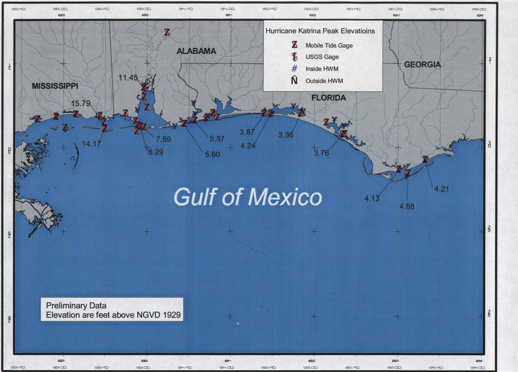