Is flash flooding getting worse? Summer’s soaking start may hold the answer
An exclusive AccuWeather analysis confirms that 2025 is shaping up to be one of the most flood-impacted summers on record in the U.S.
Dan DePodwin, AccuWeather vice president of forecast operations, was live on the AccuWeather Network to discuss flash flooding.
If it feels like flash flooding is everywhere this summer, you're not imagining it. An exclusive AccuWeather analysis confirms that 2025 is shaping up to be one of the most flood-impacted summers on record in the United States.
The summer of flooding
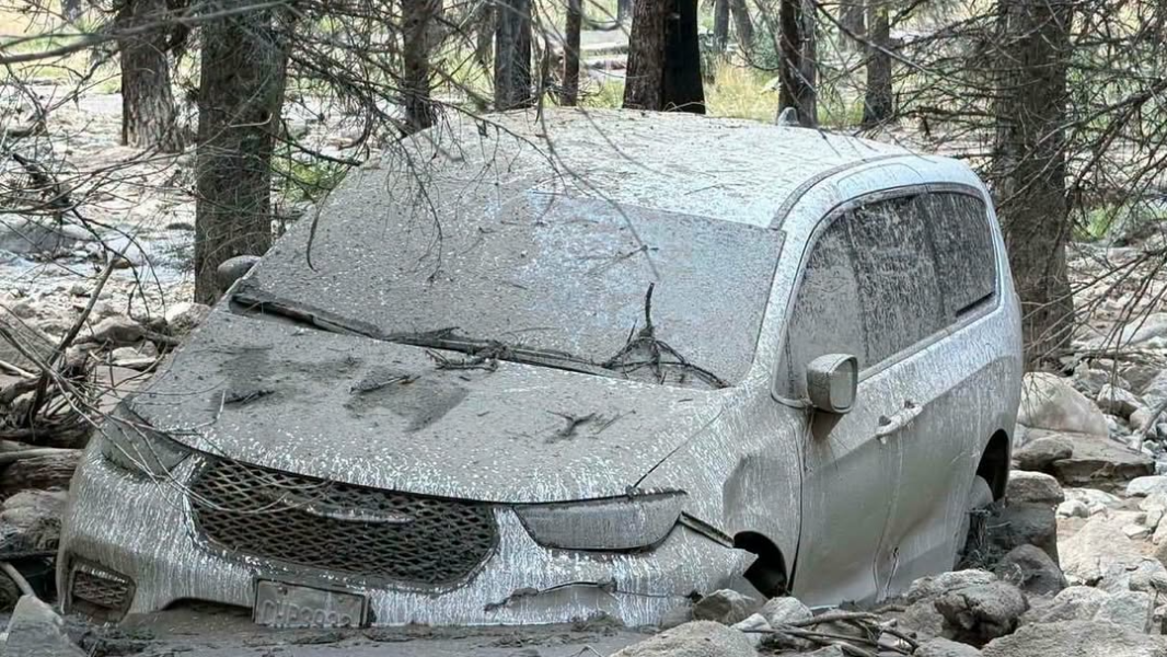
From Texas to North Carolina, Illinois to New Mexico, deadly floods have surged into the national spotlight. A slow-moving storm in Central Texas dumped over 12 inches of rain in Kerr County, causing the Guadalupe River to rise 27 feet in under an hour, killing more than 130 people. Tropical Storm Chantal shattered a rainfall record in North Carolina’s Eno River basin and claimed six lives. In Chicago, flash floods overwhelmed streets in under two hours. In New Mexico, floodwaters tore through fire-scarred terrain in Ruidoso, killing at least three people.

Search and rescue operations are performed in the Guadalupe River on July 14, 2025, in Kerrville, Texas. (Photo credit: Brandon Bell/Getty Images)
"So far in 2025 across the U.S., there's been a 70% increase in reports of flash flooding when you compare that to the 10-year historic average through mid-July," said AccuWeather Chief Meteorologist Jon Porter. This means that there have been more than 4,800 reports of flash flooding. That's a huge number and why so many people feel like they've been hearing a lot about flash flooding in the news."
Flash flood reports at this time last year were up 30%, but there hasn't been an increase every year. Both 2022 and 2023 were below the 10-year average in terms of flash flooding reports. So while flash flooding is becoming more of a problem on average in a warming atmosphere, it's not happening every year.

Percentage change in flash flood reports since 2016.
A season built for flash floods
Flash floods are more common in summer because of how the atmosphere behaves. Daytime heating fuels stronger thunderstorms. Warmer air holds more moisture. Upper-level winds slow down as the jet stream shifts north. These factors combined can allow slow-moving to stalled storms to unload tremendous rainfall over the same area, more than the ground can absorb it or infrastructure can drain it.
That’s what happened in Texas Hill Country, where a slow-moving thunderstorm turned into what may end up being the state's second-deadliest flood event in history. The same thing overwhelmed low-lying neighborhoods in Chicago, where a stalled system dumped 5 inches of rain in just 90 minutes, more rain than what falls in an entire month.
So far this summer, the overall weather pattern has helped fuel extreme rainfall, in part due to a stronger-than-usual Bermuda High—a persistent area of high pressure near Bermuda that often influences summer conditions across the U.S.
In addition to the strong Bermuda High, a very active storm track from Canada has allowed ample opportunity for thunderstorms not just in the Ohio Valley and Midwest but farther south and in the Northeast.
That added moisture is also reaching farther, Brett Anderson, AccuWeather senior meteorologist and climate expert, explained. “A greater amount of land area being affected by these extreme rainfall events across the entire U.S."

Some regions are expected to be hit harder than others, Anderson added. “The Tennessee Valley is projected to experience a 20 to 40 percent increase in these rainfall events, and also parts of New England.”
While flooding has always been a year-round threat, especially in the summer, experts say the scale and intensity of these events are growing. What’s driving the surge? Part of the answer lies in the atmosphere itself.
More water vapor increases risk of extreme downpours and flash flooding
One of the clearest contributing factors to this summer’s flooding is the amount of moisture in the atmosphere. With more water vapor in the air, summer storms now carry more punch, boosting flooding potential across the country.
Data over the last 30 years from ERA5, a global weather dataset from the European Centre for Medium-Range Weather Forecasts, shows a steady increase in total column water vapor, or the amount of moisture in a vertical slice of the atmosphere, during the first five to six weeks of summer over the past 30 years. Additionally, with so much moisture over such a large area of the U.S., there is ample fuel to recharge long-lasting thunderstorms.
“One of the biggest impacts scientists have noted going way back in time was the increase in extreme rainfall events due to the increase in water vapor," Anderson said. "Warmer air holds more water vapor. More water vapor means a higher potential for heavy rainfall events.”

“As the climate continues to warm, the atmosphere holds more moisture, increasing the potential for extreme rainfall. Long-term weather records show a clear trend: flash flood events and intense rainfall rates have become more frequent in many parts of America over the past century. Studies also show this trend is expected to continue through the rest of the century,” DePodwin explained.
These changes don’t make rain more likely, but they do raise the stakes once storms form. The added moisture increases the risk of extreme downpours and flash flooding, especially when combined with stalled systems, dry ground, or urban surfaces that can’t absorb water.
“These heavy rainfall events — we can’t necessarily say that one is caused by climate change, like this most recent tragic event where over a hundred people have lost their lives,” DePodwin said. “But we can say they’re amplified by climate change. They’re certainly more intense, more frequent.”
Harder rains, faster runoff
AccuWeather Chief Meteorologist Jon Porter breaks down the factors behind the deadly flooding in both Kerrville, Texas, and Ruidoso, New Mexico.
Extreme rainfall is only part of the equation. Where the rain falls matters just as much. In Texas and New Mexico, severe to extreme drought left the soil hardened and compacted, dramatically reducing the land’s ability to absorb water. “The soil was very hard and dry,” DePodwin said. “Also the soil underneath is limestone, so it’s like raining onto concrete. It has nowhere to go other than down the river very quickly.”
Wildfires can dramatically increase the risk of flash flooding by altering the landscape in ways that make it harder for the ground to absorb water. When vegetation burns away, the soil loses its natural ability to slow and soak up rainfall. Intense heat from the fire can even create a hardened, water-repellent layer just below the surface—known as a burn scar. These burn scars can leave areas vulnerable to flooding and mudslides for years. In places like Ruidoso, New Mexico, where wildfires scorched the terrain last year, these scars left behind a flood-prone landscape. Even moderate rainfall can trigger dangerous runoff, sending water racing downhill with little warning.
Urban areas face similar challenges, not from drought but from development. Pavement and asphalt prevent water from soaking into the ground, funneling it into storm drains that can quickly overflow or become clogged with debris.
“The combination of urban development, reduced permeable land surfaces, aging drainage infrastructure, and a warming climate capable of holding more atmospheric moisture is accelerating the frequency and severity of flash flood events across many parts of the nation,” DePodwin explained.
DePodwin said urban flooding is worsening in some areas due to topsoil and natural vegetation being replaced by concrete and asphalt, as well as inadequate drainage.
“Much of the nation's infrastructure and drainage systems were designed for rainfall patterns typical of 50 to 100 years ago — not the intense and extreme rainfall events we are experiencing right now,” DePodwin explained. “As the name suggests, flash floods can occur in a matter of minutes when water not only can rapidly rise of rivers and streams but also pour into streets and other locations that are usually dry."
What happens next?
More flash flooding doesn’t mean there are more rainy days. It means that when rain does fall, it can fall fast and hard.
Hourly rainfall rates have increased across nearly 90% of large U.S. cities since 1970, according to Climate Central. In Chicago, rainfall intensity has increased by 8%, and this summer’s downpours shattered short-duration records set nearly 50 years ago.
These changes, combined with aging infrastructure, make fast-onset flooding more likely to cause damage, injury, and death. And while each storm has its own setup, experts agree that the atmosphere is trending wetter, the rainfall is falling harder, and the risk isn’t going away.
As the atmosphere grows wetter and storms become more intense, experts say preparation is key. Flash flooding can happen with little warning, and in places that aren’t used to seeing it. Know your flood risk, pay attention to alerts, and never underestimate even a short burst of heavy rain. Being weather-aware can make the difference between life and death. The AccuWeather app is a great way to receive Flash Flood Warnings which can alert you to dangerous conditions.
Want next-level safety, ad-free? Unlock advanced, hyperlocal severe weather alerts when you subscribe to Premium+ on the AccuWeather app. AccuWeather Alerts™ are prompted by our expert meteorologists who monitor and analyze dangerous weather risks 24/7 to keep you and your family safer.
Report a Typo