Heartland begins digging out as blockbuster spring blizzard finally departs
Millions are digging out from a powerful spring storm that swept across the U.S. In Nebraska, folks still reeling from historic flooding are now battling snow.
As “spring fever” spread across the central United States with temperatures soaring into the 50s, 60s and even the 70s Fahrenheit in some locations earlier in the week, a powerful, slow-moving storm moved into the region by midweek and pummeled a large swath of the middle of the country with weather conditions more typical of January than April. By midday Friday, major interstates were being reopened and Americans began digging out from underneath some significant snowfall totals.
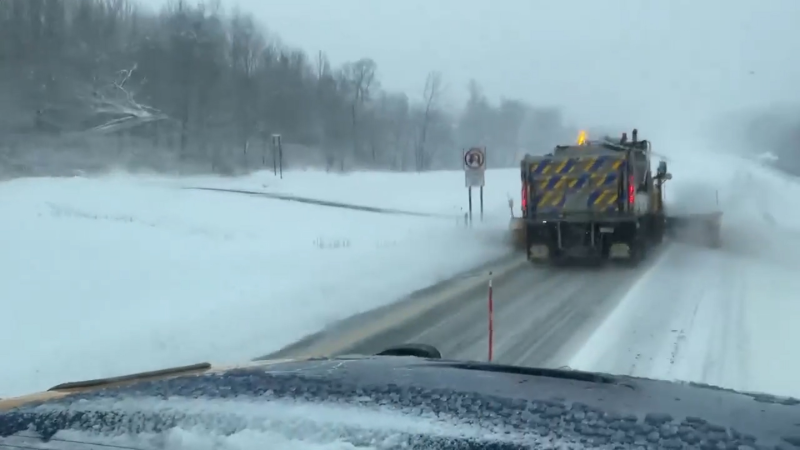
The intense spring blizzard dumped up to 30 inches in some areas, caused power outages in multiple states, created treacherous travel conditions that caused accidents and closed roads and disrupted air travel as hundreds of flights were delayed or canceled throughout the week. The storm whipped up dangerous whiteout conditions, prompting local officials to urge residents to stay home and avoid the roads into Friday morning.
The monster storm turned deadly on the evening of Wednesday, April 10, in Denver, Colorado, and is being blamed for at least two fatalities – one in Denver and the other in Minnesota. James Raff, an aircraft inspector for United Airlines lost control of his truck amid slick road conditions and collided with a Denver International Airport (DIA) snowplow, Denver police told AccuWeather. The snowplow tried to avoid the impact, authorities said, but the truck crashed into the snowplow. Raff, 65 and from nearby Aurora, was pronounced dead at the scene and no other injuries were reported.
"We are deeply saddened to learn of the passing of Aircraft Inspector Jim Raff. The thoughts of the entire United family are with his loved ones," United Airlines said in a statement to AccuWeather on Friday morning.
Hundreds of car accidents were reported due to the dangerous conditions through the week. Over 100 crashes and more than 160 spinouts were reported in Minnesota alone as of Thursday, April 11. Road conditions remained poor throughout much of Minnesota and South Dakota on Friday morning.
A 21-year-old man was killed after he lost control of his car and crossed the center median of Highway 12 in Buffalo, Minnesota, early Friday morning. A semi truck collided with the passenger side of his vehicle, throwing his car off of the roadway and into a ditch, according to the Minnesota Highway Patrol.
The major snowstorm prompted Minnesota Gov. Tim Walz to declare a state of emergency on Thursday night. Walz also activated the Minnesota National Guard to help rescue stranded drivers.
While the heaviest snowfall ended by Friday afternoon, the combination of light to moderate snow and gusty winds kept visibility poor and travel conditions difficult throughout the day. A number of major roads remained closed or impassable, and officials said work to clear the roads on Friday continued and urged motorists to drive with caution.
Wyoming and South Dakota have seen some of the most significant snowfall totals, with some locations buried in more than 20 inches of snow. The highest snowfall total from the storm was recorded in Terry Peak, South Dakota, situated in the state's Black Hills, reporting 30 inches. The persistent winds whipping across the region caused even higher snow drifts, topping 5 feet in some areas. Prior to the storm, AccuWeather forecasters predicted 30 inches of snowfall would be possible in some isolated spots.

AccuWeather projects a total of $3 billion in damage and economic losses from the powerful storm, based on an analysis of damages already inflicted and those expected to occur. The storm brought travel nightmares for both those traveling by air or car this week, as roads closures were common through the impacted regions and many flights were delayed or canceled due to the turbulent weather.
Nearly 1,000 flights were canceled and over 1,500 delayed at airports across the region, according to FlightStats. Minneapolis-St. Paul International Airport accounted for the most cancellations and delays. The high volume of flight disruptions had a ripple effect at airports across the country, resulting in additional cancellations and delays at airports far away from the worst of the blizzard. By Friday morning, chaos at airports spanning the U.S. had calmed down significantly, with arriving and departing traffic experiencing delays of only 15 minutes or less, according to the Federal Aviation Administration (FAA).
Strong wind gusts over 50 mph were common as the storm slowly spun across central U.S., blowing over trees, toppling power lines and even knocking some high-profile vehicles over onto their sides. Pueblo West, Colorado, was rattled by an ferocious wind gust of 107 mph on Wednesday as the system rapidly strengthened over Colorado. A gustnado was also reported in the area on Wednesday afternoon.
Power crews continued working around the clock to restore power to impacted customers on Friday. During the height of the storm, more than 100,000 customers were without power from Colorado through Michigan, with strong winds bringing down new power lines as quickly as they could be repaired. By Thursday evening, the number of outages had been reduced to around 46,000, according to PowerOutage.us, with that number dropping to around 13,237 in Minnesota as of Friday afternoon.
"If you’re looking for big spring snow in the central U.S., the Black Hills of South Dakota is the place to look,” said AccuWeather Senior Meteorologist Alex Sosnowski.
Thundersnow was reported in several locations, particularly on the eastern and northern areas of the storm. In central Minnesota, Isanti County officials report that lightning struck a shed on Thursday, sending the building up in flames. The Sheriff's Office and the Isanti Fire District responded to this unique call on Thursday afternoon. Photos posted on social media by the Sheriff's Office show the shed nearly burnt to the ground, officials describing the event as "bizarre."
Relentless wind and heavy snow pummeled Watertown, South Dakota, where AccuWeather reporters Jonathan Petramala and Blake Naftel covered the storm. Both reporters captured the powerful storm on video, sharing videos on social media of the strong winds, thundersnow and heavy snow. Petramala captured video in the midst of a powerful snowdrift that left a pickup truck trapped in a parking lot. The motorist inside the vehicle was only able to escape with the assistance of a driver in another truck who towed the stuck vehicle out.
On the storm's southern side, the high winds and dry air made for a high fire danger for portions of New Mexico and Texas. These strong winds also kicked up clouds of dust over New Mexico and Texas so large that they were able to be viewed from space. Petramala and Naftel also captured an unusual occurrence that many referred to as "dirty snow." High winds around the powerhouse storm whipped up dust from New Mexico and West Texas and lofted it high into the atmosphere. The dust then cast a yellow, orange or even brown hue to the snow across portions of the north-central U.S. as far up as Minnesota.
Some schools and office buildings remained closed on Friday, as the storm began to roll out of the region.
In terms of overall power, this week's storm rivals the bomb cyclone storm that tore through the middle of country last month and unleashed historic flooding in the Midwest when it was over.
Additional reporting by Brian Lada, Adriana Navarro, Kevin Byrne, Jonathan Petramala and Blake Naftel.
Report a Typo


