Plume of Pacific moisture to spread rain, snow across Northwest
An active weather pattern will persist across much of the Northwest, bringing heavy rain and mountain snow to the region through midweek.
For the first half of this week, an active weather pattern will continue across much of the northwestern United States. A plume of moisture will surge into parts of Washington, Oregon and far Northern California.
A northward bulge in the jet stream over much of California, Nevada, Utah and southern Idaho will help to keep much of the Southwest dry into at least midweek.
"While a majority of the West will experience a trend towards drier conditions this week, that will not be the case across the Pacific Northwest. Multiple waves of moisture taking aim at the region will likely keep wet weather in the forecast into the middle of this week," explained AccuWeather Meteorologist Brandon Buckingham.

A zone of low pressure advanced into the far southeast flank of Alaska and the coast of British Columbia over the weekend and spread rain and snow across the region. The storm's associated frontal boundary has swung into the Pacific Northwest Monday night and has continued to bring a swath of rain and high elevation snow into Tuesday morning.
During the second half of the week, storm activity along the Northwest coast is expected to decline gradually. Although nearby areas of low pressure could bring intervals of rain or snow to the region from Wednesday to Friday, these events are likely to be weak compared to the river of moisture approaching for the early days of the week.
Even though the stream of rain forecast to move into the Northwest early in the week may bring pockets of localized flooding, rockslides and rises on select streams and creeks, the rain may also prove beneficial for western Washington.
GET THE FREE ACCUWEATHER APP
•Have the app? Unlock AccuWeather Alerts™ with Premium+
Many observation sites in western Washington, including Seattle, Olympia and Tacoma, Washington, recorded lower rainfall totals throughout January, February and March. From January to March, all three locations recorded roughly 54% of the historical average rainfall for each site. However, April showers have helped to keep rainfall amounts on track for the most part for those locations in Washington so far this month.
So far in April, temperatures across the Seattle and Portland areas have trended on the cooler side compared to what is typically observed this time of year. AccuWeather meteorologists say that monthly values are generally running between 4-5 degrees F below the historical average for early April, and this trend is forecast to continue through the week.

Daytime high temperatures in Seattle this week are forecast to dip to around 50 F, with intervals of rain expected across the metro area through Wednesday or Thursday.
Cooler conditions will largely be confined to areas west of the Rocky Mountains during the first half of the week, while locations from the Intermountain West into the Plains will be experiencing a surge of warmth throughout the week.
Even places in Utah, such as Salt Lake City, will see much milder conditions early this week, climbing to near 80 F on Tuesday. This surge of warmth will be quite noticeable compared to high temperatures recorded around Salt Lake City at the start of the previous week when the city only climbed to the 30s F and totaled nearly 15 inches of snow from Sunday to Wednesday last week.
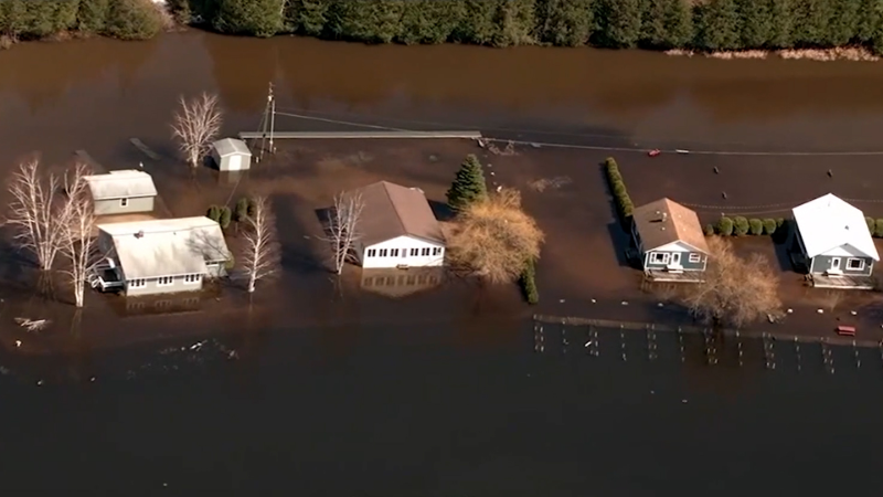
Due to the climbing temperatures, forecasters are monitoring the threat of flooding from area snowmelt across parts of the western and central states.
"Across the interior Northwest, valley rain and mountain snow will be much more sparse in coverage over the coming days, but even though largely dry weather is in store, the flooding threat is expected to increase. This will occur as a result of climbing temperatures that will begin to melt off some of the deep snowpack across the mountains," stated Buckingham.
Ice jams will elevate the flood from Montana and Wyoming to the Great Lakes region through Tuesday. Snowmelt along the foothills of the mountain regions could quickly cause rises in area rivers and streams, including portions of the Missouri River.
"Widespread major flooding of the Missouri River is not anticipated due to average snowfall east of the mountains and flood mitigation (dams) in place," AccuWeather Senior Meteorologist Alex Sosnowski said.

If possible, residents are encouraged to clear any snow or ice from flow paths and culverts to allow for runoff to be transported away from roadways and structures.
Want next-level safety, ad-free? Unlock advanced, hyperlocal severe weather alerts when you subscribe to Premium+ on the AccuWeather app. AccuWeather Alerts™ are prompted by our expert meteorologists who monitor and analyze dangerous weather risks 24/7 to keep you and your family safer.
Report a Typo


