Downpours, storms to drench Memorial Day gatherings in southern US
While the West will be best, and some may shiver in the Northeast, dangerous conditions from flash flooding and severe thunderstorms will lurk from the southern Plains to the interior Southeast on Memorial Day.
AAA says a record 45.1 million people will be traveling for Memorial Day. This will be the busiest weekend of travel for this holiday in 20 years. Kellan Howell shares what’s driving the high numbers.
While some of the best weather in the nation will be from the Rockies to the West Coast on Memorial Day, the Northeast will be chilly but mainly dry. Downpours are likely to cause problems for parades and outdoor ceremonies from the central and southern Plains to the southern East Coast, AccuWeather meteorologists say.
Most areas from the Rockies on west can expect a nice day for the unofficial start of the summer season with sunshine and a warm afternoon. Thunderstorms are not expected for most places, including over the rugged terrain of the Rockies, which is a favorite of hikers.

Most West Coast beaches should experience some sunshine during the afternoon after morning patchy low clouds and fog burn off. An exception will be along the coasts of Washington and Oregon, where persistent clouds can lead to spotty showers.
Heat will build over the deserts with afternoon temperatures to push 100 F.
Farther to the east, the weather will not be so nice in terms of the warm and dry ideal.
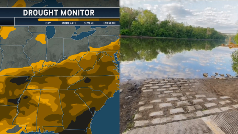
The Northeast will continue its drying trend after a rare late-May nor'easter dumped up to a few inches of rain on portions of New England, the central Appalachians and the mid-Atlantic.
Air that is unusually cool for late May—5 to 15 degrees below the historical average—will continue through the first holiday of the summer season, along with spotty showers over the interior Northeast. However, cooler weather is often preferred over hot and humid conditions during parades.

Much of the northern Plains and parts of the Upper Midwest will be cool but dry.
Farther south and west, the weather will deteriorate significantly on Memorial Day.
Rounds of showers and thunderstorms that ramped up early during the extended holiday weekend from the central and southern Plains to the lower part of the Mississippi Valley will continue on Memorial Day.

Where the ground has become saturated, the risk of flash flooding will increase significantly with each additional downpour. Some locations may escape with little or no rain on Memorial Day, but people in those areas will be lucky if outdoor plans proceed without problems from rain and severe thunderstorms.
Most of the severe thunderstorm threat will be on the southern and eastern edge of the persistent downpour zone and will extend from central Texas to Georgia and South Carolina.

The main threats from severe thunderstorms on Monday include dangerous lightning, winds strong enough to snap tree limbs and hail large enough to damage vehicles. However, a few tornadoes cannot be ruled out as well.
Meanwhile, much of the Florida Peninsula will be very warm and humid with only spotty thunderstorm activity, which is fairly typical for late May.


Want next-level safety, ad-free? Unlock advanced, hyperlocal severe weather alerts when you subscribe to Premium+ on the AccuWeather app. AccuWeather Alerts™ are prompted by our expert meteorologists who monitor and analyze dangerous weather risks 24/7 to keep you and your family safer.
Report a Typo