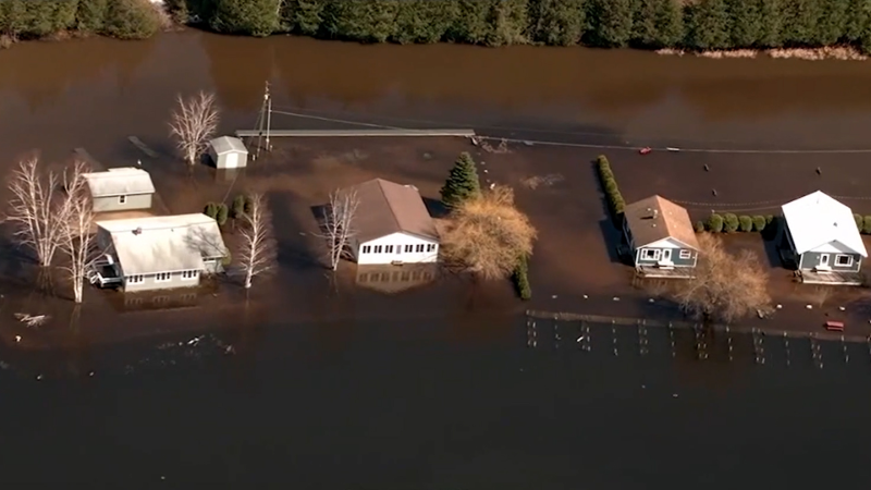
Coastal storm deluging NYC with rain capable of spawning life-threatening flash flooding
The heaviest rain event since Tropical Rainstorm Ida's catastrophic flooding in New York City was unfolding on Friday, and AccuWeather forecasters say inches of rain will continue to pour down.
A coastal storm has developed off the Northeast coast, unleashing torrents of rain around the greater New York City area. Several more inches of rain will unload across the area, causing. potentially life-threatening flooding situation into the weekend, according to AccuWeather meteorologists.
“It appears that the rainfall from this storm could be New York City’s heaviest since Hurricane Ida in 2021,” AccuWeather Chief Meteorologist Jon Porter said. That tropical rainstorm brought major flooding and more than 7 inches of rain to Manhattan on the first day of September that year.
As of mid-afternoon on Friday, the current storm has far surpassed rainfall from Ida at JFK International Airport with 8.48 inches falling. The storm total from Ida at the airport was under 3 inches.
AccuWeather National Reporter Bill Wadell said that traffic was a mess in Queens and across New York City on Friday morning amid the excessive rainfall. He noted that ponding of water was occurring on roadways and around JFK.

The Metropolitan Transit Authority (MTA) suspended train services at many stations, and there were extensive delays where New York City subway trains were still running on Friday morning.
“There is only extremely limited subway service available because of heavy flooding caused by rainfall. Service may be suspended on certain stations,” MTA said on its website.
The latest storm, although non-tropical in nature, is another thorn in the side for coastal locations still reeling from the effects of Ophelia. Well after its demise, the former tropical storm brought days of cloudy, cool, wet and windy weather to portions of the Northeast earlier this week and contributed to a prolonged period of pounding surf, coastal flooding and erosion.
'Serious' flash flood risk unfolding around NYC
As of early Friday morning, AccuWeather forecasters were honing in on the immediate New York City and Tri-State area eastward across parts of Long Island and southern New England as the zone at greatest risk for the narrow corridor of heavy rain to set up.
Through Thursday, Central Park has received an astounding 8.73 inches of rainfall this month. The Big Apple's historical average rainfall for September is 4.31 inches. In parts of central and northern New Jersey, as little as 0.75 of an inch to 1.50 inches of rain falling in a three-hour period would be capable of causing flash flooding due to recent wet conditions.

The latest storm will unload a swath of 2-4 inches of rain across the region, with localized pockets of higher amounts. A small pocket where 4-8 inches of rain is in store and most likely to fall extends from western Long Island, New York, to just north of New York City, including southwestern Connecticut. The AccuWeather Local StormMax™ is 12 inches.
During the height of the downpours, there is the potential for rain rates to exceed 1 inch per hour, AccuWeather Meteorologist Joe Bauer explained. Such rates were already being realized in parts of the New York metropolitan area through the early hours of Friday, with 1.19 inches of rain falling during the 2 AM hour at John F. Kennedy International Airport, and flash flood warnings were issued early Friday morning for the areas of New York City and Long Island that had received the most intense downpours so far.
"Should extreme rainfall rates above 1 inch per hour occur in urban areas, such as New York City, flash flooding with rapidly rising water can quickly escalate into a life-threatening situation in a matter of minutes, as urban environments have many impermeable surfaces such as sidewalks and streets which promote greater runoff," AccuWeather Chief Meteorologist Jon Porter said.
Experts advise motorists to avoid areas of street flooding because it is impossible to know how deep the water is or how fast it is moving. In addition to slower ground travel, airports could face increased delays and cancellations.
AccuWeather meteorologists say that drier air pressing in from the north will result in a sharp variation in where serious flash flooding occurs and where no more than nuisance rain falls.
Coastal storm to prolong beach hazards
Waters have remained rough along the beaches of the Eastern Seaboard since last weekend, and persistent onshore winds are expected to keep coastal hazards high into the weekend.

Early Friday, coastal flood advisories stretched from eastern Virginia to the southwestern Connecticut coastline where the onshore winds and full moon were expected to contribute to higher-than-normal inundation at high tide in the most vulnerable low-lying areas.
Weather to dry out, warm up next week
In the wake of the coastal storm, AccuWeather forecasters say that an extended stretch of nice weather is shaping up for the Northeast as an area of high pressure will build over the region during the first week of October.
From Sunday into at least next Thursday, each day will likely feature dry weather, at least partial sunshine and high temperatures in the 70s and even lower 80s F. Temperatures at this level are 5-10 degrees Fahrenheit above the historical average.

The pattern next week for the first week of October will promote more opportunities for leaf peeping, raking and other various outdoor fall activities when compared to the cool, cloudy and damp weather during late September.
Want next-level safety, ad-free? Unlock advanced, hyperlocal severe weather alerts when you subscribe to Premium+ on the AccuWeather app. AccuWeather Alerts™ are prompted by our expert meteorologists who monitor and analyze dangerous weather risks 24/7 to keep you and your family safer.
Report a Typo


