Latest storm spreads rain, snow into the Northwest
Following a potent storm this past weekend, a new storm will spread areas of drenching rain, mountain snow and gusty winds to the Northwest, including Northern California into Tuesday night.
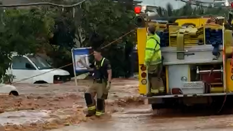
From a damaging tornado in California to flooding in Washington to heavy snow in Utah, mid-December storms have wreaked havoc in the western U.S.
The ongoing stormy pattern across the West will not wane as the new week continues, AccuWeather meteorologists say. As one storm shifts across the northern Rocky Mountains with drenching rain and mountain snow, a new storm brewing offshore will move in and push inland through Tuesday.
Past weekend storm produces confirmed tornado
Not only did the storm this past weekend bring flooding rainfall to some locations in Northern and Central California but also intense thunderstorms.
Early Saturday morning, a rare tornado warning was issued for San Francisco County and northwestern San Mateo County, noting that a severe thunderstorm capable of producing a tornado was located nearby. While it is rare for tornadoes to touch down in Central California, it's not entirely unheard of. Shortly after the warning was issued, a wind gust of 83 mph was reported at the San Francisco International Airport as the robust storms rolled across the Bay Area.

Reports of overturned cars and tree damage were submitted on Saturday across Scotts Valley, just south of the Bay Area, with video footage of the whirlwind inflicting destruction.
A tornado touched down in Scotts Valley, California, on Saturday afternoon, causing damage and flipping over some cars. No injuries were reported.
Have the app? Unlock AccuWeather Alerts™ with Premium+
Forecasters also noted that elsewhere across the region, strong straight-line winds near the ground also caused problems from the coast to the mountains and valleys across the interior. From Friday to Saturday at the coast, gusts were in the 40- to 60-mph range, with local winds gusting upwards of 80 mph.
Storm to affect the Northwest through Tuesday
Early this week, conditions will remain stormy across the Northwest states as another storm moves onshore into Washington, Oregon and Northern California.

While this storm will not be quite as strong and impactful as the storms prior, forecasters say that it can still bring localized flooding rainfall and widespread, strong winds in quick succession to the initial round of storms. Residents across the region still cleaning up from any wind damage or those starting to restore power to their homes and businesses can face another round of active weather.
"The current storm will target more of the Pacific Northwest and northern Intermountain West through Monday, bringing periods of rain and mountain snow to Northern California. Across the Cascades, upwards of a foot of snow can fall at the highest peaks with accumulating snow down to pass levels," detailed Gilman.
The strongest winds will primarily be confined to the immediate coastlines of Washington and Oregon on Tuesday.
"There will be an atmospheric river associated with the storm into Tuesday," AccuWeather Senior Meteorologist Brett Anderson said. "The plume of moisture extends all the way from the coastal northwest to just north of Hawaii."
The timing of this storm’s front will cause some ponding on streets and highways which can lead to slower travel. While across the passes, roads can be snow-packed and slippery.
As the week continues, a northward nudge in the jet stream will help to keep storms farther north than what was observed this weekend.

In addition to the drier trend expected across California and the Southwest, temperatures are projected to rise gradually as well.
Wet pattern to persist in Northwest with numerous storms on the horizon
AccuWeather meteorologists continue to warn that over the next week or more, locations along the Northwest coast will not escape the waves of rain and mountain snow as the overall weather pattern suggests that additional storms are likely to swirl into the western coast.
"While a break in the busy pattern is expected for midweek, another series of storms ramps back up again for the upcoming weekend and and is likely to persist up to Christmas Day," added Gilman.

Want next-level safety, ad-free? Unlock advanced, hyperlocal severe weather alerts when you subscribe to Premium+ on the AccuWeather app. AccuWeather Alerts™ are prompted by our expert meteorologists who monitor and analyze dangerous weather risks 24/7 to keep you and your family safer.
Report a Typo


