Rain, November-like chill sweeping over Pacific Northwest
By
Ryan Adamson, AccuWeather meteorologist
Published May 6, 2022 7:02 AM EST
|
Updated May 8, 2022 5:39 AM EST
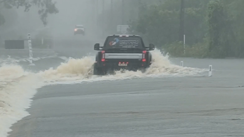
A wet and chilly pattern is gripping the Northwest, making it feel more like November than May. AccuWeather forecasters say that a series of storms will come ashore, causing precipitation to continue through Mother's Day weekend and into early this week.
Rain began with over an inch reported in Portland, Oregon, and Seattle, Thursday through Friday, with some high-elevation snow above pass level. A few tornadoes were even reported in northeastern Oregon and eastern Washington on Friday as the leading storm in the parade swept through the region.
Motorists traversing the region's mountains will want to keep an eye on the forecast as snow levels will begin to drop as a dip in the jet stream becomes more pronounced early this week.
This dip in the jet stream will bring snow to the passes in Washington, Oregon and Idaho on Sunday, according to AccuWeather Senior Meteorologist Mike LeSeney.
The coldest air will also be in place on Sunday, with the heaviest precipitation focused in southwestern Oregon and northwestern California.
Precipitation may not be as heavy farther north, but snow levels may get as low as 2,000 feet in Washington, Oregon, California and Idaho by Monday morning.
"Mountain snow will blanket the slopes of the Sierra Nevada and Cascades, resulting in slippery travel through the mountain passes," cautioned LeSeney.
Even though snow won't fall at the lowest elevations, temperatures will be well below normal. Seattle will only manage to climb into the lower 50s F into Monday, temperatures more typical of early November. The average high in the Emerald City in early May is 65 F.
CLICK HERE FOR THE FREE ACCUWEATHER APP
Portland, Oregon, could be even colder. The high temperatures Sunday will struggle to get out of the lower 50s F, a high temperature more typical of mid-November. It will also be nearly 15 degrees lower than the normal early-May high of 68.
Waves of rain and mountain snow will continue this week, although the precipitation is not expected to be heavy.
Unfortunately, no precipitation is in the offing for Southern California or other locations in the Southwest, where both a short-term and long-term drought continues. Additionally, strong winds will continue to dry things out further and keep the fire danger very high.
By late week, much of the West is expected to be dry as the wet season comes to a close. However, there could be a couple storms that try to clip western Washington with precipitation during the middle of May.
For the latest weather news check back on AccuWeather.com. Watch the AccuWeather Network on DIRECTV, Frontier, Spectrum, fuboTV, Philo, and Verizon Fios. AccuWeather Now is now available on your preferred streaming platform.
Report a Typo


News / Winter Weather
Rain, November-like chill sweeping over Pacific Northwest
By Ryan Adamson, AccuWeather meteorologist
Published May 6, 2022 7:02 AM EST | Updated May 8, 2022 5:39 AM EST
A wet and chilly pattern is gripping the Northwest, making it feel more like November than May. AccuWeather forecasters say that a series of storms will come ashore, causing precipitation to continue through Mother's Day weekend and into early this week.
Rain began with over an inch reported in Portland, Oregon, and Seattle, Thursday through Friday, with some high-elevation snow above pass level. A few tornadoes were even reported in northeastern Oregon and eastern Washington on Friday as the leading storm in the parade swept through the region.
Motorists traversing the region's mountains will want to keep an eye on the forecast as snow levels will begin to drop as a dip in the jet stream becomes more pronounced early this week.
This dip in the jet stream will bring snow to the passes in Washington, Oregon and Idaho on Sunday, according to AccuWeather Senior Meteorologist Mike LeSeney.
The coldest air will also be in place on Sunday, with the heaviest precipitation focused in southwestern Oregon and northwestern California.
Precipitation may not be as heavy farther north, but snow levels may get as low as 2,000 feet in Washington, Oregon, California and Idaho by Monday morning.
"Mountain snow will blanket the slopes of the Sierra Nevada and Cascades, resulting in slippery travel through the mountain passes," cautioned LeSeney.
Even though snow won't fall at the lowest elevations, temperatures will be well below normal. Seattle will only manage to climb into the lower 50s F into Monday, temperatures more typical of early November. The average high in the Emerald City in early May is 65 F.
CLICK HERE FOR THE FREE ACCUWEATHER APP
Portland, Oregon, could be even colder. The high temperatures Sunday will struggle to get out of the lower 50s F, a high temperature more typical of mid-November. It will also be nearly 15 degrees lower than the normal early-May high of 68.
Waves of rain and mountain snow will continue this week, although the precipitation is not expected to be heavy.
Unfortunately, no precipitation is in the offing for Southern California or other locations in the Southwest, where both a short-term and long-term drought continues. Additionally, strong winds will continue to dry things out further and keep the fire danger very high.
By late week, much of the West is expected to be dry as the wet season comes to a close. However, there could be a couple storms that try to clip western Washington with precipitation during the middle of May.
More to see:
For the latest weather news check back on AccuWeather.com. Watch the AccuWeather Network on DIRECTV, Frontier, Spectrum, fuboTV, Philo, and Verizon Fios. AccuWeather Now is now available on your preferred streaming platform.
Report a Typo