Go Back
  • For Business
  • |
  • Warnings
  • Data Suite
  • Forensics
  • Advertising
  • Superior Accuracy™
Gabrielle forms in Atlantic, may track near Bermuda. See the track forecast. Chevron right

Columbus, OH

57°F
Location Chevron down
Location News Videos
Use Current Location
Recent

Columbus

Ohio

57°
No results found.
Try searching for a city, zip code or point of interest.
settings
Columbus, OH Weather
Today WinterCast Local {stormName} Tracker Hourly Daily Radar MinuteCast® Monthly Air Quality Health & Activities

Around the Globe

Hurricane Tracker

Severe Weather

Radar & Maps

News

News & Features

Astronomy

Business

Climate

Health

Recreation

Sports

Travel

For Business

Warnings

Data Suite

Forensics

Advertising

Superior Accuracy™

Video

Winter Center

AccuWeather Early Hurricane Center Top Stories Trending Today Astronomy Heat Climate Health Recreation In Memoriam Case Studies Blogs & Webinars

News / Winter Weather

New England ice storm to trigger major hazards, power outage risk

By Alex Sosnowski, AccuWeather senior meteorologist

Published Feb 16, 2023 12:29 PM EDT | Updated Feb 17, 2023 12:56 PM EDT

Copied

AccuWeather meteorologists warn a colder and potentially stormier pattern with snow and ice will set up across the northern third of the U.S. during the second half of February.

A significant ice storm is set to unfold across northern New York state and northern New England into Friday. The culprit behind the threat of ice, which will be heavy enough to threaten treacherous travel conditions, damage and power outages, is a far-reaching winter storm that has brought extensive snow impacts from the Western states into the central United States and severe weather and flooding dangers to the Southern states.

The impactful ice event will unfold in parts of the Adirondack Mountains in northern New York, the Champlain Valley of Vermont and neighboring areas of Canada and most of the Green and White Mountains of northern New England by early Friday, according to AccuWeather Meteorologist Brandon Buckingham.

The icy zone began to take shape near Detroit and southern Michigan Thursday night then extended across southern Ontario later on Thursday night and will continue onward toward the coast of northern Maine and southern New Brunswick on Friday.

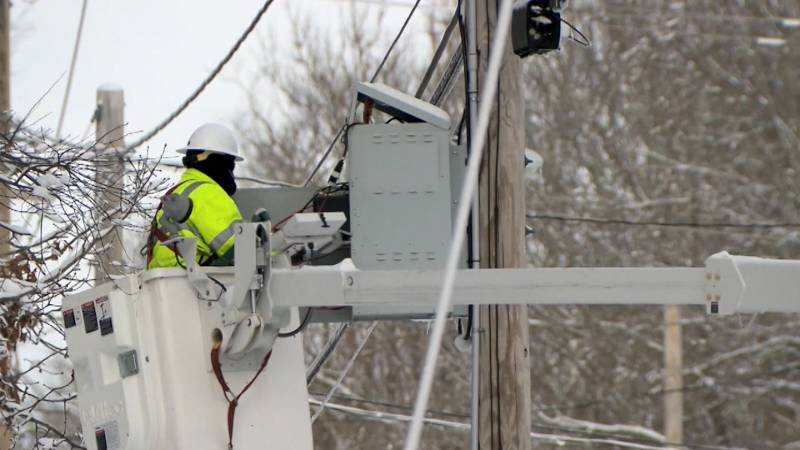
Ice can accrue to a thickness of 0.10 to 0.40 of an inch, with the heaviest amounts anticipated where mostly freezing rain occurs. Ice accumulation of 0.25 of an inch is enough weight to bend tree limbs and even cause weak trees to come crashing down. If power lines are in the way, power outages will result.

In some cases, sleet will be mixed in, which may reduce the stress on trees and power lines. On the other hand, the ice buildup from sleet or freezing rain will create hazardous conditions on roads and sidewalks.

GET THE FREE ACCUWEATHER APP

  •   Have the app? Unlock AccuWeather Alerts™ with Premium+

Forecasters urge people to avoid travel as roads can become a sheet of ice with no traction. Due to fallen trees and power lines, cleanup on secondary roads may take some time.

AccuWeather meteorologists warn that the ice storm may be a preview of a wintry weather pattern expected to take shape next week and continue into March and perhaps April.

Significant winter storm for major population centers in Canada

Near and north of the wintry mix zone, a stripe of heavy snow will extend from the Midwest to central Ontario through portions of the Ottawa and St. Lawrence Valley to northern Maine and a large part of New Brunswick. This zone can expect 3-10 inches (8-25 cm) of travel-snarling snow.

"Cities such as Windsor, Toronto and Kingston, Ontario, may deal with an icy mixture of freezing rain initially Thursday night, then precipitation is likely to transition to sleet and snow as temperatures dip on Friday," Buckingham said.

Snow will be the predominant precipitation type in southern Quebec and northern Maine, where the air will be cold enough throughout the storm.

“Within this corridor, snowfall totals could approach a foot (30 cm) before the storm concludes later on Friday,” Buckingham said.

Major airline delays and flight cancellations are likely in Toronto, Ottawa, Montreal, Quebec City and St. John in Canada, as well as at regional airports such as Burlington, Vermont, and Bangor, Maine.

AccuWeather forecasters say that enough cold air will set up across the northern tier of the northeast U.S. as a major storm heads eastward to bring the chance of heavy snow and ice next week. Heavy snow may also fall on some of the heaviest population centers in southeastern Canada.

More to read:

LIVE: Snow, drenching storms causing problems in central US
Flowers, trees blooming weeks earlier than normal in the Eastern US
Colder air, snow chances in store for Midwest and Northeast
Doomsday Glacier 'in trouble' after scientists find 'staircase' cracks

Want next-level safety, ad-free? Unlock advanced, hyperlocal severe weather alerts when you subscribe to Premium+ on the AccuWeather app. AccuWeather Alerts™ are prompted by our expert meteorologists who monitor and analyze dangerous weather risks 24/7 to keep you and your family safer.

Report a Typo

Weather News

Weather News

Deputies rescue men, dog after sailboat drifts into shipping channel

Sep. 18, 2025
Weather Forecasts

Final days of summer to bring heat and drought in eastern, central US

Sep. 18, 2025
Weather News

Firefighters battle lightning, hail while extinguishing fire

Sep. 18, 2025
Show more Show less Chevron down

Topics

AccuWeather Early

Hurricane Center

Top Stories

Trending Today

Astronomy

Heat

Climate

Health

Recreation

In Memoriam

Case Studies

Blogs & Webinars

Top Stories

Hurricane

Gabrielle forms in Atlantic, may track near Bermuda

2 hours ago

Weather News

Another home collapses into the ocean on North Carolina's Outer Banks

17 hours ago

Weather Forecasts

Final days of summer to bring heat and drought in eastern, central US

3 hours ago

Recreation

Machu Picchu at risk of losing ‘credibility’ as one of 7 Wonders of th...

2 hours ago

Hurricane

Rain to briefly ease dryness in Southwest, but raise flood risk

1 hour ago

More Stories

Featured Stories

Live Blog

Does this radar loop show insects or birds?

LATEST ENTRY

Expert debunks claim about weird weather radar

1 day ago

Weather News

Pilot scolded to ‘pay attention’ as Air Force One flies nearby

2 hours ago

Weather News

Mount St. Helens stirring up leftover ash 45 years after ‘the big one’

1 day ago

Climate

Bob Dylan to perform at Farm Aid festival this weekend

1 hour ago

Travel

Flying cars collide at airshow rehearsal in China

1 day ago

AccuWeather Winter Weather New England ice storm to trigger major hazards, power outage risk
Company
Proven Superior Accuracy™ About AccuWeather Digital Advertising Careers Press Contact Us
Products & Services
For Business For Partners For Advertising AccuWeather APIs AccuWeather Connect RealFeel® and RealFeel Shade™ Personal Weather Stations
Apps & Downloads
iPhone App Android App See all Apps & Downloads
Subscription Services
AccuWeather Premium AccuWeather Professional
More
AccuWeather Ready Business Health Hurricane Leisure and Recreation Severe Weather Space and Astronomy Sports Travel Weather News Winter Center
© 2025 AccuWeather, Inc. "AccuWeather" and sun design are registered trademarks of AccuWeather, Inc. All Rights Reserved.
Terms of Use | Privacy Policy | Cookie Policy | About Your Privacy Do Not Sell or Share My Personal Information

...

...

...