Go Back
  • For Business
  • |
  • Warnings
  • Data Suite
  • Newsletters
  • Advertising
  • Superior Accuracy™
Tropical trouble could stir near Southeast beaches around 4th of July. Get details Chevron right
Severe storms, flash flooding to bring July Fourth holiday travel hassles. Get details Chevron right

Columbus, OH

72°F
Location Chevron down
Location News Videos
Use Current Location
Recent

Columbus

Ohio

72°
No results found.
Try searching for a city, zip code or point of interest.
settings
Columbus, OH Weather
Today WinterCast Local {stormName} Tracker Hourly Daily Radar MinuteCast Monthly Air Quality Health & Activities

Around the Globe

Hurricane Tracker

Severe Weather

Radar & Maps

News

News & Features

Astronomy

Business

Climate

Health

Recreation

Sports

Travel

For Business

Warnings

Data Suite

Newsletters

Advertising

Superior Accuracy™

Video

Winter Center

AccuWeather Early Hurricane Center Top Stories Trending Today Astronomy Heat Climate Health Recreation In Memoriam Case Studies Blogs & Webinars

News / Weather News

What are Chinook winds?

By Alex Sosnowski, AccuWeather senior meteorologist

Copied

While strong winds often occur during a storm, there are some instances in western North America where destructive winds may develop when the sky is clear.

The winds described in this case are referred to as Chinook winds.

The term Chinook is derived from the Native American people who lived in the geographical area from where the wind originates. The Chinook people lived in the vicinity of the Columbia River, which forms the present-day boundary of Washington and Oregon. However, often the brute force of the Chinook wind is not realized until the air flows hundreds of miles farther to the east and over the Rockies.

"Often these winds are directed by the circulation around a large storm moving in from the Pacific Ocean, but not all the time," according to AccuWeather Senior Meteorologist Brett Anderson.

"Chinook winds are most common from the late autumn through the winter and into the early spring," Anderson said.

"This is the time of the year when the jet stream is the strongest and storms are most active."

In the absence of a strong storm, a straight-line jet stream set up from west to east across the nation can be enough to generate a significant Chinook event.

As air flows in from the Pacific Ocean and across Washington, Oregon and sometimes British Columbia, Canada, it blows uphill over the western slopes of the Rockies, where it sometimes generates clouds and rain and/or snow.

Static Chinook Winds 10 am

As the winds blow downhill thousands of feet from the high elevations of the Rockies to the Plains, they pick up speed due to gravity. In this area east of the Rockies, there is often no precipitation and clouds may disappear in the dry air.

A 40- to 50-mph wind over the ridges and passes may reach speeds of 80 to 100 mph by the time the air reaches the foothills and High Plains.

At this force, trees and power lines can be knocked down, vehicles may be pushed off the road and trucks may be flipped over. Significant property damage may also occur.

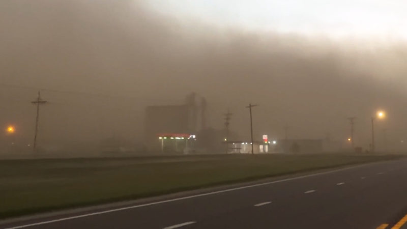
During very dry conditions, dust storms can occur during a Chinook wind event.

Where snow is on the ground, blizzard conditions may develop, before the snow melts in the warmth or evaporates in the dry air.

"Chinook winds are most frequent in Montana but are common in Wyoming and Alberta and can occur as far south as Colorado," Anderson said.

RELATED:

Blizzards: The fiercest of winter’s fury defined
What’s the difference between straight-line winds and tornadoes?
How do avalanches occur?

"Another common occurrence during a Chinook wind event is for the air to warm dramatically from the ridges to the foothills and plains below," he added.

The greatest temperature rises in the United States have occurred during Chinook wind events in Montana. In these cases, Arctic air was quickly eroded by mild air from the Pacific Ocean.

Loma, Montana, holds the world record for the greatest 24-hour temperature change. On Jan. 15, 1972, the temperature rose 103 F, from 54 degrees below zero Fahrenheit to 49 above zero.

On Jan. 11, 1980, at Great Falls International Airport, Montana, the temperature rose from minus 32 F to 15 F in seven minutes. This 47-degree-Fahrenheit rise is the record for the most rapid temperature change in the U.S.

During a more typical Chinook wind warming event, temperatures may rise 25 to 50 degrees.

Occasionally, air that has been warmed by this process can reach thousands of miles across the Mississippi River and into the Eastern states.

Report a Typo

Weather News

Recreation

Boulders narrowly miss swimmers at popular Utah waterfall

Jun. 27, 2025
Weather Forecasts

July 4 Forecast: Thunderstorms to focus over Upper Midwest and Florida

Jul. 1, 2025
Weather News

Girl, 8, rescued after 7 hours in flooded sewer in China

Jun. 27, 2025
Show more Show less Chevron down

Topics

AccuWeather Early

Hurricane Center

Top Stories

Trending Today

Astronomy

Heat

Climate

Health

Recreation

In Memoriam

Case Studies

Blogs & Webinars

Top Stories

Severe Weather

Severe storms, flash flooding to bring July 4 holiday travel hassles

6 hours ago

Weather News

Storm chaser stages whirlwind proposal with real tornado

8 hours ago

Weather News

Tropical trouble could stir near Southeast beaches around 4th of July

6 hours ago

Astronomy

July offers rare meteor shower combo, stunning views of the Milky Way

5 days ago

Weather News

Flights cancelled as Atlanta airport recovers from severe weather

2 days ago

More Stories

Featured Stories

Travel

Fourth of July gas hasn’t been this cheap since 2021

10 hours ago

Recreation

Two people rescued after going overboard on Disney cruise ship

11 hours ago

Weather News

Fossil reveals ‘Last of Us’-type fungus likely lived with dinosaurs

6 days ago

Health

'Inverse' vaccines may hold key to challenge autoimmune diseases

1 day ago

Weather News

World’s most liveable city for 2025 revealed

1 week ago

AccuWeather Weather News What are Chinook winds?
Company
Proven Superior Accuracy About AccuWeather Digital Advertising Careers Press Contact Us
Products & Services
For Business For Partners For Advertising AccuWeather APIs AccuWeather Connect RealFeel® and RealFeel Shade™ Personal Weather Stations
Apps & Downloads
iPhone App Android App See all Apps & Downloads
Subscription Services
AccuWeather Premium AccuWeather Professional
More
AccuWeather Ready Business Health Hurricane Leisure and Recreation Severe Weather Space and Astronomy Sports Travel Weather News Winter Center
© 2025 AccuWeather, Inc. "AccuWeather" and sun design are registered trademarks of AccuWeather, Inc. All Rights Reserved.
Terms of Use | Privacy Policy | Cookie Policy | About Your Privacy Do Not Sell or Share My Personal Information

...

...

...