Go Back
  • For Business
  • |
  • Warnings
  • Data Suite
  • Forensics
  • Advertising
  • Superior Accuracy™
Storm rolling into California with torrential rain, feet of snow. Get the latest forecast. Chevron right

Columbus, OH

35°F
Location Chevron down
Location News Videos
Use Current Location
Recent

Columbus

Ohio

35°
No results found.
Try searching for a city, zip code or point of interest.
Create Your Account Unlock extended daily and hourly forecasts — all with your free account.
Let's Go Chevron right
Have an account already? Log In
settings
Help
Columbus, OH Weather
Today WinterCast Local {stormName} Tracker Hourly Daily Radar MinuteCast® Monthly Air Quality Health & Activities

Around the Globe

Hurricane Tracker

Severe Weather

Radar & Maps

News

News & Features

Astronomy

Business

Climate

Health

Recreation

Sports

Travel

For Business

Warnings

Data Suite

Forensics

Advertising

Superior Accuracy™

Video

Winter Center

AccuWeather Early Hurricane Center Top Stories Trending Today Astronomy Heat Climate Health Recreation In Memoriam Case Studies Blogs & Webinars
Dense Fog Advisory

News / Weather News

A Quick Word About Next Week's Storm

By Staff

Published Feb 28, 2015 1:30 PM EST | Updated Feb 28, 2015 1:47 PM EST

Copied

I had a few minutes to spare this evening, no time for a video but there are a couple of things I wanted to quickly point out about next week's storm ... actually a sharp cold front that will bring a turn from the coming warmup back to the deep freeze.

Above is the GFS forecast for Thursday morning. The front by this point is roughly from Hatteras to Tallahassee. You'll note how it looks like all the rain is behind the front. That's because the models are showing an undercutting type of cold front (the technical term is anafront, as opposed to a katafront that might instead lead to significant severe weather). By that, I mean that the colder air mass will arrive sooner near the surface than aloft, instead of around the same time as is more typical.

This type of setup can produce a lot of rain and that's what the models are showing. I tweeted this out last night since I neglected to mention it in the video that I made. Yesterday, the GFS model was showing up to 3 inches of rain through next week and a fairly large area of 2 inch rains across Kentucky and Tennessee, east into Virginia and North Carolina. That combined with snow melt up to and during the time the rain falls Tuesday into Wednesday can lead to some flooding.

Today's model runs (that's the GFS run above) show a lot of rain in the same areas once again. In fact, the area where 1.5 inches or more is predicted by the model is even bigger than yesterday!

But, there is one other concern as well.

Y'all may have already had a weather geek friend show you this by way of social media or told you about it. The Euro looks similar, by the way. The model snowfall plots (that's the 12Z GFS run from today above) show the rain turning over to snow and apparently leaving a lot behind as the colder air blasts in. "Apparently" being the operative word here, that's not really what the model is calling for. The truth might actually be more sinister. One thing that isn't widely known beyond the community of meteorologists and some weather geeks is that these model snow plots assume all frozen or freezing precipitation to be snow and plots it that way. So, if there's 1" of liquid equivalent that falls as sleet and freezing rain, well then the model plots it (using the 10:1 ratio that is a decent rule of thumb) as a 10 inch snowstorm.

Your friendly neighborhood meteorologist knows (or should know) to dig deeper. If you do, you might see something like this if you look at model forecast skew-t diagram:

The above is valid for Tupelo on Thursday morning (120 hours from 12Z Saturday morning). Oh, no! It's above freezing aloft but below freezing at the surface! That means the model isn't really calling for snow, it's calling for freezing rain or maybe sleet! I noticed this in several places where I looked ... Shreveport, North Georgia and the I-85 Corridor in the Carolinas. So, it doesn't look to be a rain to snow event there, but perhaps instead rain to freezing rain, then sleet. Maybe there's a little snow at the very end. Triangle residents (Raleigh area, for those outside of North Carolina), keep in mind y'all had thunder with the last snow, so that Old Wives Tale Clock is ticking again there (it appears to be correct about a third of the time, so says Tim Buckley of WFMY in Greensboro).

However, the snow the model appears to be calling for farther north might well be reasonable. The air will be colder aloft in those areas, so a few inches of snow (maybe more) after some rain looks reasonable. A foot in southern Arkansas is probably a stretch, though.

I'll have more to say on this tomorrow, assuming I survive my wife's company's outing tonight! See y'all then (and be good)!

Report a Typo

Weather News

Weather News

Lightning strike sparks windmill fire near Breckenridge, Texas

Feb. 16, 2026
Hurricane

Lake Lure begins refilling namesake lake after Helene recovery efforts

Feb. 13, 2026
video

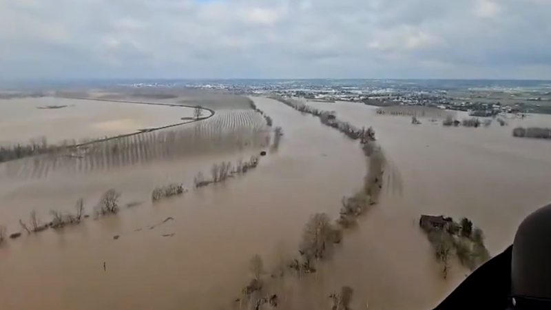
Severe flooding swamps communities along France’s Garonne River

Feb. 16, 2026
Show more Show less Chevron down

Topics

AccuWeather Early

Hurricane Center

Top Stories

Trending Today

Astronomy

Heat

Climate

Health

Recreation

In Memoriam

Case Studies

Blogs & Webinars

Top Stories

Winter Weather

California bracing for flooding, pass-closing snow and severe storms

13 hours ago

Travel

Italy’s famous 'lovers’ arch' crashes into the sea on Valentine’s Day

15 hours ago

Weather Forecasts

Record warmth to expand across central, eastern US this week

12 hours ago

Weather News

Shipwreck missing since 1872 discovered at bottom of Lake Michigan

14 hours ago

Weather Forecasts

Snow, ice, rain and severe weather coming to central, eastern U.S.

11 hours ago

More Stories

Featured Stories

Recreation

Presidents Day marks first Free National Park day in 2026

17 hours ago

Weather News

What's behind South Carolina’s recent earthquakes

15 hours ago

Weather News

Gray wolf tracked in Los Angeles County for first time

5 days ago

Astronomy

A 'ring of fire' eclipse is coming Feb. 17

19 hours ago

Weather News

99% of Florida is in drought with almost no rain falling in February

3 days ago

AccuWeather Weather News A Quick Word About Next Week's Storm
Company
Proven Superior Accuracy™ About AccuWeather Digital Advertising Careers Press Contact Us
Products & Services
For Business For Partners For Advertising AccuWeather APIs AccuWeather Connect Personal Weather Stations
Apps & Downloads
iPhone App Android App See all Apps & Downloads
Subscription Services
AccuWeather Premium AccuWeather Professional
More
AccuWeather Ready Business Health Hurricane Leisure and Recreation Severe Weather Space and Astronomy Sports Travel Weather News Winter Center
© 2026 AccuWeather, Inc. "AccuWeather" and sun design are registered trademarks of AccuWeather, Inc. All Rights Reserved.
Terms of Use | Privacy Policy | Cookie Policy | About Your Privacy Do Not Sell or Share My Personal Information | Data Sources

...

...

...