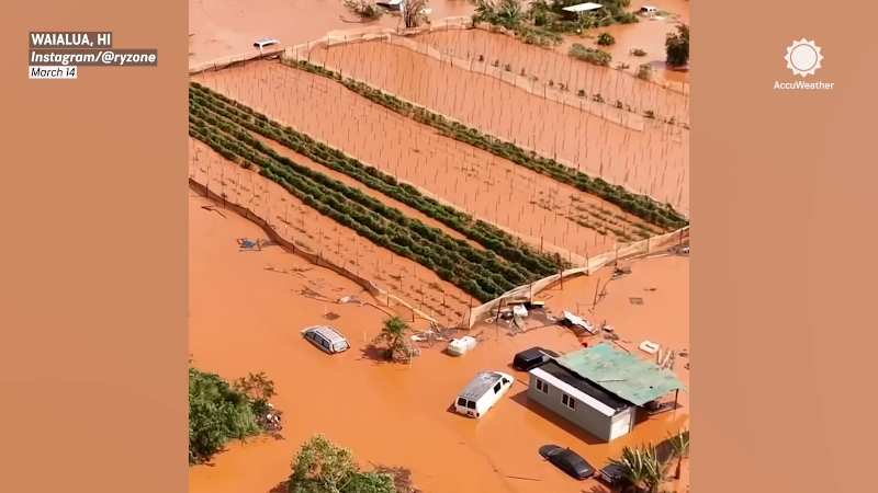
Storm to affect parts of California, Southwest with locally heavy rain, isolated flash flooding
Wet weather will affect parts of the Southwest, especially central and southeastern California; there is also an increased risk for lightning and wildfires.
Rain from what was once Tropical Storm Mario led to disastrous scenes in parts of the Southwest on Sept. 18.
In the wake of a soaking rain and even mudslides in parts of the West earlier this week, a new storm is targeting the region for this week, say AccuWeather meteorologists.
The new storm, similar to the last one, but centered farther north, will bring a plethora of impacts to the region, especially in Central California, with localized flooding downpours, lightning and even an increased risk of wildfires is expected.

Damage is seen from mudslides after storms in Yucaipa, Calif., Friday, Sept. 19, 2025. (AP Photo/Damian Dovarganes)
"Following the rain event from former Tropical Storm Mario that brought a month's worth of rain to many locales in California, another storm is expected to pump moisture into California this week" said AccuWeather Meteorologist Brandon Buckingham.
A few showers moved ashore along California's southern coast on Monday, including around San Diego. Steadier rain moved in Tuesday night and beyond for areas near and north of Los Angeles to San Francisco and Sacramento. On Wednesday, a plume of moisture was affecting the San Francisco Bay Area, some of the Coast Ranges and part of the Central Valley.

Tropical moisture can cause downpours that lead to localized flooding, mudslides and other debris flows.
San Diego and Los Angeles area missing out on the lion's share of the rain this time. With the last storm, downtown Los Angeles recorded nearly a tenth of an inch of rain, while San Diego measured nearly a half of an inch, both well above the historical average totals for mid-September.
As of midday on Wednesday, most of the rainfall had been under 0.25 inches, while San Luis Obispo, California, had picked up 0.35 inches.
GET THE FREE ACCUWEATHER APP
•Have the app? Unlock AccuWeather Alerts™ with Premium+
While the last storm exited quickly, this new one may linger longer.
"Depending on the evolution of the storm, there is a chance for it to slow to a crawl across the interior Southwest later this week if it becomes separated from the main jet stream winds," said Buckingham.

"This could result in a more prolonged stretch of cooler conditions and keep a lingering chance for pop-up shower and thunderstorm activity later into the week," Buckinham added.
The zone from southeastern California to southwestern New Mexico could experience locally heavy, gusty thunderstorms with the greatest risk of flash flooding.

Despite the risk for travel-disrupting rain, the wet weather is greatly needed. According to the latest U.S. Drought Monitor released on Thursday, most of the West, except for a portion of Northern California and Oregon, is abnormally dry or in drought.
Because of the prolonged dry weather in some areas, conditions may become favorable for new wildfires in the region.
"The storm will likely bring with it a risk of lightning strikes that could lead to wildfire concerns," added Buckingham. "However, because of the quick succession of rain events across California and portions of the Southwest, the risk can be on the lower end for the locales that picked up meaningful rainfall."

Unfortunately for rain-seeking Northwesterners, the rain will not make it into that region. Instead, an area of high pressure will promote dry and very warm conditions this week.
Want next-level safety, ad-free? Unlock advanced, hyperlocal severe weather alerts when you subscribe to Premium+ on the AccuWeather app. AccuWeather Alerts™ are prompted by our expert meteorologists who monitor and analyze dangerous weather risks 24/7 to keep you and your family safer.
Report a Typo


