Go Back
  • For Business
  • |
  • Warnings
  • Data Suite
  • Forensics
  • Advertising
  • Superior Accuracy™
Significant September Nor’easter is brewing for the East Coast. Click for details. Chevron right
Hurricane Polo is forecast to become Category 5 storm. Click for details. Chevron right

Columbus, OH

60°F
Location Chevron down
Location News Videos
Use Current Location
Recent

Columbus

Ohio

60°
No results found.
Try searching for a city, zip code or point of interest.
Get Premium+
Create Your Account Unlock extended daily and hourly forecasts — all with your free account.
Let's Go Chevron right
Have an account already? Log In
settings
Help
Columbus, OH Weather
Today WinterCast Local {stormName} Tracker Hourly 10-Day Radar MinuteCast® Monthly Air Quality Health & Activities

Around the Globe

Hurricane Tracker

Severe Weather

Radar & Maps

News

News & Features

Astronomy

Business

Climate

Health

Recreation

Sports

Travel

For Business

Warnings

Data Suite

Forensics

Advertising

Superior Accuracy™

Video

Winter Center

Top Stories Severe Weather Hurricane Center Astronomy Heat Alert Climate Recreation Trending Today Health In Memoriam Case Studies Blogs & Webinars

Weather Blogs / WeatherMatrix

Blizzard of 2018: 100+ mph winds, record low pressure, huge waves

By Jesse Ferrell, AccuWeather meteorologist

Published Jan 6, 2018 12:51 AM EDT | Updated Jan 7, 2018 12:16 AM EDT

Copied

The first major winter storm of 2018 started out by delivering snow and ice to Florida and Georgia, then brought heavy snow to the eastern Carolinas and mid-Atlantic, before burying New England in up to two feet of snow.

New Blizzard Snow Totals Map 1/6

The highest snow totals by state were:

  • Holden, ME: 24.0"

  • Sharon, MA: 19.0"

  • Brick & Bayville, NJ: 18.0"

  • Hancock, NH: 17.9"

  • Warren, RI: 16.9"

  • Staffordville, CT: 16.6"

  • Terryville, NY: 16.4"

  • Hallwood, VA: 14.8"

  • Morgan, VT: 14.0"

  • Pittsville, MD: 13.0"

  • Rockyhock, NC: 12.0"

  • Stockley, DE: 11.4"

  • Andrews, SC: 8.0"

  • Ellabell, GA: 6.0"

  • Killearn Lakes, FL: 0.1"

The heavy snow on the coasts of the Carolinas and Georgia were particularly impressive. Charleston, Savannah and northern Florida hadn't seen significant snow since December 1989. The Outer Banks of North Carolina see snow every few years, but not normally this much right up against the ocean.


The storm was preceded and followed by extreme, record-setting cold... the Outer Banks were also dealing with frozen bays and "ice shoves" -- something that normally happens in the Great Lakes or on the coast of New England.

The Outer Banks are no stranger to extreme weather but the sight of ice shoves jutting up against a dock in Duck, North Carolina, on Jan. 3 makes for a rare scene.

The highest wind gusts reported by state (>70 mph) were:

  • 122 mph @ Mt. Washington, NH

  • 108 mph @ Wreckhouse, Newfoundland

  • 106 mph @ Grand Etang, Nova Scotia

  • 77 mph @ Third Island, VA

  • 76 mph @ Nantucket, MA

  • 72 mph @ Buoy #44317

  • 71 mph @ Block Island, RI

Wind Gusts > 70 Mph During Blizzard 2018
NWS

Waves reported were over 50 feet at two buoys! I don't think I've seen higher waves recorded on buoys since I've been blogging (2005). The all-time record was 59 feet up until 2007 when it rose to 62.

  • #44317: 56 feet

  • #44150: 51 feet

  • #44139: 43 feet

  • #44011: 43 feet

Buoy Showing 56-Foot Waves during Blizzard of 2018

Over 100,000 people lost power due to high winds, and damage was reported. Atmospheric pressures fell to rarely seen levels. At sea, the WPC reckoned the center of the cyclone officially fell to 949 mb (28.02 in.), plunging more than 60 mb in less than a day, which was probably an all-time record. As far as actual recording instruments, one station on land indicated 948 mb (27.99 in) but that sensor had problems. Buoy #44027's pressure reading bottomed out at 28.17", while other nearby buoys' pressure readings stopped transmitting due to instrument malfunction or quality control algorithms before hitting their lows.

A report of 947 mb (27.95") was rumored at Kent Island, New Brunswick, Canada, something I could not confirm as of this writing. St. Johns, New Brunswick, Canada had never experienced pressure readings so low. The reason these readings are significant is that those pressures are normally reserved for a Category 3 hurricane. The Blizzard of 1993 was only 960 mb and the 1991 Perfect Storm was even higher, at 972 mb. One of the only landfalling storms to beat the Blizzard of 2018 for pressure was Hurricane Sandy, at 940 mb, in 2012. It's quite possible this storm was the deepest landfalling winter storm in the U.S. on record.

Buoy Showing 28.17" Pressure During Blizzard 2018

EXCLUSIVE: Violent winds take down gas station canopy in Garfield, NJ #nbc4ny pic.twitter.com/RDov0rmVdQ

— Steven Bognar (@Bogs4NY) January 4, 2018

On the Massachusetts shore, coastal homes were inundated with a cold slushy ice, snow and storm surge; Boston broke their record high tide! Reed Timmer had a heck of a ride through the floodwaters.

https://business.facebook.com/AccuWeather/videos/10155957159817889/
Report a Typo

Weather News

Weather News

Why meteorological, astronomical fall start on different dates

Sep. 21, 2026
video

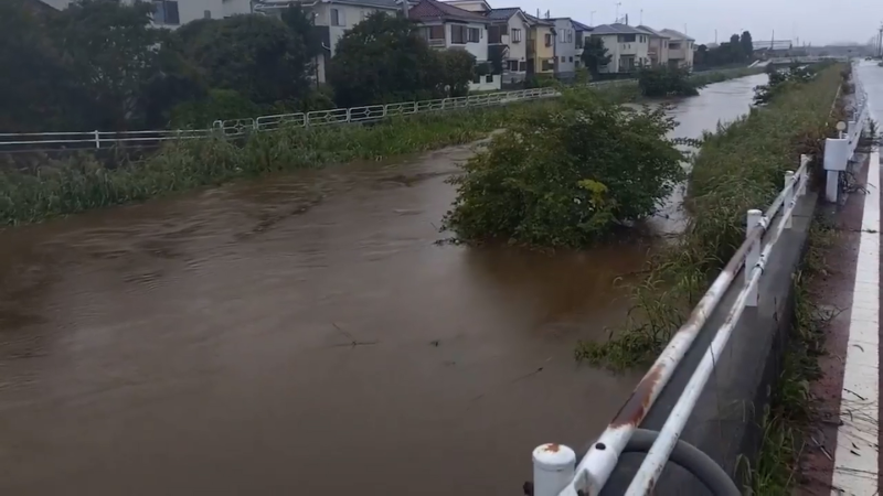
Typhoon Dujuan brings flash flooding to roads in Japan

Sep. 21, 2026
Recreation

Hungry bears are breaking into homes as drought dries up their food

Sep. 18, 2026
Show more Show less Chevron down

Topics

Top Stories

Severe Weather

Hurricane Center

Astronomy

Heat Alert

Climate

Recreation

Trending Today

Health

In Memoriam

Case Studies

Blogs & Webinars

ABOUT THIS BLOG
WeatherMatrix
Jesse Ferrell
AccuWeather Meteorologist and Social Media Manager Jesse Ferrell covers extreme weather and the intersection of meteorology and social media.
  • Astronomy
    with Dave Samuhel
  • Canadian weather
    with Brett Anderson
  • Global climate change
    with Brett Anderson
  • Global weather
    with Jason Nicholls
  • Northeast US weather
    with Elliot Abrams
  • Plume Labs on Air Quality
    with Tyler Knowlton
  • RealImpact of weather
    with Dr. Joel N. Myers
  • WeatherMatrix
    with Jesse Ferrell
  • Western US weather
    with Brian Thompson

Featured Stories

Astronomy

Harvest Moon 2026: When to see September’s full moon

2 hours ago

Weather News

Lake Tahoe’s poisoned-pine mystery: $147,000 reward offered

1 hour ago

Recreation

Body of missing hiker recovered in Washington's Olympic National Park

4 hours ago

Weather News

These cities have had more 100+ degree days this year than ever

3 days ago

Recreation

Man and his dog found alive after 7 days in remote Wyoming wilderness

5 days ago

AccuWeather Weather Blogs Blizzard of 2018: 100+ mph winds, record low pressure, huge waves
Company
Proven Superior Accuracy™ About AccuWeather Digital Advertising Careers Press Contact Us
Products & Services
For Business For Partners For Advertising AccuWeather APIs AccuWeather Connect Personal Weather Stations
Apps & Downloads
iPhone App Android App See all Apps & Downloads
Subscription Services
AccuWeather Premium AccuWeather Professional
More
AccuWeather Ready Business Health Hurricane Leisure and Recreation Severe Weather Space and Astronomy Sports Travel Weather News Winter Center
Company
Proven Superior Accuracy™ About AccuWeather Digital Advertising Careers Press Contact Us
Products & Services
For Business For Partners For Advertising AccuWeather APIs AccuWeather Connect Personal Weather Stations
Apps & Downloads
iPhone App Android App See all Apps & Downloads
Subscription Services
AccuWeather Premium AccuWeather Professional
More
AccuWeather Ready Business Health Hurricane Leisure and Recreation Severe Weather Space and Astronomy Sports Travel Weather News Winter Center
© 2026 AccuWeather, Inc. "AccuWeather" and sun design are registered trademarks of AccuWeather, Inc. All Rights Reserved.
Terms of Use | Privacy Policy | Cookie Policy | About Your Privacy Do Not Sell or Share My Personal Information | Data Sources

...

...

...