Thunderstorms on the prowl: Straight-line winds, tornadoes and flooding pose risks across the South
More than half a foot of rain can pour down as severe weather sweeps through the region. AccuWeather forecasters say the pattern may repeat in mid-March.
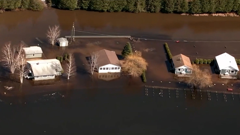
Intense amounts of rain in the Gulf Coast could cause life-threatening flash floods overnight.
Damaging winds, flash flooding and isolated tornadoes will threaten life and property as thunderstorms sweep through the Southern states into Saturday evening, AccuWeather meteorologists warn.
The corridor between Interstate 10 and I-20 from northern Florida to far southeastern Georgia is forecast to be hit the hardest with heavy rainfall and severe thunderstorms.

Clusters of showers and thunderstorms drifted eastward across the Florida Panhandle, southern Alabama and southern Georgia through Saturday morning.
Preliminary storm reports from southern Georgia noted a tornado on the ground roughly 5 miles north-northeast of Ambrose, Georgia, around midday Saturday. Storms that pushed through Florida and South Carolina on Saturday resulted in downed trees and building damage, according to local storm reports.
Into the evening hours, thunderstorms that develop eastward can reach severe limits with straight-line winds or even tornadoes, causing tree damage and power outages in some communities.
"Thunderstorms can produce rainfall rates of at least 1-2 inches per hour,” AccuWeather Meteorologist Joe Bauer said.

Motorists should use caution while driving through Saturday evening, as high water levels might be hard to see in the dark. Road closures may occur as a result of flooding or debris.
As drier, cooler air sweeps east across the South Central states and western portions of the Southeast, heavy rain and thunderstorms are expected from the Florida Peninsula into the Carolinas into Saturday evening, according to AccuWeather Meteorologist Brandon Buckingham.
Those with outdoor plans in this corridor may want to consider delaying them until Sunday, as it will be a soggy start to the weekend. In addition to heavy rainfall, thunderstorms may once again reach severe levels and produce damaging winds and isolated tornadoes. This risk will be greatest where the sun manages to break out, most likely in portions of South Carolina, Georgia and northern Florida.

Rinse and repeat next week?
AccuWeather's long-range team is keeping a close eye on the pattern late next week across the southern tier of the country as additional downpours and severe weather may be in the cards.
"Beware the Ides of March! Why? Severe weather may come calling," AccuWeather Senior Meteorologist Joe Lundberg said.
A potent storm expected to dive southward over the Rockies will help to draw warm, moist air from the Gulf of Mexico into the south-central and southeastern United States by late week.
"This could be the fuel for a potential outbreak of severe thunderstorms, which then carries downstream across the Mississippi Valley into portions of Alabama, Tennessee and Georgia going into Friday, March 15 (Ides of March)," Lundberg said.
Regardless of the severity of thunderstorms later next week, experts say the pattern can bring more soaking rain to the region, resulting in slowed travel, disrupted outdoor plans and possible flooding.
Want next-level safety, ad-free? Unlock advanced, hyperlocal severe weather alerts when you subscribe to Premium+ on the AccuWeather app. AccuWeather Alerts™ are prompted by our expert meteorologists who monitor and analyze dangerous weather risks 24/7 to keep you and your family safer.
Report a Typo


