Springtime severe weather risks persist this week
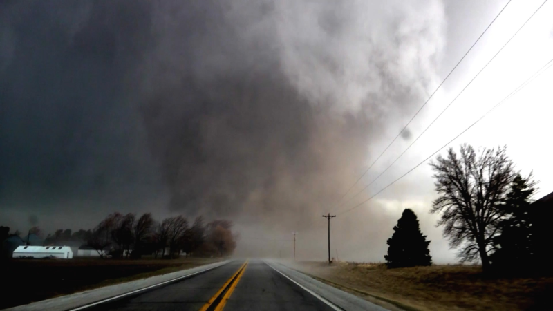
As a storm system tracks across the central U.S., rounds of showers and localized pockets of severe weather will persist across the Mississippi and Ohio river valleys this week.
With the spring season in full swing, AccuWeather meteorologists warn that a dozen states from the central United States to the East Coast could be at risk for some severe weather in the coming days.
Severe weather began first thing on Sunday, with severe-warned storms firing up in Indiana and Ohio during the morning. In Iowa, hail the size of tennis balls was reported across the state in cities such as Ames and Carroll. Severe hail was also reported in Okawville, Illinois on Sunday afternoon. More isolated storms fired up in portions of Texas, bringing severe hail and damaging wind gusts to central portions of the state.
In total, Sunday was the most active severe weather day of the past week. The Storm Prediction Center received over 400 reports of severe hail and wind, mainly in a region extending from Kansas to Illinois, and southward into Kentucky.
Severe storms continued into Monday as well, with reports coming in from Wisconsin to Texas throughout the course of the day. The most intense storms were concentrated in Missouri, a state that his been hard hit by storms in recent days, with hail as large as tennis balls being reported in southern portions of the state.
On Tuesday, thunderstorms could also be particularly feisty across southeast Virginia, North Carolina and the eastern half of South Carolina on Tuesday, especially in the afternoon and evening. Any storms that fire up during this time could be heavy, bringing torrential downpours and sudden gusty winds. Locations such as Myrtle Beach, Raleigh and Virginia Beach may all be threatened by these strong storms.

Thunderstorms again ignite in central US
Meanwhile, the central U.S. will be gearing up for yet another round of stormy weather Tuesday, as a pair of storms captures the moisture from the Gulf of Mexico.

Thunderstorms are expected to be most widespread in the afternoon and evenings but may contain some gusty winds or hail as well. Into Tuesday evening, storms may form into a line as they move into central and eastern Kansas, with high wind gusts as the main hazard.
Farther south, a different cluster of storms is expected across much of Texas and Louisiana, including cities such as Lake Charles, Louisiana, and Houston. While damaging winds and hail may occur in only isolated instances, the slow moving nature of these storms may lead to localized flooding.

Looking into the second half of the week, AccuWeather meteorologists are again warning that residents across the Plains should be on alert for more rounds of severe weather.
"Some of the same locations across the Front Range and the Plains could be at risk for severe thunderstorms from Tuesday through Thursday," said AccuWeather Meteorologist Joseph Bauer.
People living in areas from Denver to Rapid City, South Dakota on southward to the Red River and communities like Amarillo and Lubbock, Texas, should be on alert for these more potent thunderstorms on these days.

In addition to the potential for hail and damaging winds, and even a tornado or two at the end of the week, downpours are also a concern.
Similarly, locations in the Plains should be on the look-out for more severe weather on Thursday afternoon and evening. All of the same modes of severe weather in in play, including hail, damaging winds and flooding downpours. Isolated tornadoes should also be a concern for residents late on Thursday.

A lot of the same areas that will be the target of thunderstorms these days could use the rain. Most locations are experiencing severe, extreme or even exceptional drought conditions, according to the U.S. Drought Monitor. With how dry it's been, however, too much rain could more easily lead to flash flooding.
As the end of the week approaches, a unique weather pattern may unfold, allowing for both thunderstorms and rounds of rain to impact some of the same areas.
"We could see the weather pattern evolve into what is called a 'Rex Block' towards this coming weekend. This is when we see an area of high pressure, in this case over the Northwest, over an area of low pressure, in the Southwest," Bauer explained.
This could lead to the development of a wet pattern between the southern Rockies to the southern Plains from later this week into early next week, assisting those locations in the High Plains that are still in an enormous drought from the winter.
Want next-level safety, ad-free? Unlock advanced, hyperlocal severe weather alerts when you subscribe to Premium+ on the AccuWeather app. AccuWeather Alerts™ are prompted by our expert meteorologists who monitor and analyze dangerous weather risks 24/7 to keep you and your family safer.
Report a Typo


