Severe thunderstorms to target Plains, Southeast through midweek
Following destructive winds in parts of Oklahoma and Texas Sunday night, severe thunderstorms will continue to rumble across portions of the Plains and Southeast through at least midweek.
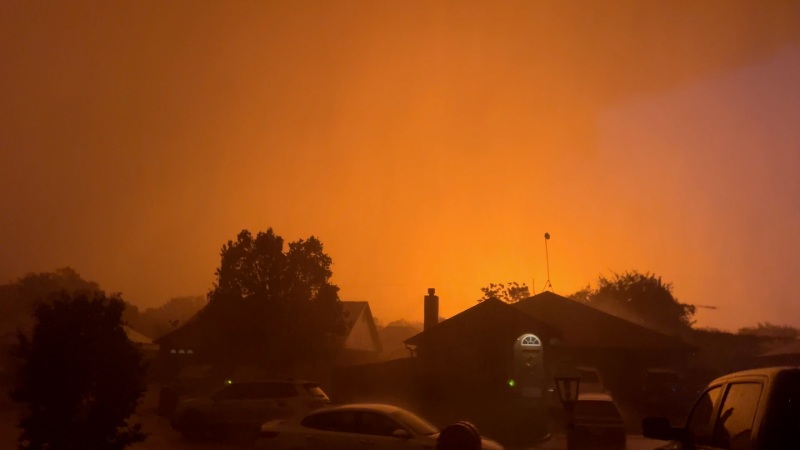
Severe hail and strong winds fell on Paducah, Texas, on June 8.
Despite a somewhat less-intense severe weather threat, when compared to this past weekend, more storms will erupt in various parts of the central and eastern U.S. into midweek.
Another active week of severe weather in the central and eastern United States began as wind gusts of over 80 mph tore through parts of the southern Plains on Sunday. This event was categorized as an extreme risk for severe weather, which AccuWeather has only issued six times since the spring of 2023.

An approaching storm with a shelf cloud and rain shaft is visible during a Project ICECHIP operation on Tuesday, June 3, 2025, in Scotland, Texas. (AP Photo/Carolyn Kaster)
As thunderstorms charged across Oklahoma and Texas, there were numerous reports of destructive wind gusts, baseball-sized hailstones and even a few tornadoes.
Additional rounds of destructive storms are expected to occur in the same area and elsewhere this week, but with a somewhat lower risk level.
The severe threat will continue this week
Tuesday, the overall risk for severe storms will be lower in the East.
While heavy rain appears to be the primary concern from the South to the Northeast, a few storms can still be capable of generating gusty winds from around the Interstate 95 corridor to the Atlantic and Gulf coasts.

Another area of severe weather will be found across western Texas and New Mexico, with hail and damaging winds the primary concerns, though an isolated tornado cannot be ruled out.
Thunderstorms will also be capable of producing torrential downpours, leading to flash flooding, particularly in western Texas, where the most rainfall has fallen this past weekend.

Though much of the thunderstorm activity has been concentrated across the southern tier of the nation during the early part of June, thunderstorm activity will be reignited across portions of the Midwest by the middle of the week.
On Wednesday afternoon and evening, thunderstorms from South Dakota to Wisconsin will be capable of producing hail, flooding downpours and localized damaging wind gusts between 50 and 60 mph.

With outdoor summer plans getting underway, having a way to receive warnings both at and away from home or work will be important over the next few days. The AccuWeather App offers push notifications of severe weather alerts so you can take quick action in the event of storms.
Want next-level safety, ad-free? Unlock advanced, hyperlocal severe weather alerts when you subscribe to Premium+ on the AccuWeather app. AccuWeather Alerts™ are prompted by our expert meteorologists who monitor and analyze dangerous weather risks 24/7 to keep you and your family safer.
Report a Typo


