More severe thunderstorm complexes to rattle, drench central US
A stormy weather pattern across the central United States will help alleviate ongoing drought concerns but will also pack dangerous wind gusts and hail into the weekend.
While the summer of 2023 has been a season of smoke for parts of the northern United States, it has been a season with many thunderstorms for much of the Plains and Midwest. AccuWeather meteorologists believe that more rounds of severe weather will affect the Central states in the coming days.
The weather pattern has been ripe for large complexes of thunderstorms to form and travel dozens to hundreds of miles over the central region of the U.S. This is typically how much of the Plains and Mississippi Valley zones receive rainfall in the summer. However, there have been numerous complexes of storms this summer and more are on the way.
Rain in recent weeks has been a good thing for drought-stricken areas of the region. The drought has been a problem since early in the winter. While most levels of drought have shrunk in size since the start of the spring, there remain some locations of the central Plains that are still in need of non-flooding rainfall, according to the United States Drought Monitor.

More rain will fall on some of these extra-needy zones through this week. But, unfortunately, so will the potential for large complexes of storms with flash flooding as well as damaging wind gusts and hail.
On Sunday, storms were most intense across portions of central Kansas. At least 1 tornado occurred in the state, near the town of Bunker Hill, while softball sized hail was reported in Barton County, Kansas.
Meanwhile, thunderstorms led to a swath of damaging winds in the St. Louis metro area, as well as across much of northern Louisiana. Between Missouri and Louisiana, over 55,000 utility customers remained without power as of Monday morning.
As this zone of severe thunderstorms presses eastward at the start of the new week, the risk of locally severe weather will ramp up over parts of the Ohio and Tennessee valleys to the western slopes of the Appalachians on Monday afternoon and evening.
Have the app? Unlock AccuWeather Alerts™ with Premium+
Localized wind gusts of 50-60 mph are possible with an AccuWeather Local StormMax™ of 70 mph in the strongest storms. The greatest threats will be from flash flooding and lightning strikes for those outdoors.

Farther west, storm-weary residents across the Plains states will not have a long a break between rounds of severe weather.
As a disturbance rolls southeastward across the northern Plains on Monday, more thunderstorms are forecast to erupt and turn severe from late in the day to Monday night. The corridor at greatest risk for severe weather stretches from parts of South Dakota to Kansas and northwestern Missouri.

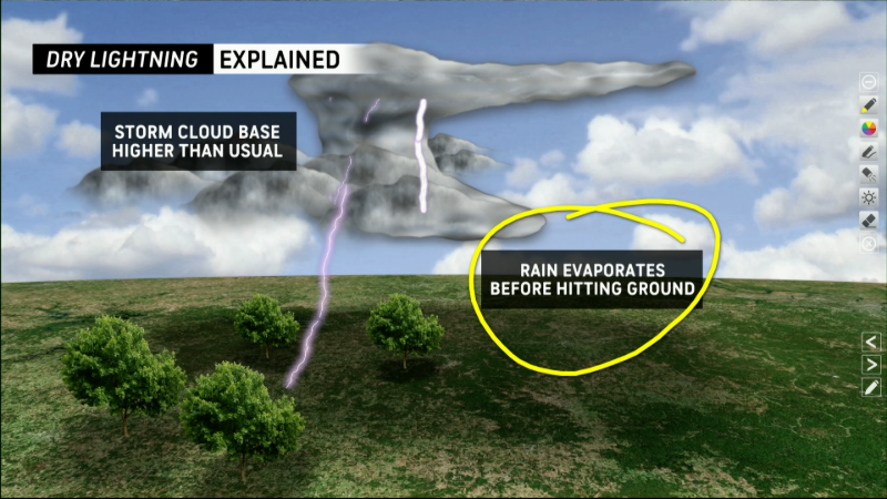
Even farther west, storms are expected to develop from the Montana plains westward into portions of Idaho. While these are likely to remain rather isolated, large hail and strong wind gusts can accompany any storm. In locations that have been dry as of late, lightning will be capable of sparking wildfires in some cases.

Additional rounds of severe weather, including a large or long-lived thunderstorm complex or two is likely to occur over portions of the Plains and Midwest from Tuesday to Friday.
It is possible for the same complex that begins over the northern Plains Monday night to continue to move along over portions of the middle Mississippi Valley and the Ohio Valley on Tuesday.

Another complex of thunderstorms, some potentially severe may develop over the Dakotas and travel toward Minnesota on Tuesday.
Many portions of the Plains and Mississippi Valley are likely to pick up 0.25 of an inch to 1 inch of rain through the end of the week. However, pockets of heavier rain are likely to occur where thunderstorms repeat. Rainfall will be more liberal in nature east of the Mississippi, where parts of the Ohio and Tennessee Valley may pick up 1-3 inches into Tuesday. Locally higher amounts are likely, with double and triple that amount of rain foreseen for the Northeast, where flooding problems may become widespread.

As long as the setup remains with a heat dome of high pressure from the Southwest to the South Central states, and a large storm continues to create a dip in the jet stream over the eastern parts of Canada to the central and eastern U.S., more complexes of thunderstorms are likely to erupt.
The storms tend to form along the edge of hot and cool air and are carried along by the stream to the east and southeast.
The same pattern has allowed a new round of smoke to be carried southeastward from massive wildfires in western Canada to the North-Central states this weekend. The smoke can reach the Northeast and Southeast states early this week.
Want next-level safety, ad-free? Unlock advanced, hyperlocal severe weather alerts when you subscribe to Premium+ on the AccuWeather app. AccuWeather Alerts™ are prompted by our expert meteorologists who monitor and analyze dangerous weather risks 24/7 to keep you and your family safer.
Report a Typo


