Frequent rain, thunderstorms to depart by Mother's Day in Northeast
Wet weather is expected to continue into the start of Mother’s Day weekend across the Northeast.
There's good news on the weather maps for Sunday in the northeastern United States with a bright Mother's Day forecast. However, AccuWeather meteorologists say there are some downpours to dodge until then.
A pesky storm has been largely responsible for rounds of rain and thunderstorms through the first part of this week.
During the 48-hour period ending at 9 a.m. EDT Wednesday, the storm brought close to 3 inches of rain to Mount Pocono, Pennsylvania. Westhampton Beach, New York, picked up 2.51 inches of rain during the same period, while 3.24 inches drenched Oxford, Connecticut. The setup also spawned severe weather in the region, with a tornado spotted in parts of eastern Pennsylvania on Tuesday afternoon.
That storm was finally pivoting out by way of New England and southeastern Canada on Wednesday, which brought widespread showers and spotty thunderstorms to New England into Wednesday evening.
Just as that old storm left the U.S., a new storm developed over the Ohio Valley and eastern Great Lakes region, expanding rain over the Northeast.

Through the start of the weekend, a general 1-2 inches of rain is likely to fall on the Northeast. However, a zone where 2-4 inches of rain can fall is most likely from parts of eastern Pennsylvania to central New England. The AccuWeather Local StormMax™ rainfall in this zone is 5 inches.

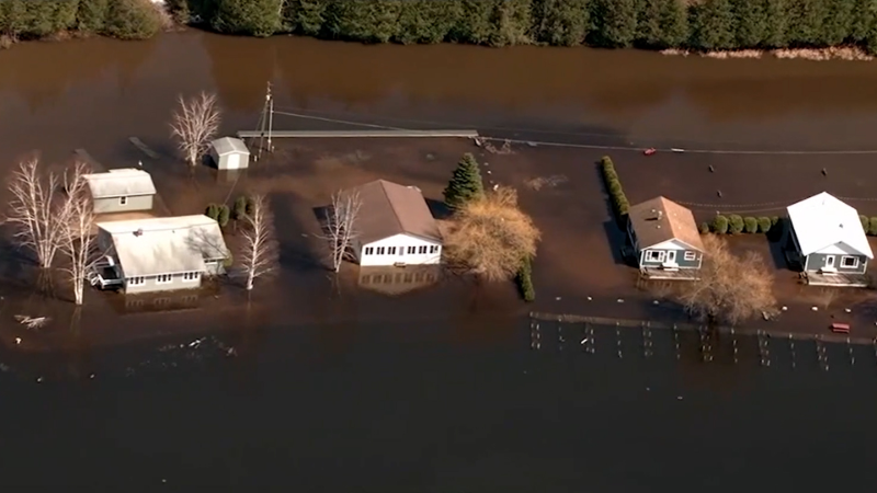
The late-week rain is on top of the wet conditions from recent days. In the rainiest spots, some small streams could spill out of their banks. At the very least, the downpours can lead to ponding on some highways and city streets and slick travel in general.
"Fortunately, this second storm will keep moving along, when compared to its predecessor, " AccuWeather On-Air Meteorologist Melissa Constanzer said.

The steady movement will limit the amount of rain and should salvage at least half of the Mother's Day weekend.
The slow, but steady movement will allow dry air to sweep from west to east across the Northeast states this weekend.
Both days of the weekend will be dry from Pennsylvania, central New York and much of New Jersey to Michigan, Ohio, West Virginia, Maryland, Delaware and much of Virginia. This includes Washington, D.C., Pittsburgh, Philadelphia and New York City.

The two dry days in these areas will give plenty of flexibility for catching up on lawn maintenance, outdoor exercise, yard sales, college graduations and sports-related activities. It may also help keep Mom from getting wet on either day for the special weekend.
The steady movement of the storm will bring a drying and clearing trend on Saturday afternoon for eastern New York and southern and western New England--so it may be dry with some sunshine in these areas by dinnertime. Burlington, Vermont; Hartford, Connecticut; Providence, Rhode Island; and Boston fall into this weather regime for Saturday.
Rainy conditions are likely to linger all day in Maine, but throughout Mother's Day, all of the Northeast, including Portland, Maine, should be dry with at least some sunshine.

Along with the return of sunshine, temperatures are forecast to trend upward. Several hours of sunshine versus clouds all day long can often result in a 10-20 degree difference in high temperatures.
Despite the warming trend by day over the weekend, temperatures may still drop to chilly levels at night. It is possible that some of the normally cold spots of the interior Northeast could get close to frosty levels on Saturday night or Sunday night or possibly both nights.
By early next week, clouds and spotty rain from a southern storm will begin to work into portions of Virginia, West Virginia and Ohio. How far north and how quickly that moisture spreads will depend on the path that Southern storm takes.
Want next-level safety, ad-free? Unlock advanced, hyperlocal severe weather alerts when you subscribe to Premium+ on the AccuWeather app. AccuWeather Alerts™ are prompted by our expert meteorologists who monitor and analyze dangerous weather risks 24/7 to keep you and your family safer.
Report a Typo


