Blizzards, Bitter Cold, Lake Effect.......
The hits keep coming and its only January 2nd. Really looking forward to my day off on Saturday after 8 straight days in the forecast office dealing with all sorts of extreme weather in the U.S. and Canada.
Anyway, here is our latest storm snowfall map for eastern and Atlantic Canada.
I personally believe there will be areas getting 30-35 cm over parts of southern and eastern Nova Scotia with this storm, but does it really matter? The combination of wind, snow, blowing snow and cold will make it very difficult to measure and drifts will be several times higher.
I expect blizzard conditions from Yarmouth to Sydney, NS for Friday then into the Avalon Peninsula (St. John's, NL) for Friday night, where it looks like there will be about 30 cm of snow, with the potential for slightly more in some areas as the storm takes a classic track for that region. Snow drifts across southern Newfoundland will be impressive.
The storm will move away from Newfoundland Saturday morning, but blowing and drifting will continue.
-------
Behind this storm, the combination of bitterly cold air and winds will make for a very unpleasant day if you are outdoors. The map below shows how cold on average it will feel during the day Friday (degrees C.)
Speaking of cold, I saw some very impressive cold (also new records) across parts of Ontario and Quebec earlier this morning....Courtesy of EC.
------ Snow from the Rockies to the Prairies
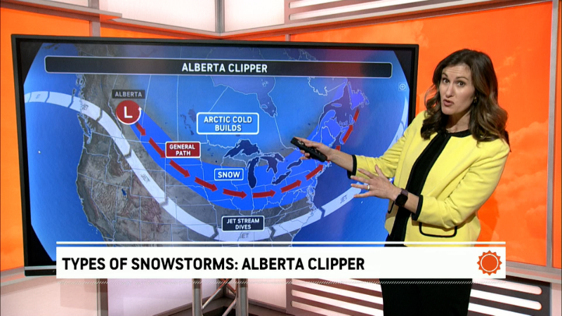
A clipper system will send colder air back down into the Prairies on Friday along with a short period of accumulating snow.
In general, expect about 5-10 cm of snow for much of this region, though there will be higher amounts (10-20 cm) over the western half of Alberta due to increased lift into the higher elevations.
------
Next storm
Another storm will track up from the southern U.S. toward eastern Ontario or northern New England late in the weekend. The track and strength of this storm is still very questionable, but the map below that I drew up earlier today is our latest thinking.
Looks like the main impacts for eastern Canada will be during the Sunday afternoon through the first half of Monday time period.
West of the track this will likely be a moderate snow storm with at least 8-15 cm, while east of the track enough milder air aloft could change snow over to a mix in Quebec and farther east.
The American models are currently weaker and farther east with the storm, while the European model has been consistently farther west and stronger, but warmer for the Northeast U.S. and Quebec. The Canadian model seems to be a little closer to the European.
--- Bitter cold blast and lake-effect snow behind the storm
Regardless of the storm track Sunday, a blast of Arctic air and strong winds will sweep across eastern and then Atlantic Canada early next week. Where temperatures get above freezing with some melting there will be a rapid freeze-up Sunday night or Monday, which could cause more road problems in addition to trying to open your car door.
As the cold blast passes over the warmer Great Lakes there will be a major lake-effect snow outbreak Monday and Tuesday with the potential for over 60 cm (2 feet) in some areas. Right now, it looks like the main snow bands will be orientated mostly from west to east with the highest accumulations likely just south of Buffalo, NY (southtowns?) and in the Tug Hill region of NY.
Over Ontario there will also be areas of heavy, lake-effect snow from Huron/Georgian Bay, but the fetch is not as great compared to the Erie and Ontario, so not as extreme.
Report a Typo


