New clipper storm to bring more wintry mix, prolong Northeast's chill
A new clipper storm will bring bursts of snow, gusty winds and slippery travel to parts of the Northeast. As more cold air pours in from Canada, more lake-effect snow will unfold later in the weekend to early next week.
An icy mix is in store for parts of New England this weekend, but overall, the weather is bouncing back from winterlike to fall-like.
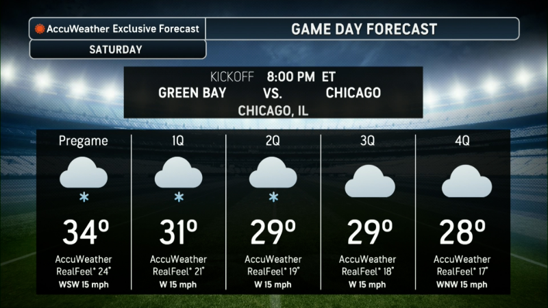
Cold air spilling south from Canada will dominate the weather across the northeastern United States through the weekend. A fast-moving storm tracking out of Canada is forecast to pass through Saturday into early Sunday, followed by a new round of lake-effect snow, AccuWeather meteorologists say.
A dip in the jet stream will confine warm air to the Central and Southeastern states while leaving the door open for more cold air from Canada to flow into the Northeast.
This pattern will also allow fast-moving clipper storms to track across the region.

The region was treated to lighter winds on Friday, offering a brief respite from recent gusty days. However, snow showers will continue into the evening hours in northwestern New England and parts of eastern upstate New York. Rain showers may dampen some Friday evening football games in parts of central and eastern Pennsylvania, New Jersey and central and southeastern New York.
A brief surge of warmer air is possible across the central Appalachians and parts of the mid-Atlantic on Saturday ahead of the next fast-moving Canadian storm. The combination of warm air and moisture may promote gusty showers and isolated thunderstorms from Michigan and Ohio to Pennsylvania and West Virginia during Saturday afternoon and evening.

The new clipper system is expected to move through late Saturday into Sunday morning, with most of the rain, snow and ice occurring near and north of its track.
Slippery travel is most likely from northeastern New York through Vermont, central and northern New Hampshire and western Maine Saturday night into Sunday morning due to a wintry mix of snow, sleet and freezing rain.

In the wake of this weekend's clipper storm, a fresh batch of cold air will sweep in on gusty west-to-northwest winds Sunday.
As colder air arrives, rain showers are expected to transition to snow showers from Ohio and West Virginia to Pennsylvania and New York.

Motorists traveling along interstates 70, 76, 77, 78, 80, 81, 86, 88 and 90 should prepare for rapid reductions in visibility and changing road conditions as rain showers transition to snow squalls.

Bands of lake-effect snow are expected to develop Sunday and continue into Monday across parts of Michigan, northeastern Ohio, northwestern Pennsylvania and western and central New York. Snow bands may shift from a northwest-to-southeast alignment to a west-to-east orientation as the wind direction changes. Several inches of snow are likely to accumulate within the lake-effect bands, with the highest accumulations occurring where the bands persist or overlap.

High temperatures are forecast to range from the 30s and 40s across the interior to the 40s and lower 50s near the Northeast coast through this weekend and into early next week. This represents less extreme cold compared to the start of the week, when temperatures were 10-20 degrees Fahrenheit below the historical average. Some days will be near average, while others run 5-10 degrees below.
When winds are active, AccuWeather RealFeel® Temperatures may be 10-20 degrees lower than the actual air temperature, particularly during nighttime, cloudy, rainy or snowy conditions.
Want next-level safety, ad-free? Unlock advanced, hyperlocal severe weather alerts when you subscribe to Premium+ on the AccuWeather app. AccuWeather Alerts™ are prompted by our expert meteorologists who monitor and analyze dangerous weather risks 24/7 to keep you and your family safer.
Report a Typo


