Dramatic satellite photos reveal sharp turnaround in water levels in California reservoirs
From space, the recovery of the Golden State's parched reservoirs has been breathtaking, and while they will keep rising in the short term, concerns remain as the state emerges from a long-term drought.
Images from Maxar Technologies show the effects of flooding on different areas in California.
A hyperactive wet season, punctuated by several atmospheric river events, has led to a dramatic rise in reservoir levels in California over the last few months. But according to AccuWeather forecasters, the water isn't done rising yet.
Satellite images from the space technology company Maxar revealed the dramatic shifts in water levels since late last year, which was easily visible from space.
As of Wednesday, the levels at California's two largest reservoirs, Lake Shasta and Lake Oroville, located in the northern part of the state, were at 78 and 82 percent of capacity, respectively. Those levels are both more than 100 percent of the historical average water level for the date. As recently as early January, the levels at both reservoirs were only around 30 percent of capacity.

The difference in water levels at Lake Oroville in northern California between July 2022 and March 2023. (satellite images ©2023 Maxar Technologies).
The dramatic water rise at Lake Oroville since last summer happened in spite of the spillway being open there earlier this month for the first time since 2019. The California Department of Water Resources undertook the controlled release to minimize flood risk ahead of the most recent storm that unleashed a drenching rain across California.
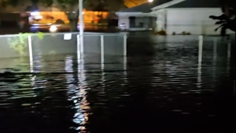
The before-and-after satellite photos not only revealed the water rises in reservoirs, but the impact of flooding from the recent barrage of storms. Farms and towns near the city of Watsonville and along the Pajaro River near California's central coast are enduring major flooding. That flooding was also ongoing near the towns of Tulare and Corcoran, as shown in the dramatic imagery.
On the ground, data from the Department of Water Resources confirms that 12 out of the 17 major water supply reservoirs in the state were at or above their historical averages for late March.

Experts warn, however, that high reservoir levels are not a silver bullet for pulling California for good out of its years-long water crisis, as there are other factors to consider. Current water levels are also similar to those just three years ago before severe drought conditions returned to much of the state.
At the same time, the snowpack in the mountains, most notably the Sierra Nevada range, is at or close to all-time records. The water "locked up" as snow in the mountains will feed the downstream reservoirs deep into the summer as it melts, as large, moisture-packed storms become less likely to impact the state during the warmer months.

Precipitation estimates from the National Weather Service's Advanced Hydrologic Prediction Service reveal that areas near California's Pacific coast, and in nearby valleys and basins, as well as in the state's foothills and mountains, have received anywhere from 30 to 100 inches of liquid equivalent precipitation over the last 180 days, since late September. For many areas, this is 200 to 400 percent of normal for that time frame.
Due to the sheer amount of water that has poured into the state's reservoir system, officials in some cases have had to switch from a drought control posture to a flood management one.
"The purpose of reservoirs is to manage water, so it can be put to a variety of uses, such as for fish flows or deliveries to cities or farms," explained Jeanine Jones, interstate resources manager for the California Department of Water Resources, in an interview with AccuWeather Prime earlier this week.
"Some reservoirs are now making releases to maintain flood-control space, because many of California's reservoirs serve a dual purpose of flood control during the winter time," Jones explained.
GET THE FREE ACCUWEATHER APP
• Have the app? Unlock AccuWeather Alerts™ with Premium+
As the Golden State heads into a climatologically drier time of year from the late spring through the summer months, the frequency of storms that help fill the reservoirs will diminish. Sure enough, AccuWeather's team of long-range forecasters is expecting the storm track that has led to the recent atmospheric river events to lift north of the state in April. Despite that, there will still be opportunities for fresh precipitation.
"There will still be bouts of rain and mountain snow on occasion deep into the spring," AccuWeather Meteorologist Joe Bauer said. With rounds of precipitation still ahead, the water level in the reservoirs will likely rise more before the inevitable fall during drier months.
Recent memories of long-term droughts always have Californians on edge. This is largely because 60 percent of residential and agricultural water use comes from groundwater supplies, which have been diminished in recent years.
"People are very focused on the reservoir levels right now, but it's important to recognize that groundwater is also a very important source of water supply for California," added Jones. "Even though [the state] has a lot of surface water reservoirs that are full and making releases, it will take many years to replenish the groundwater levels that have been depleted over our last, numerous dry years."
Update on the California drought
New data released from the U.S. Drought Monitor on Thursday revealed even more improvements to the drought across California. The dry conditions that were once prevalent across all of Southern California have been completely erased, although pockets of moderate to severe drought still exist in the interior desert.
Drought conditions also remain in the Sacramento Valley and most of Northern California, although significant improvements have been made since early October.

Further drought improvements are a near-certainty as the latest drought assessment was conducted before the end of the most recent bomb cyclone in California.
Additionally, the U.S. Drought Monitor does not consider the overabundance of snow in the Sierra Nevada when issuing their drought assessments. As the snow gradually melts throughout the spring and summer, the water flowing from the mountains will continue to chip away at the drought, leading to further improvements in the water table across the state.


Want next-level safety, ad-free? Unlock advanced, hyperlocal severe weather alerts when you subscribe to Premium+ on the AccuWeather app. AccuWeather Alerts™ are prompted by our expert meteorologists who monitor and analyze dangerous weather risks 24/7 to keep you and your family safer.
Report a Typo