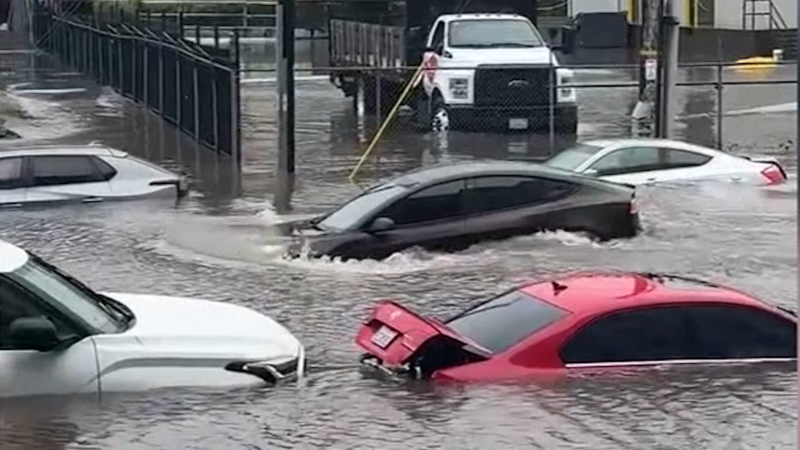
Far-reaching storm to bring rain, thunderstorms to eastern US into this weekend
From snow storms to hurricanes, AccuWeather storm chaser Reed Timmer chased it all in 2018. Find out what his top five chases of the year were.
The same storm system that brought snow, ice and travel disruptions across parts of Oklahoma and Texas will bring heavy rain and thunderstorms from the Deep South to the mid-Atlantic into this weekend.
Drenching thunderstorms that first erupted over the lower Mississippi Valley on Thursday will focus from northern Florida to eastern North Carolina on Friday.
"While a severe weather outbreak is not foreseen, some of the storms can be quite heavy with gusty winds and flooding downpours," according to AccuWeather Senior Meteorologist Alex Sosnowski.

"Of the small number of storms that may become severe, a spin off tornado or two cannot be ruled out."
Because the soil is saturated, it will not take as high of wind gusts as usual to topple trees and power lines.
Although the storm system will begin to weaken by Friday evening, some rain is still forecast to dampen the mid-Atlantic states and Interstate 95 corridor from Washington, D.C., to New York City from Friday night into Saturday.

Many small streams and large rivers are running well above average following the wettest year on record in 2018 for some places in the eastern United States.
Some rivers have been above flood stage for several weeks and even months, and the additional rainfall will only exacerbate the ongoing flooding issues in the South.
Smaller streams and creeks that are currently below flood stage but still running high may again overflow their banks as a general rainfall of 1 to 2 inches occurs over the Deep South and central Appalachians.

Motorists traveling on interstates 10, 40, 81, 85 and 95 may all face wet weather and slick roadways at some point through Friday.
Standing water on roadways greatly increases the risk of hydroplaning when traveling at highway speeds, so anybody with travel plans in the threat zone should reduce speed if they encounter heavy rain.
If the roadway ahead is covered with water, be sure to seek an alternate route, as it is impossible to tell how deep the water is using only the naked eye.
By the time the storm reaches the major cities of the I-95 corridor on Friday night and Saturday, its forward speed and weakened state will prevent as much rain from falling as what is expected farther south and west.

“A lack of Arctic air will limit the amount of snow and ice in the Northeast and allow Boston, New York City, Philadelphia and Washington, D.C., to only receive rain,” Sosnowski said.
Thus, the main impacts of the rain from Washington, D.C., to New York City and even Boston will be to cause incidents of low-lying and poor drainage flooding and to dampen outdoor plans on the first day of the weekend.
“Just enough cold air may be present to allow some ice and snow at times in parts of northern Pennsylvania, the southern tier of New York state and part of western New England from late Friday night to early Saturday,” Sosnowski added.

Fortunately, any snow or ice concerns will not be long-lasting, and no significant snow or ice accumulations are currently anticipated.
As the storm moves offshore Saturday evening, dry conditions should return to the Northeast by Sunday, but a brief shot of colder air is likely to dive into New England.
Report a Typo


