Thanksgiving storm could snarl travel, upend plans in East, Central US
A few spots could have major travel delays in the days leading up to Thanksgiving.
Those with travel plans in the eastern and central United States should be prepared for disruptions due to a large storm that will take shape in the Gulf on Tuesday, expand northward to much of the Southeast on Wednesday and reach the Northeast and Midwest on Wednesday night and Thanksgiving Day. How significant impacts become will depend on the intensity of the storm.
Early this month, AccuWeather's Long-Range Team of meteorologists warned of a storm in the East with mostly rain around Thanksgiving. That forecast is coming to fruition, with a substantial storm bringing rain and wind to a broad area of the East during the middle and latter part of Thanksgiving week.
“This potential nor’easter comes at a time when millions of people are traveling and businesses are preparing for the holiday season," Vice President of Forecast Operations Dan DePodwin said. "A significant deterioration in the weather is expected starting Tuesday night across the Southeast and then spreading northward along and east of the Appalachians Wednesday through Friday."

While the primary form of precipitation in this storm will be rain for most areas, that rain can be heavy enough to cause flooding in poor-drainage areas on streets and highways.
As the storm strengthens, winds will increase along the Atlantic Coast and the Midwest. The winds will raise seas and tides along the East Coast, leading to beach erosion and coastal flooding. The storm will lead to large waves over some of the Great Lakes with the risk of overwash along the shoreline.

Winds may get strong enough along part of the Atlantic Seaboard and the Appalachians to lead to sporadic power outages, which could be extra bad news for those preparing Thanksgiving meals.
The combination of heavy rain at times, increasing winds and low clouds will lead to an expansion of airline delays in Orlando and Miami from Tuesday to Wednesday, in Atlanta and Charlotte on Wednesday, expanding to Washington, D.C., Philadelphia, New York City, Boston, Detroit and perhaps Chicago on Thanksgiving Day.

While rain does not substantially affect airport operations, fog, wind and thunderstorms can.
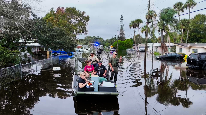
The storm has the potential to bring locally excessive rainfall to parts of Florida from late Tuesday through Wednesday night. Anything more than spotty showers can greatly exacerbate ongoing flooding in the St. Johns River basin and other areas in the eastern half of the Peninsula that have experienced rounds of major flooding this month.

Even if rain holds off in New York City on Thanksgiving Day morning, winds are likely to kick up, making it difficult to handle the multiple large balloons scheduled to fly in the parade.
What is the snow potential for this storm?
In terms of wintry precipitation, initially, the storm is likely to be too warm for snow in most places. However, at the onset, a brief period of wet snow or sleet can occur in the northern part of New York State and New England later Thanksgiving Day and night.

As the storm strengthens and begins to manufacture its own cold air, some wet snow or a mixture of rain and wet snow may develop in parts of the Midwest, perhaps including Chicago, Indianapolis and Detroit on Thanksgiving Day.
"There would need to be a major injection of cold air to bring a heavy snowstorm to the Midwest," AccuWeather Meteorologist Brandon Buckingham said. "Right now, we don't see that happening, but will continue to monitor."

On the storm's backside, as more cold air is drawn in, a change to a wet snow mix or snow showers may be possible by Friday in parts of the Appalachians and the eastern Great Lakes region.
This does not appear to be the type of storm that would unload widespread heavy snow on ski resorts in the Northeast. Mostly rain from the storm could dash hopes of a long weekend on the slopes.

Best bets for plenty of natural snow for Thanksgiving will be in the Sierra Nevada, Cascades and Rockies.

Caveats on the storm
More details will emerge in the coming days, as the storm has not yet formed. It is possible the storm has a complex structure that moves northward in a strung-out fashion from the Midwest to the Appalachians and the Atlantic Coast.
Which center becomes the primary storm could affect the severity of conditions.
GET THE FREE ACCUWEATHER AP
•Have the app? Unlock AccuWeather Alerts™ with Premium+
A more potent storm tracking northward over the Midwest, or a storm that forms on the coast and slips out to sea, could mean less intense wind and rain in the Northeast. But even with this scenario, there would still be areas of rain that spread northward and linger for a few days in the Midwest and Northeast, with pockets of wet snow mixed in.


Want next-level safety, ad-free? Unlock advanced, hyperlocal severe weather alerts when you subscribe to Premium+ on the AccuWeather app. AccuWeather Alerts™ are prompted by our expert meteorologists who monitor and analyze dangerous weather risks 24/7 to keep you and your family safer.
Report a Typo