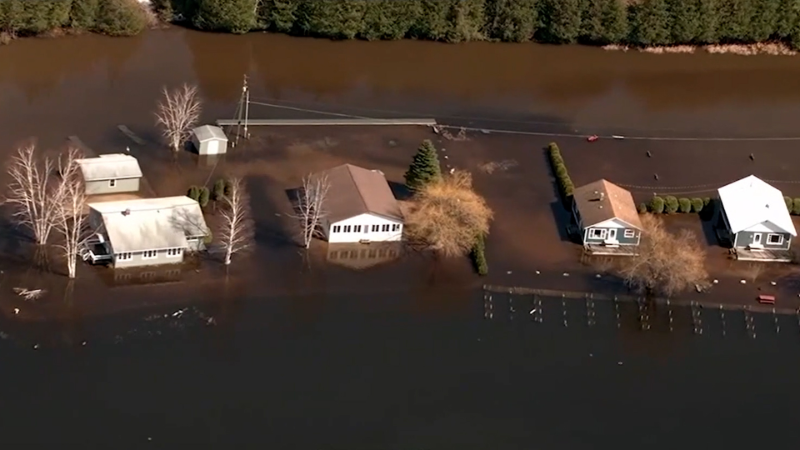
Heavy rain looms for south-central United States, easing drought with flood risk
A future storm may end the south-central United States dry stretch this week, with the potential for 2-4 inches of rain and localized flooding.
AccuWeather long-range expert Joe Lundberg was live on the AccuWeather Network on Nov. 14 to discuss what the weather will be like around the country next week.
Rain is expected to develop over a large portion of the south-central United States this week, signaling the end of the current stretch of warm, dry weather. The change in pattern will raise the risk of flooding and could help raise water levels along parts of the Mississippi River, which have fallen to near-record low levels in recent weeks.

Before the shift, warmth will abound over the southern portion of the Plains and the lower Mississippi Valley. The warm and dry conditions will raise the risk of wildfires.
A storm that was over the northern Pacific Ocean on Friday is forecast to move south along the West coast before turning inland this week. The most likely track will be across portions of central Texas and through eastern Oklahoma before advancing northeast toward central Missouri, potentially impacting travelers along areas of interstates 20, 40 and 70 along the way.

The heaviest rainfall is expected to spread across a swath from locations north of Dallas through just south of Kansas City, Missouri, where at least 4-8 inches of rain is forecast. Locations surrounding this corridor from the Gulf Coast of Texas north to Chicago will also contend with an inch or two of rainfall from this pattern.
Soil moisture levels in the region range from near normal to extreme drought, according to the latest U.S. Drought Monitor.

For that reason, the same amount of rain could produce very different impacts across short distances — from little effect to small stream or urban flash flooding. However, some areas could receive sufficient rainfall for flash flooding to occur, even where drought conditions persist.
A long-term drought across much of the Mississippi River basin has caused the river to drop to levels rarely seen before. The drought began in midsummer, when the pattern shifted from frequent rain and flooding to only occasional, lighter rain.
Several smaller storm systems have brought brief rounds of rain to parts of the region in recent weeks, leading to short-lived rises in water levels along the Ohio River and the middle and lower Mississippi Valley. However, after each storm passed and the brief rise in water moved downstream, levels quickly fell again and continued to disrupt tug and barge traffic.

Later in the week, the developing pattern could bring a general 2-4 inches of rain, with locally higher amounts, from central Texas to central Illinois and southern Indiana. Some of the rain will fall over the Red River basin, which has little effect on the Mississippi River. However, heavier rain reaching the Arkansas, Missouri and Ohio basins could provide a modest rise in Mississippi River levels for a week or two in December.
Significant rises in river levels are possible during and after the rain event late this week. Anyone planning activities near unprotected riverbanks should consider alternate plans, as some low-water crossings may become impassable for a time.
Want next-level safety, ad-free? Unlock advanced, hyperlocal severe weather alerts when you subscribe to Premium+ on the AccuWeather app. AccuWeather Alerts™ are prompted by our expert meteorologists who monitor and analyze dangerous weather risks 24/7 to keep you and your family safer.
Report a Typo


