Additional strong Santa Ana winds brewing for Southern California
Additional rounds of Santa Ana winds and heightened fire risk are coming to Southern California.
AccuWeather’s Ken Clark warns of more Santa Ana wind events that will continue to fuel the extreme fire risk as well as the deadly wildfires that continue to burn in Southern California as of Jan. 10.
While calm winds and days of soaking rain are what fire-ravaged areas of Southern California desperately need, more rounds of wind are in store that will again cause the wildfire risk to surge, AccuWeather meteorologists say.
A continuation of the extremely dry pattern that started back in the spring of 2024 will continue.
Los Angeles has not received a quarter of an inch of rain since mid-April last year, a period when downtown L.A. typically receives between 5 and 6 inches of rain.

"San Diego is experiencing its driest start to winter ever, with the period from July 1 to Jan. 8 being the driest on record," explained AccuWeather California Expert Meteorologist Ken Clark. Only 0.16 of an inch of rain has fallen compared to a historical average of 3.74 inches.
The dry conditions have not significantly affected deep soil moisture and reservoir levels, but more importantly, they have left the landscape tinder-dry and prime fuel for wildfires, fueled by powerline sparks, burning embers and careless human activity.
While there will be periods where winds drop off, there will be more bouts of problematic winds through the next week. Any time there is higher pressure over land versus the nearby Pacific Ocean, dry winds can kick up, race down mountainsides and squeeze through canyons. A unique setup from Tuesday to Wednesday night caused winds to roar even in the Los Angeles basin.

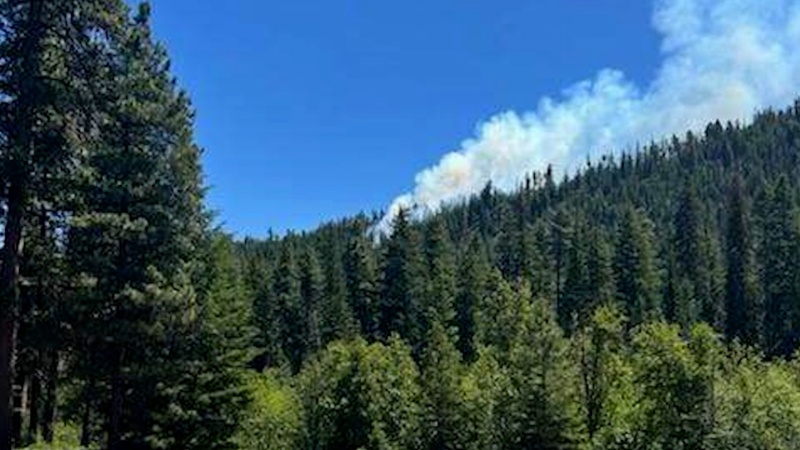
The devastation of the Palisades Fire is seen in the early morning in the Pacific Palisades neighborhood of Los Angeles, Friday, Jan. 10, 2025. (AP Photo/John Locher)
Some weather assistance for firefighters is in store into Saturday midday.
"From Friday night through part of Saturday winds should be relatively tranquil compared to recent days," Zehr said. Unfortunately, any smoke being output by smoldering fires, when combined with light winds, can lead to pollutants being trapped rather than dispersed, creating unhealthy air quality concerns.
A minor flare-up of winds is likely from Saturday night to Sunday morning.

Beginning on Monday, winds are forecast to increase across coastal areas of Southern California.
"At this time, it appears a moderate to possibly a strong wind event is coming during the period from Monday to Tuesday and perhaps Wednesday," Zehr said.

Winds next Monday to Wednesday may be more easterly and can behave differently than the powerful northeast winds the region experienced this week; however, they can still cause significant wildfire dangers.
Similar to the fast-moving inferno setup from earlier this week, there will be an area of high pressure over the interior Southwest states and a dry storm pushing southward along the coast, Zehr explained. Where that storm tracks and stalls will determine the magnitude of the winds and if the core is centered around Los Angeles, farther south toward San Diego or perhaps just to the north of L.A.

Additional Santa Ana events seem likely as the pattern of high pressure areas building across the interior Southwest and ripples in the jet stream drop southward along the California coast later next week and into the second half of the month.


Want next-level safety, ad-free? Unlock advanced, hyperlocal severe weather alerts when you subscribe to Premium+ on the AccuWeather app. AccuWeather Alerts™ are prompted by our expert meteorologists who monitor and analyze dangerous weather risks 24/7 to keep you and your family safer.
Report a Typo