Go Back
  • For Business
  • |
  • Warnings
  • Data Suite
  • Newsletters
  • Advertising
  • Superior Accuracy™
Over 100 million people at risk for daily severe storms, drenching rain into next week. Click for details Chevron right

Lynco, WV

81°F
Location Chevron down
Location News Videos
Use Current Location
Recent

Lynco

West Virginia

81°
No results found.
Try searching for a city, zip code or point of interest.
settings
Lynco, WV Weather
Today WinterCast Local {stormName} Tracker Hourly Daily Radar MinuteCast Monthly Air Quality Health & Activities

Around the Globe

Hurricane Tracker

Severe Weather

Radar & Maps

News

News & Features

Astronomy

Business

Climate

Health

Recreation

Sports

Travel

For Business

Warnings

Data Suite

Newsletters

Advertising

Superior Accuracy™

Video

Winter Center

Radar Satellite

Current Conditions

Forecast Wind Flow
Lightning

Smoke

Wind Wind Gusts Temperature RealFeel® RealFeel Shade™ Past 24-Hour Precipitation

Lynco, WV Smoke Map

Near Surface Smoke

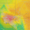
This interactive map helps you identify near surface smoke in your area. Near surface smoke is defined as smoke that will hover within eight meters from the ground. Activating the playbar displays the location of smoke in one-hour increments, in an animated loop. You can also manually drag the scrubber bar. To read more detailed information about how differing smoke levels may impact your health, click the (?) beneath the map. Help improve AccuWeather Maps by sending us feedback. →

NEAR SURFACE SMOKE MAP µg/m3
µg/m3 is micrograms of gaseous pollutant per cubic meter of ambient air
Dangerous > 200

Any exposure to the air, even for a few minutes, can lead to serious health effects for anyone. Avoid outdoor activities

Very Unhealthy 150-199

Health effects will be immediately felt by sensitive groups and should avoid outdoor activity. Healthy individuals are likely to experience difficulty breathing and throat irritation; consider staying indoors and rescheduling outdoor activities

Unhealthy 100-149

Health effects can be immediately felt by sensitive groups. Healthy individuals are likely to experience difficulty breathing and throat irritation with prolonged exposure. Limit outdoor activity

Poor 50-99

The air quality has reached a high level of pollution and is unhealthy for sensitive groups. Reduce time spent outside if you are feeling symptoms such as difficulty breathing or throat irritation

Moderate 25-49

The air quality is generally acceptable for most individuals. However, sensitive groups may experience minor to moderate symptoms from long-term exposure

Minimal 10-24

The air quality is unaffected for most individuals. Enjoy your normal outdoor activities

Trace < 9

The air quality is unaffected for most individuals. Enjoy your normal outdoor activities

Now
Near Surface Smoke (µg/m3)
Trace
Minimal
Moderate
Poor
Unhealthy
Very Unhealthy
Dangerous
< 9
10-24
25-49
50-99
100-149
150-199
> 200
RELATED MAPS

Air Quality

This map displays air quality data that indicates whether the air in a selected area is healthy or potentially dangerous

Air Quality

Wind Flow

This interactive map provides a visual representation of wind speed and direction over the next 24 hours

Wind Flow

Around the Globe

Hurricane Tracker

Severe Weather

Radar & Maps

News

Video

Winter Center

Top Stories

Severe Weather

Over 100 million at risk for severe storms, downpours into next week

1 hour ago

Recreation

2 hikers die on Maine mountain amid treacherous weather

1 day ago

Weather News

Northeast to cycle between deluges, dry air following warmth

2 hours ago

Weather News

Crane collapse during high winds kills 2 in Florida

3 hours ago

Weather News

Hazy sky to persist as wildfire smoke and Saharan dust invades US

1 hour ago

More Stories

Featured Stories

Weather News

D-Day: The weather forecast that changed history

9 hours ago

Astronomy

'Zero shadow day' makes photos look like AI

5 hours ago

Weather News

Cologne evacuation order lifted after three World War II bombs defused

9 hours ago

Recreation

Missing Colorado rafter identified

6 hours ago

Travel

FAA says Newark airport’s technology problems should be resolved by Oc...

10 hours ago

World North America United States West Virginia Lynco
Company
Proven Superior Accuracy About AccuWeather Digital Advertising Careers Press Contact Us
Products & Services
For Business For Partners For Advertising AccuWeather APIs AccuWeather Connect RealFeel® and RealFeel Shade™ Personal Weather Stations
Apps & Downloads
iPhone App Android App See all Apps & Downloads
Subscription Services
AccuWeather Premium AccuWeather Professional
More
AccuWeather Ready Business Health Hurricane Leisure and Recreation Severe Weather Space and Astronomy Sports Travel Weather News Winter Center
© 2025 AccuWeather, Inc. "AccuWeather" and sun design are registered trademarks of AccuWeather, Inc. All Rights Reserved.
Terms of Use | Privacy Policy | Cookie Policy | About Your Privacy Do Not Sell or Share My Personal Information

...

...

...