Severe storms to evolve into big flooding threat across central US
By
Renee Duff, AccuWeather senior meteorologist
Updated Apr 28, 2021 9:48 AM EDT
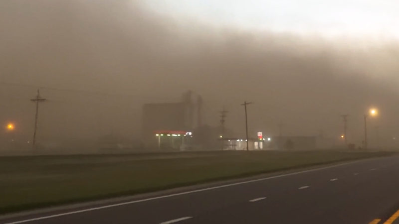
AccuWeather's Bill Wadell travelled through several towns in Oklahoma as numerous storms, some tornado-warned, brought heavy rain, flooding and lightning on April 27.
What will begin as an eruption of severe thunderstorms across the southern Plains into Wednesday could turn into a dangerous flash flooding situation as slow-moving downpours unload half a foot of rain or more across the south-central United States.
Such will be the weather setup this week that will lead to the heightened flood risk, according to AccuWeather forecasters. A storm system that brought a little relief to drought-stricken areas of the Southwest slowed down as it emerged from the Rockies and into the High Plains from into the middle of the week before it finally reaches the East later in the week.
The typically swift west-to-east progression of storm systems across the nation will be slowed down significantly this week thanks to a broad area of high pressure building in the East, which is contributing to summerlike warmth in the Midwest and Northeast. Broad high pressure systems such as this can essentially act as a roadblock in the atmosphere, slowing the forward movement of storms and potentially increasing the risk of repeating downpours and flooding.
"Warm and humid air surging northward from the Gulf of Mexico will be met by cooler air coming out of the Rockies, leading to a recipe for thunderstorm activity," AccuWeather Senior Meteorologist Tyler Roys said.
Thunderstorms began to erupt near Lubbock, Texas, during Tuesday afternoon. More storms fired into the evening hours in the western parts of Texas and Oklahoma.
CLICK HERE FOR THE FREE ACCUWEATHER APP
These thunderstorms can be capable of giant hail, up to baseball or even softball size at times, as well as tornadoes, powerful winds and locally torrential downpours which can flood drainage ditches and roadways quickly, according to AccuWeather Meteorologist Jake Sojda.
A separate zone of severe weather fired up farther north during Tuesday evening, centered on northeastern Colorado and neighboring parts of Kansas and Nebraska, with similar hazards expected for the strongest of these storms.
Farther to the Northeast into Tuesday night, from parts of the northern Plains to the Upper Midwest, heavy, gusty and locally severe storms occurred, bringing gusty winds and large hail.
This radar image shows strong thunderstorms (red, orange and purple) over parts of Michigan, Wisconsin, Minnesota and northwestern Iowa on Tuesday afternoon, April 27, 2021. (AccuWeather/NOAA)
Once the thunderstorms over the southern Plains got underway, they slowly expanded eastward Tuesday night into Wednesday.
Cloud cover and downpours leftover from Tuesday night are likely to put a cap on the severity of thunderstorms on Wednesday for at least part of the region, but forecasters cannot rule out feisty storms entirely.
The greatest risk for severe thunderstorms may center on Texas, Oklahoma and western Arkansas.
"While there's likely to remain at least some threat for damaging wind gusts and maybe hail and isolated tornadoes right through Wednesday night, the overall setup may turn into more of a heavy rain and flooding threat for a majority of the region," AccuWeather Storm Warning Meteorologist Mike Youman said.
Downpours on Wednesday and Wednesday night can stretch from central Texas to portions of Illinois and Indiana. Travel through some of the bigger cities such as Dallas and St. Louis could be severely slowed as a result with urban flooding possible.
In some areas, the heavy rain can flood fields, damaging crops that have already been planted, or delaying planting in areas where farmers are still prepping fields, according to Sojda.
"However, in parts of southern Oklahoma into Texas, where patches of moderate to extreme drought exists, some heavy rainfall may be welcome," Sojda said.
The heaviest rainfall of 4-6 inches is expected to fall at rates of 2 inches per hour at times from portions of Oklahoma and southeastern Kansas to central Missouri and northwestern Arkansas, according to AccuWeather's team of storm warning meteorologists in Wichita, Kansas. Where downpours repeat in this corridor, the AccuWeather Local StormMax™ of 10 inches could be achieved.
The forecasters are reminding motorists to never attempt to drive through floodwaters. Flash flooding at night is particularly dangerous and even more difficult to spot while in a vehicle.
Even in the absence of flooding, reduced visibility and ponding of water on the roadways will create hazards for motorists on stretches of interstates 35, 40, 44 and 70 around the middle of the week.
Rain and thunderstorms will gradually move eastward during the latter part of the week, leaving much drier weather behind for the central U.S. while bringing a return of wet weather to the East. In the meantime, very warm air will be building in this part of the country as the severe weather and flooding unfold across the nation's midsection.
Keep checking back on AccuWeather.com and stay tuned to the AccuWeather Network on DirecTV, Frontier, Spectrum, FuboTV, Philo, and Verizon Fios.
Report a Typo


News / Severe Weather
Severe storms to evolve into big flooding threat across central US
By Renee Duff, AccuWeather senior meteorologist
Updated Apr 28, 2021 9:48 AM EDT
AccuWeather's Bill Wadell travelled through several towns in Oklahoma as numerous storms, some tornado-warned, brought heavy rain, flooding and lightning on April 27.
What will begin as an eruption of severe thunderstorms across the southern Plains into Wednesday could turn into a dangerous flash flooding situation as slow-moving downpours unload half a foot of rain or more across the south-central United States.
Such will be the weather setup this week that will lead to the heightened flood risk, according to AccuWeather forecasters. A storm system that brought a little relief to drought-stricken areas of the Southwest slowed down as it emerged from the Rockies and into the High Plains from into the middle of the week before it finally reaches the East later in the week.
The typically swift west-to-east progression of storm systems across the nation will be slowed down significantly this week thanks to a broad area of high pressure building in the East, which is contributing to summerlike warmth in the Midwest and Northeast. Broad high pressure systems such as this can essentially act as a roadblock in the atmosphere, slowing the forward movement of storms and potentially increasing the risk of repeating downpours and flooding.
"Warm and humid air surging northward from the Gulf of Mexico will be met by cooler air coming out of the Rockies, leading to a recipe for thunderstorm activity," AccuWeather Senior Meteorologist Tyler Roys said.
Thunderstorms began to erupt near Lubbock, Texas, during Tuesday afternoon. More storms fired into the evening hours in the western parts of Texas and Oklahoma.
CLICK HERE FOR THE FREE ACCUWEATHER APP
These thunderstorms can be capable of giant hail, up to baseball or even softball size at times, as well as tornadoes, powerful winds and locally torrential downpours which can flood drainage ditches and roadways quickly, according to AccuWeather Meteorologist Jake Sojda.
A separate zone of severe weather fired up farther north during Tuesday evening, centered on northeastern Colorado and neighboring parts of Kansas and Nebraska, with similar hazards expected for the strongest of these storms.
Farther to the Northeast into Tuesday night, from parts of the northern Plains to the Upper Midwest, heavy, gusty and locally severe storms occurred, bringing gusty winds and large hail.
This radar image shows strong thunderstorms (red, orange and purple) over parts of Michigan, Wisconsin, Minnesota and northwestern Iowa on Tuesday afternoon, April 27, 2021. (AccuWeather/NOAA)
Once the thunderstorms over the southern Plains got underway, they slowly expanded eastward Tuesday night into Wednesday.
Cloud cover and downpours leftover from Tuesday night are likely to put a cap on the severity of thunderstorms on Wednesday for at least part of the region, but forecasters cannot rule out feisty storms entirely.
The greatest risk for severe thunderstorms may center on Texas, Oklahoma and western Arkansas.
"While there's likely to remain at least some threat for damaging wind gusts and maybe hail and isolated tornadoes right through Wednesday night, the overall setup may turn into more of a heavy rain and flooding threat for a majority of the region," AccuWeather Storm Warning Meteorologist Mike Youman said.
Downpours on Wednesday and Wednesday night can stretch from central Texas to portions of Illinois and Indiana. Travel through some of the bigger cities such as Dallas and St. Louis could be severely slowed as a result with urban flooding possible.
In some areas, the heavy rain can flood fields, damaging crops that have already been planted, or delaying planting in areas where farmers are still prepping fields, according to Sojda.
"However, in parts of southern Oklahoma into Texas, where patches of moderate to extreme drought exists, some heavy rainfall may be welcome," Sojda said.
The heaviest rainfall of 4-6 inches is expected to fall at rates of 2 inches per hour at times from portions of Oklahoma and southeastern Kansas to central Missouri and northwestern Arkansas, according to AccuWeather's team of storm warning meteorologists in Wichita, Kansas. Where downpours repeat in this corridor, the AccuWeather Local StormMax™ of 10 inches could be achieved.
The forecasters are reminding motorists to never attempt to drive through floodwaters. Flash flooding at night is particularly dangerous and even more difficult to spot while in a vehicle.
Even in the absence of flooding, reduced visibility and ponding of water on the roadways will create hazards for motorists on stretches of interstates 35, 40, 44 and 70 around the middle of the week.
Rain and thunderstorms will gradually move eastward during the latter part of the week, leaving much drier weather behind for the central U.S. while bringing a return of wet weather to the East. In the meantime, very warm air will be building in this part of the country as the severe weather and flooding unfold across the nation's midsection.
Related:
Keep checking back on AccuWeather.com and stay tuned to the AccuWeather Network on DirecTV, Frontier, Spectrum, FuboTV, Philo, and Verizon Fios.
Report a Typo