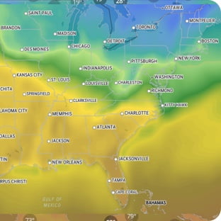
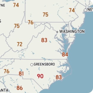
special weather statement in effect A winter storm is possible for Christmas Day. Location: Buchans and the interior, Connaigre, and the Burin Peninsula. Time span: Early Thursday morning until Thursday evening. Projected snowfall: 10 to 20 cm. Projected maximum wind gusts: - Southeasterly to northeasterly between 60 and 80 km/h (Thursday). - Westerly to southwesterly between 60 and 80 km/h (Thursday night). Blowing snow: localized in nature, especially over inland areas and over higher terrain. Remarks: Some uncertainty remains on the exact track and strength of this system, which may lead to changes in projected amounts and winds. Travel is likely to be affected. Consider changing travel plans to before or after the storm if possible. Additionally, a second similar system may affect a similar area for Friday night into Saturday. At this time the uncertainty on this system is very high, but the public is advised to monitor future forecasts closely and keep it in mind when planning Holiday travel. ### Please continue to monitor alerts and forecasts issued by Environment Canada. To report severe weather, send an email to NLstorm@ec.gc.ca or post reports on X using #NLwx. For more information about the alerting program, please visit: https://www.canada.ca/en/services/environment/weather/severeweather/weather-alerts/colour-coded-alerts.