Rare Cat 3 hurricane in Arabian Sea; Alberto to flood holiday weekend
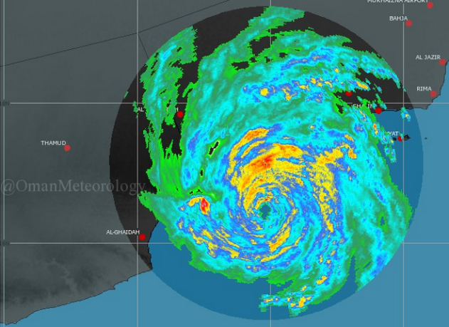
Cyclone Mekunu is a rare, major, Category 3 hurricane this morning making landfall in Yemen and Oman. The radar is very impressive!
Cyclones aren't rare in the Arabian Sea, but a storm this strong hitting land is -- assuming the NOAA database is correct (which it probably isn't in this area of the world before 2000). Here are some tidbits:
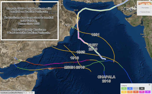
- Only two hurricane-force storms have ever hit the Arabian Peninsula (Oman and Yemen):
- Cyclone Chapala in 2015 (Cat 4 at sea) which hit as a Cat 1 in the southern half of Yemen.
- Cyclone Phet in 2010 (also Cat 4 at sea) which hit northern Oman as a Cat 2 storm, tying for the strongest on record over water and the strongest ever to make landfall on the Peninsula.
- Only one hurricane has come close to landfall anywhere where Mekunu is, which is smack in the middle of the storms listed above, near Salalah, Oman.
- That was an unnamed storm in 1959, although the NOAA database officially declassifies the storm before it hits land.
- WikiPedia says of that storm
So, if Cyclone Mekunu makes landfall as a Category 3 storm, it will be the strongest ever to hit the Arabian Peninsula. If not, it will still be the only hurricane-force storm to officially hit the area since 1959. Either way, it's very rare and people there will not be prepared for it.
In the video below, from Salalah this morning, it looks like the guy is having a great time doing a "flood selfie" but the truth is, this is a very dangerous storm, the likes of which people in the area have probably never seen, and there will be reports of deaths, injuries, and a lot of damage.
One of the main reasons this could be a terrible storm for the area -- Salalah has some of the only mountainous terrain on the Arabian Peninsula surrounding it!
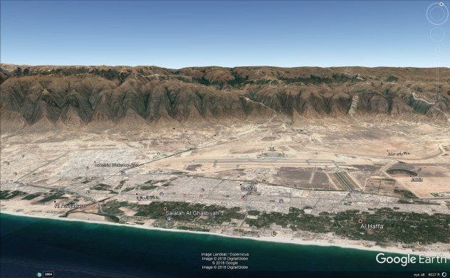
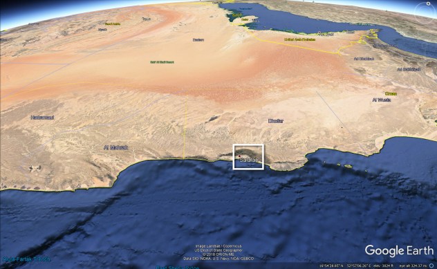
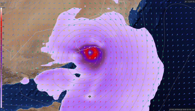
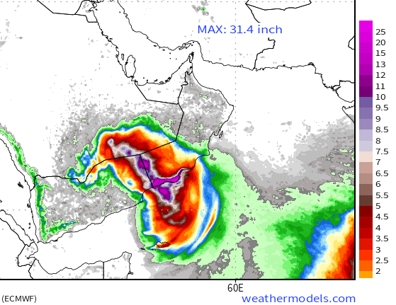
As rain "upslopes" the mountains, it will dumping even higher rain in the mountains and beyond, exacerbating flooding in the city. The European model is calling for two feet of rain to inundate the entire valley around Salalah!
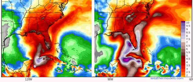
In other news... Subtropical Storm Alberto has formed, as we forecast earlier this week. It's still unclear where the worst flooding will be, but we are calling for 10 to 20 inches of rain somewhere in the Southeast, which means everyone who lives there (not just on the coast) needs to prepare now.
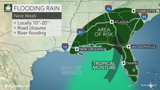
The two major forecast model ensembles below show the most likely areas to be affected, but even they are generalizing and don't know where exactly the heaviest rain will fall.
