Radar Shots of Inland Hurricane
UPDATE 9/16/2010: This storm has been reclassified as a "Super Derecho."
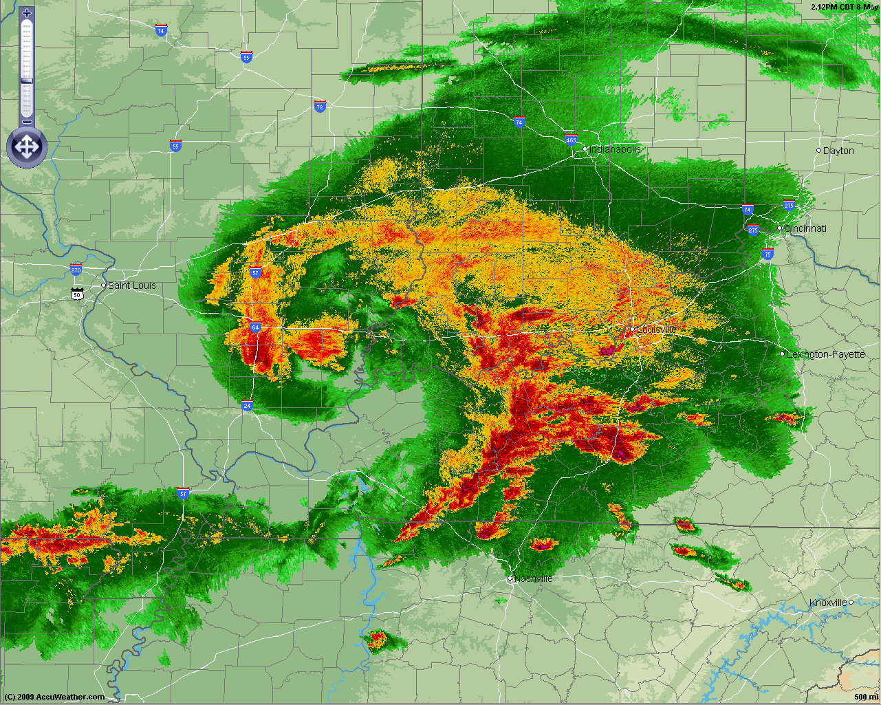
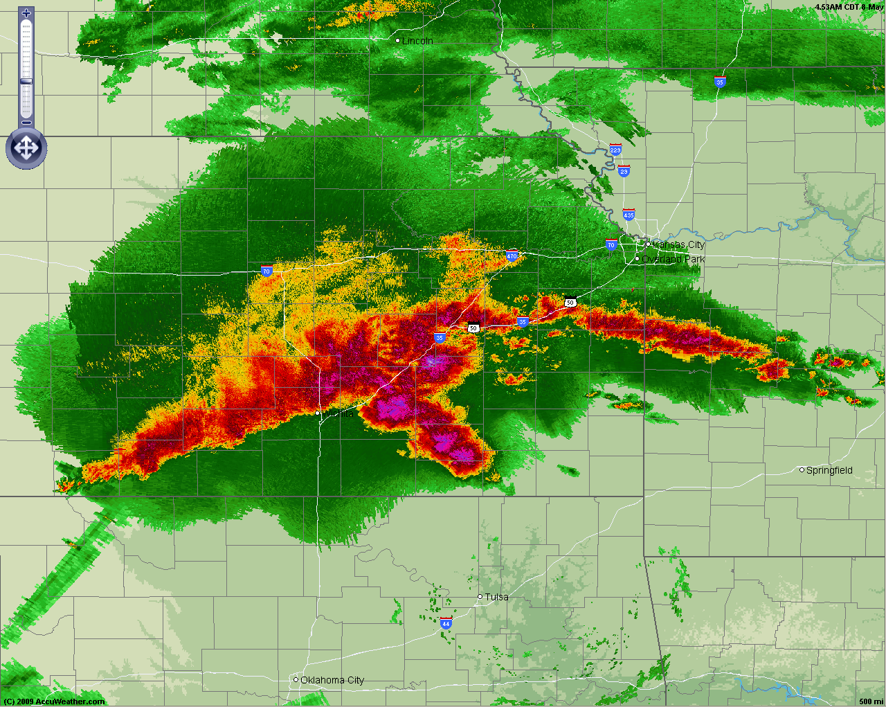
I'm sure you've heard about what we are calling an "inland hurricane" that ripped through the Midwest Friday (also known as a derecho, a line of intense thunderstorms causing high winds). The storm caused wind reports of over 90 mph in Missouri and over 100 mph in Illinois! Below are radar shots from various stages of the storm from AccuWeather.com MapSpace™ (formerly known as Enhanced Radar):


Joe Bastardi explains the term in his blog today:
On Tuesday he predicted that the weather conditions were right for a "landcane" but it didn't come to fruition... until today.
The CIMSS blog also has some excellent satellite/lightning shots.
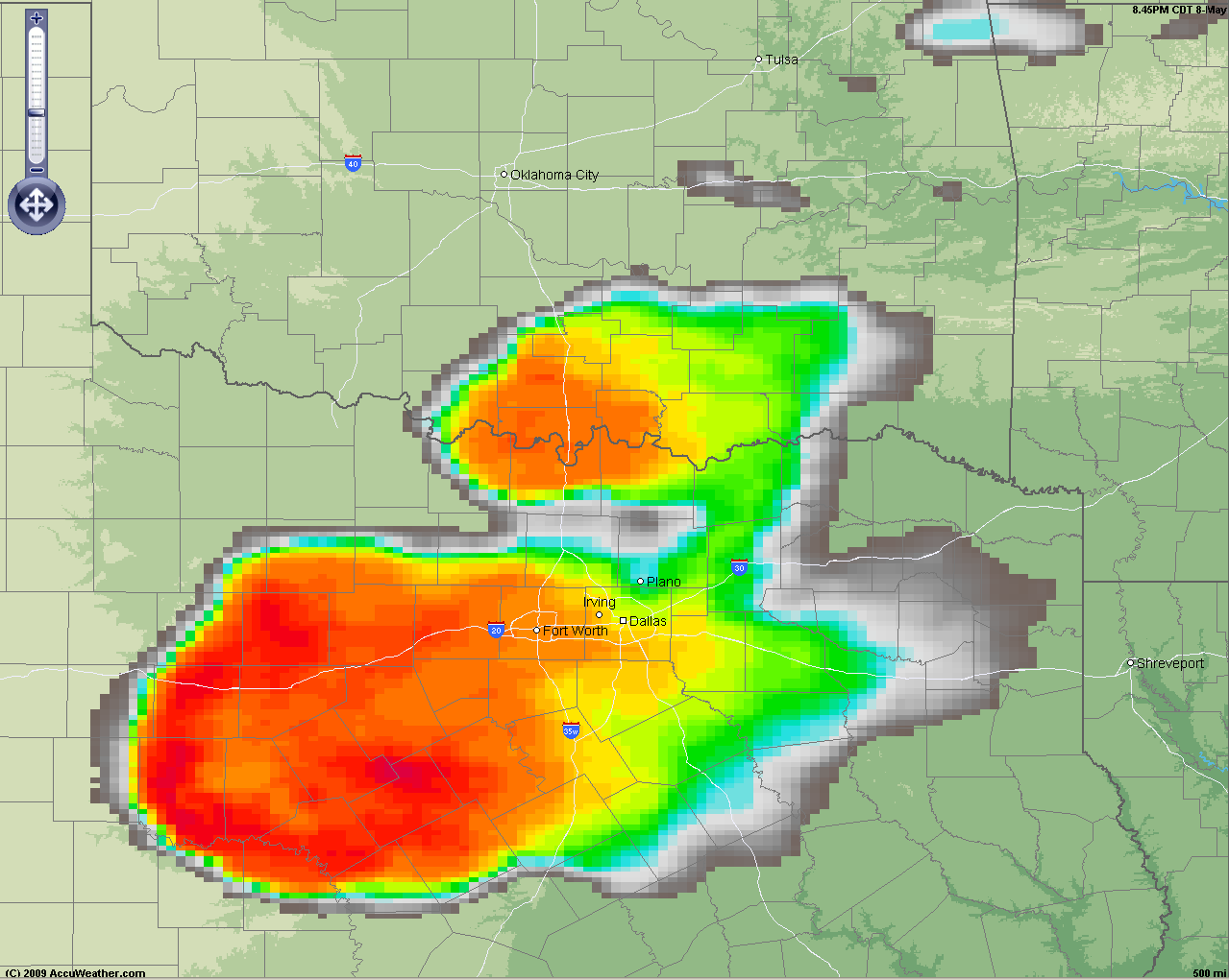
BONUS: Check out this impressive supercell thunderstorm storm cell in Texas tonight:


