Rounds of snow to stretch from Washington state to Denver this week
By
Nicole LoBiondo, AccuWeather meteorologist &
Courtney Travis, AccuWeather senior meteorologist
Updated Mar 23, 2021 4:40 PM EST
The National Weather Service reported winds of up to 64 mph in the Amarillo, Texas, area. This U.S. flag held up against the elements of strong winds and heavy snow on March 17.
Only a week after parts of Colorado were hit with historic snowfall, more snow buried parts of the state and surrounding areas over the weekend and into Monday. But even though this wave of wintry weather has since exited the region, AccuWeather forecasters warn that more snow is to come this week.
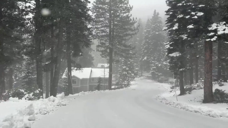
The first of two storms got underway across portions of Utah, Wyoming and the higher elevations of western Colorado by Sunday morning. Salt Lake City picked up over an inch of snowfall, while the Wasatch Range just east of the city received more than a foot.
Snow spread into the Denver metro area by Sunday evening and continued into Monday, piling up 3-6 inches across the city. Farther south, from the Palmer Divide to Colorado Springs, Colorado, between 8-10 inches of snow was common.
This month has the potential to be the snowiest March on record in Denver. Prior to the storms this week, this March already ranked among the top-five snowiest in history for Denver, as the city had picked nearly three times its normal snowfall for the month. A total of 29.6 inches of snow had fallen in the Mile High City as of Sunday. This total is now up to 30.9 inches as of early Tuesday morning.
A dip in the jet stream pattern that allowed the early-week storm to travel from the Pacific Northwest to the Rockies and Denver over the weekend will remain in place this week, leaving the opportunity open for more cold weather and snow in the western U.S.
CLICK HERE FOR THE FREE ACCUWEATHER APP
During Tuesday and Wednesday, a new storm will push inland and southeastward, spreading snow across the higher elevations of the interior west and towards the Colorado Rockies.
"The exact track of this next storm will play a major role in where the heaviest snow falls," AccuWeather Meteorologist Jake Sojda said.
With a more southerly track is possible across the Four Corners Region, more snow is expected to reach parts of Arizona and New Mexico compared to the storm earlier in the week.
The higher elevations will likely be the sweet spot for the most snow accumulation, and it is not out of the question that some locations could pick up another 6-12 inches of snow. An AccuWeather Local StormMax™ of 24 inches is predicted in the highest terrain of southern Colorado and New Mexico.
Major highways going through mountain passes could see accumulating snow, impacting travel through the middle of the week.
This storm is expected to spare the Denver metro area from any significant snowfall, with no more than a coating to an inch or two of accumulation expected late Tuesday into Wednesday.
By Wednesday morning, a third storm will reach portions of Washington and Oregon, introducing additional snowfall to these areas.
Keep checking back on AccuWeather.com and stay tuned to the AccuWeather Network on DirecTV, Frontier, Spectrum, FuboTV, Philo, and Verizon Fios.
Report a Typo




News / Winter Weather
Rounds of snow to stretch from Washington state to Denver this week
By Nicole LoBiondo, AccuWeather meteorologist & Courtney Travis, AccuWeather senior meteorologist
Updated Mar 23, 2021 4:40 PM EST
The National Weather Service reported winds of up to 64 mph in the Amarillo, Texas, area. This U.S. flag held up against the elements of strong winds and heavy snow on March 17.
Only a week after parts of Colorado were hit with historic snowfall, more snow buried parts of the state and surrounding areas over the weekend and into Monday. But even though this wave of wintry weather has since exited the region, AccuWeather forecasters warn that more snow is to come this week.
The first of two storms got underway across portions of Utah, Wyoming and the higher elevations of western Colorado by Sunday morning. Salt Lake City picked up over an inch of snowfall, while the Wasatch Range just east of the city received more than a foot.
Snow spread into the Denver metro area by Sunday evening and continued into Monday, piling up 3-6 inches across the city. Farther south, from the Palmer Divide to Colorado Springs, Colorado, between 8-10 inches of snow was common.
This month has the potential to be the snowiest March on record in Denver. Prior to the storms this week, this March already ranked among the top-five snowiest in history for Denver, as the city had picked nearly three times its normal snowfall for the month. A total of 29.6 inches of snow had fallen in the Mile High City as of Sunday. This total is now up to 30.9 inches as of early Tuesday morning.
A dip in the jet stream pattern that allowed the early-week storm to travel from the Pacific Northwest to the Rockies and Denver over the weekend will remain in place this week, leaving the opportunity open for more cold weather and snow in the western U.S.
CLICK HERE FOR THE FREE ACCUWEATHER APP
During Tuesday and Wednesday, a new storm will push inland and southeastward, spreading snow across the higher elevations of the interior west and towards the Colorado Rockies.
"The exact track of this next storm will play a major role in where the heaviest snow falls," AccuWeather Meteorologist Jake Sojda said.
With a more southerly track is possible across the Four Corners Region, more snow is expected to reach parts of Arizona and New Mexico compared to the storm earlier in the week.
The higher elevations will likely be the sweet spot for the most snow accumulation, and it is not out of the question that some locations could pick up another 6-12 inches of snow. An AccuWeather Local StormMax™ of 24 inches is predicted in the highest terrain of southern Colorado and New Mexico.
Major highways going through mountain passes could see accumulating snow, impacting travel through the middle of the week.
This storm is expected to spare the Denver metro area from any significant snowfall, with no more than a coating to an inch or two of accumulation expected late Tuesday into Wednesday.
By Wednesday morning, a third storm will reach portions of Washington and Oregon, introducing additional snowfall to these areas.
Related:
Keep checking back on AccuWeather.com and stay tuned to the AccuWeather Network on DirecTV, Frontier, Spectrum, FuboTV, Philo, and Verizon Fios.
Report a Typo