Frigid air to maintain grip on Pacific Northwest to continue for the new year
By
Ryan Adamson, AccuWeather meteorologist
Published Dec 31, 2021 9:50 AM EST
|
Updated Jan 3, 2022 4:14 AM EST
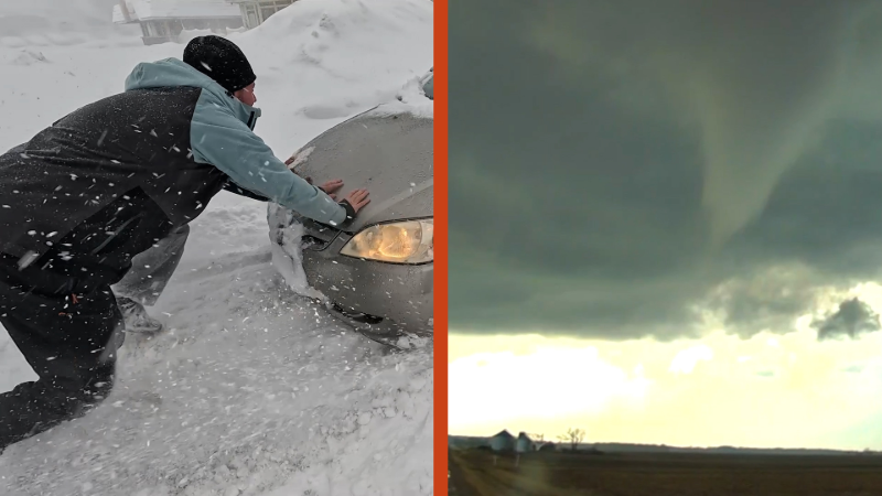
Heavy precipitation caused problems from Los Angeles to Seattle in the final days of 2021.
Much of the Pacific Northwest has endured relentless cold and several helpings of snow since Christmas. The frigid air stuck around to start the new year, but AccuWeather forecasters say that a reprieve from the snow is on the way. The question is: how long will it last?
Seattle, Washington, and Portland, Oregon, had both received snow every day from Dec. 26 to Dec. 31. The monthly total of 9.2 inches in Seattle is above the 6.3 inches typically observed in an entire winter. Portland had measurable snow on Dec. 26, Dec. 27 and Dec. 28, with only a trace observed on Dec. 29 and Dec. 30 and another 0.1 of an inch on Dec. 31, tallying up 4 inches in the month of December. A normal December snowfall total in Portland is 1.3 inches.
A warm front moved ashore on Sunday, reintroducing the likelihood of precipitation. However, since somewhat warmer air accompanied this system, snow levels rose, meaning precipitation fell in the form of rain in Seattle and Portland, rather than snow. Precipitation continued to spread inland across Washington and southward into Oregon Sunday night with moderate to locally heavy rain along the coast and snow in the Cascades.
Washington, Oregon, Northern California and Idaho are all expected to receive precipitation by Monday or Monday night as precipitation continues to expand.
Only rain is forecast to fall in Portland. Snow may occasionally mix in with the rain in Seattle, but temperatures above freezing will prevent any accumulation.
"Enough rain can fall to lead to localized flooding into Monday," AccuWeather Senior Meteorologist Alex Sosnowski said, adding that where piles of snow from late-December storms were blocking storm drains, flooding of streets can occur in Seattle and Portland, as well as other cities long the Interstate 5 corridor.
CLICK HERE FOR THE FREE ACCUWEATHER APP
It will be a different story in the mountains, with 2-4 feet of snow likely to accumulate in the Cascades by midweek. Less snow is expected in California, even so, up to another foot is possible in the northern Sierra Nevada.
Additional systems are likely to move in from the Pacific through much of the next week.
"An additional wave of moisture is set to push into the Pacific Northwest as soon as Tuesday evening, which will usher in yet another round of steadier precipitation into the area," AccuWeather Meteorologist Mary Gilbert said.
While many areas are unlikely to completely dry out before the next push of wet weather, Gilbert added that some areas will at least encounter a slight lessening of precipitation intensity later Monday into Tuesday.
The next opportunity for another, more significant, dose of adverse weather for the West looks to arrive on Thursday. Forecasters say there is the potential for heavy rain for coastal areas and heavy snow in the Cascades and perhaps the northern Rockies.
Farther south, much of Central and Southern California are expected to remain dry.
For the latest weather news check back on AccuWeather.com. Watch the AccuWeather Network on DIRECTV, Frontier, Spectrum, fuboTV, Philo, and Verizon Fios. AccuWeather Now is now available on your preferred streaming platform.
Report a Typo


News / Winter Weather
Frigid air to maintain grip on Pacific Northwest to continue for the new year
By Ryan Adamson, AccuWeather meteorologist
Published Dec 31, 2021 9:50 AM EST | Updated Jan 3, 2022 4:14 AM EST
Heavy precipitation caused problems from Los Angeles to Seattle in the final days of 2021.
Much of the Pacific Northwest has endured relentless cold and several helpings of snow since Christmas. The frigid air stuck around to start the new year, but AccuWeather forecasters say that a reprieve from the snow is on the way. The question is: how long will it last?
Seattle, Washington, and Portland, Oregon, had both received snow every day from Dec. 26 to Dec. 31. The monthly total of 9.2 inches in Seattle is above the 6.3 inches typically observed in an entire winter. Portland had measurable snow on Dec. 26, Dec. 27 and Dec. 28, with only a trace observed on Dec. 29 and Dec. 30 and another 0.1 of an inch on Dec. 31, tallying up 4 inches in the month of December. A normal December snowfall total in Portland is 1.3 inches.
A warm front moved ashore on Sunday, reintroducing the likelihood of precipitation. However, since somewhat warmer air accompanied this system, snow levels rose, meaning precipitation fell in the form of rain in Seattle and Portland, rather than snow. Precipitation continued to spread inland across Washington and southward into Oregon Sunday night with moderate to locally heavy rain along the coast and snow in the Cascades.
Washington, Oregon, Northern California and Idaho are all expected to receive precipitation by Monday or Monday night as precipitation continues to expand.
Only rain is forecast to fall in Portland. Snow may occasionally mix in with the rain in Seattle, but temperatures above freezing will prevent any accumulation.
"Enough rain can fall to lead to localized flooding into Monday," AccuWeather Senior Meteorologist Alex Sosnowski said, adding that where piles of snow from late-December storms were blocking storm drains, flooding of streets can occur in Seattle and Portland, as well as other cities long the Interstate 5 corridor.
CLICK HERE FOR THE FREE ACCUWEATHER APP
It will be a different story in the mountains, with 2-4 feet of snow likely to accumulate in the Cascades by midweek. Less snow is expected in California, even so, up to another foot is possible in the northern Sierra Nevada.
Additional systems are likely to move in from the Pacific through much of the next week.
"An additional wave of moisture is set to push into the Pacific Northwest as soon as Tuesday evening, which will usher in yet another round of steadier precipitation into the area," AccuWeather Meteorologist Mary Gilbert said.
While many areas are unlikely to completely dry out before the next push of wet weather, Gilbert added that some areas will at least encounter a slight lessening of precipitation intensity later Monday into Tuesday.
The next opportunity for another, more significant, dose of adverse weather for the West looks to arrive on Thursday. Forecasters say there is the potential for heavy rain for coastal areas and heavy snow in the Cascades and perhaps the northern Rockies.
Farther south, much of Central and Southern California are expected to remain dry.
SEE ALSO:
For the latest weather news check back on AccuWeather.com. Watch the AccuWeather Network on DIRECTV, Frontier, Spectrum, fuboTV, Philo, and Verizon Fios. AccuWeather Now is now available on your preferred streaming platform.
Report a Typo