What Are Shelf Clouds?
A shelf cloud is a low, horizontal wedge-shaped cloud, associated with a thunderstorm gust front (or occasionally with a cold front, even in the absence of thunderstorms). A rising cloud motion often can be seen in the leading part of the shelf cloud, while the underside often appears turbulent, boiling, and wind-torn.
Read: Tornado Dopplergangers: AccuWeather HQ Shelf Cloud
"Best Shelf Cloud Ever" for Indiana Sky Watchers
More Photos of Shelf Clouds
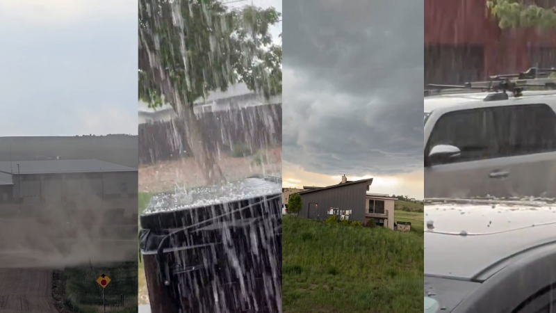
Most false tornado and false funnel cloud reports are associated with shelf clouds. Shelf clouds are low-hanging, horizontal cloud features attached to the front side of lines of storms or even a single storm. Usually there isn't any persistent rotation on a vertical axis within shelf clouds or within individual cloud fragments that extend downward from the shelf cloud, therefore they are just another scary-looking cloud.
Shelf clouds often resemble snow plows, big waves or tsunamis and can be very scary-looking since they are usually low-hanging. Sometimes they may found only a couple hundred feet above the ground. There are two other phenomena that might resemble tornadoes or funnel clouds but are not 1) dark rain shafts or narrow columns of heavy rain, and 2) the white color of a hail shaft, a column of hail extending from the ground to the cloud base, may generate a light-dark contrast with surrounding rain, resulting in what might appear to be a funnel cloud or a tornado to the untrained eye.
Source: NOAA
Report a Typo