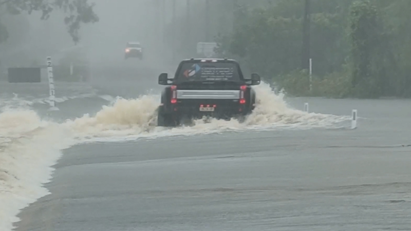
Tropical downpours may raise risk of flash flooding in Florida through Sunday
As a major snowstorm makes its way through the country, Accuweather's own storm chaser Reed Timmer shows us just how cold it was in Roanoke, Virginia on Jan. 13.
While sticky, tropical air lingers over much of the Florida Peninsula, an area of disturbed weather will bring the threat for flash flooding.
"An area of thunderstorms near western Cuba began to spin on Friday," according to AccuWeather Senior Meteorologist Alex Sosnowski.
Since then, the system has drifted just to the east of the northern Florida Peninsula, where it will bring heavy showers and thunderstorms through Sunday.

The threat for this system to become a tropical depression or storm is very low.
As the disturbance drifts to the west, showers and thunderstorms will be enhanced from east to west throughout portions of the Florida Peninsula through Sunday.
“In the areas of heaviest rain, localized flooding will be possible,” according to AccuWeather Meteorologist Ryan Adamson. “This will hamper continuing cleanup efforts in the wake of Hurricane Irma.”
Motorists should avoid driving through flooded roads and obey all road closures.
The disturbance will also contribute to rough surf and offshore squalls, which will pose trouble for bathers and boaters.

Beyond this weekend, the disturbance will meander westward over the eastern Gulf of Mexico but encounter disruptive winds at levels high up in the atmosphere as it does so, preventing tropical development.
Farther north, Sunday's forecast is looking less stifling.
"Aside from the Florida Peninsula and South Texas, much of the rest of the South can expect lower humidity and temperatures, when compared to recent weeks," Sosnowski said.
Meanwhile, even if the disturbance near Florida fails to develop, additional threats may arise nearby in the coming weeks.