Storm-ravaged central US braces for more tornadoes, flooding through Tuesday
At least 2 people are dead after a tornado tore through a mobile home park in El Reno, Oklahoma, on May 25. The tornado ripped multiple homes to shreds and ripped the second floor off a nearby hotel.
It will be no rest for the weary across the central United States as lives and property will continue to be threatened by severe weather and flooding through Tuesday.
"The overall weather pattern that has been in place across the U.S. will continue early this week, which will bring more rounds of severe weather to the Plains," according to AccuWeather Meteorologist Brett Rathbun.
Severe weather broke out late Sunday and continued through Sunday night across the Plains. There were numerous tornado reports in eastern New Mexico and Colorado, western Kansas and West Texas.
A wind gust of 82 mph was clocked in the Oklahoma Panhandle.
These storms went on to blast there way through Kansas with damaging winds on Sunday night.
On Memorial Day, dozens of tornadoes were reported from Iowa and Minnesota to Indiana, as well as in northeast Colorado and western Nebraska. On Monday night, the devastating tornadoes shifted into Ohio.
Downloading the free AccuWeather app and enabling audible alerts on your cell phone is a great way to receive severe weather bulletins as they are issued so you can seek shelter.
The severe weather threat across the Plains may ramp up again Tuesday afternoon and night from eastern Nebraska, Iowa and Illinois to western Arkansas, Oklahoma and northeastern Texas.

Once again, the communities of Oklahoma City and Tulsa, Oklahoma; Wichita, Kansas; Omaha, Nebraska; Kansas City, Springfield and St. Louis, Missouri; and Des Moines, Iowa, will be at risk.
The threat may also spread southward to the northwest suburbs of Dallas.
All modes of severe weather, including tornadoes, will once again be possible on Tuesday.
There can be incidents of damaging baseball-sized or greater hail, which can severely injure or kill any person or animal caught outside during the storm.
Motorists should remain extremely vigilant across the region and be ready to seek shelter. A vehicle is never a safe place to be during a tornado.
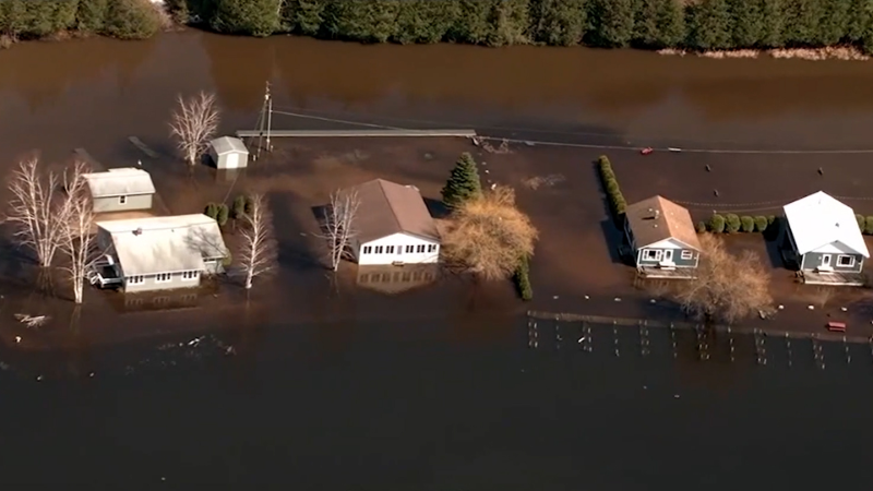
"While the threats for hail, damaging winds and tornadoes will continue on Tuesday, flooding is starting to become the most worrisome impact," according to AccuWeather Meteorologist Brett Rathbun. "The central Plains is already dealing with moderate to major flooding from all the rain this month."
A quick 1-2 inches of rain will easily aggravate flooding from northern Oklahoma to Iowa. In the hardest-hit areas, it may take less than an inch of rain in one to three hours for flooding to worsen.
Wichita has measured over 12 inches of rain so far this May. The additional rain on Tuesday can make this month the wettest May (beating May 2008 and its 13.14 inches) and all-time wettest month (surpassing June 1923 and its 14.43 inches).

A separate area of heavy rain will raise the risk of flooding across eastern Wyoming through Tuesday.
In addition to what fell last week, there can be an AccuWeather Local StormMax™ of 8 inches of rainfall in the areas of the Central states that receive rounds of heavy rainfall into Tuesday night.
The central Plains may finally welcome much-needed drier weather Wednesday into Thursday. A part of Oklahoma, Arkansas and northern Texas will have to endure more violent thunderstorms and flooding at midweek before the drier air sweeps in on Thursday.
"However, there are early indications this weather pattern could return this weekend and into the following week with more rounds of severe weather across the central U.S.," Rathbun said.
Keep checking back for updates on AccuWeather.com and stay tuned to the AccuWeather Network on DirecTV, Frontier and Verizon Fios.


