Tropical Storm Nestor to target northwest Florida, southeastern US
By
Alex Sosnowski, AccuWeather senior meteorologist
Updated Aug 7, 2020 1:26 PM EST
Tropical Storm Nestor formed Friday over the central Gulf of Mexico and has officials in the southeastern United States on alert as forecasters warn the system could trigger dangerous storm surge flooding, damaging winds and heavy rain.
Nestor, was traveling quickly northeastward over the Gulf on Saturday morning, cruising along at 17 mph. The storm is located 85 miles south-southwest of Panama City, Florida, with maximum sustained winds of 50 mph.
A satellite image shows the NOAA42 P-3 Hurricane Hunter plane as it collected data in Potential Tropical Cyclone 16 over the Gulf of Mexico on Friday, October 18, 2019. (NOAA)
(NOAA)
The storm is projected to make landfall in northern Florida on Saturday morning and is then likely to continue to move northeastward across southern Georgia and then along the South Carolina and North Carolina coasts over the weekend.
The rating for this system on the AccuWeather RealImpact™ Scale for Hurricanes is less than 1 and will be focused along the Florida Panhandle. The AccuWeather RealImpact™ Scale for Hurricanes ranges from values of less than 1 to 5.
"Nestor will bring heavy rainfall, damaging winds and a coastal storm surge to parts of the Florida Panhandle and northwestern Florida during Saturday morning," Kottlowski said.
In terms of economic impacts to the region, AccuWeather Founder and CEO Dr. Joel N. Myers said, "No significant overall economic impact is expected," from the storm, but he added, "There will be some brief economic impact where heavy rains and coastal flooding occurs."
Near and north and east of the center winds may gust in the neighborhood of 40 to 60 mph. Isolated tornadoes can also occur on the northeastern side of the storm.
As the storm moves swiftly along, strong gusts are likely along the Carolina and Virginia coasts form Saturday to early Sunday.
Similarly, a storm surge of several feet is possible, due in large part to the shape of the coastline in the area. This part of the Florida coast tends to trap and funnel water inland during approaching storms.
Seas and surf will remain rough across Florida Gulf coast early this weekend.
Small craft should consider remaining in port during the day Saturday along the Atlantic coast from northeastern Florida to the Virginia capes. Sunday should bring much better boating, fishing and bathing conditions.
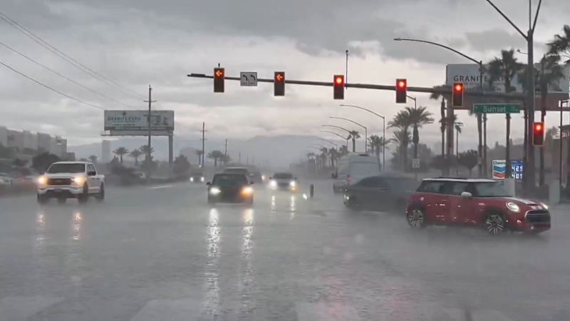
Drenching rain and localized flooding will be the main impact from the storm as it moves along over the Southeastern states.
Rain and gusty winds will make viewing and playing in football games in the Southeast difficult. However, lightning is also a threat from the storm system and could delay some games.
"During autumn, a lot of the rainfall these states typically get are from tropical systems," AccuWeather Meteorologist Courtney Travis said. "With a lack of persistent land-falling storms, much of the region is in a drought."
Urban flooding can occur even though much of the Southeast states could stand more rain due to the ongoing drought conditions.
A general 1-3 inches of rain is forecast from the northeastern Gulf coast to near the mouth of the Chesapeake Bay. An AccuWeather Local StormMax™ of 6 inches is most likely along the upper Gulf coast of Florida and perhaps along the North Carolina coast.
A storm earlier this week brought much of the region soaking rain, but more rain is needed to make up for the deficit. The rain is coming too late for some agricultural interests and could inhibit harvest in some cases including cotton.
During early next week, the feature is forecast to move well off the mid-Atlantic coast but has a chance of being captured and pulled toward New England as a non-tropical storm approaches from the Midwest.
The Atlantic hurricane season officially continues through the end of November.
As of Wednesday, Oct. 16, there have been 15 tropical depressions, 13 tropical storms, five hurricanes and three major hurricanes in the 2019 Atlantic hurricane season.
AccuWeather's prediction for the 2019 Atlantic hurricane season, issued in April, was for 12-14 tropical storms, five to seven hurricanes and two to four major hurricanes.
"In terms of the long-range outlook for the Atlantic Basin, there may be signifiant inhibiting factors for tropical development during the latter part of October into early November," Kottlowski said.
"It is possible that tropical activity effectively shuts down after the Gulf of Mexico system this week," he added.
Download the free AccuWeather app to see the latest forecast and advisories for your region. Keep checking back for updates on AccuWeather.com and stay tuned to the AccuWeather Network on DirecTV, Frontier and Verizon Fios.
Report a Typo


News / Weather News
Tropical Storm Nestor to target northwest Florida, southeastern US
By Alex Sosnowski, AccuWeather senior meteorologist
Updated Aug 7, 2020 1:26 PM EST
Tropical Storm Nestor formed Friday over the central Gulf of Mexico and has officials in the southeastern United States on alert as forecasters warn the system could trigger dangerous storm surge flooding, damaging winds and heavy rain.
Nestor, was traveling quickly northeastward over the Gulf on Saturday morning, cruising along at 17 mph. The storm is located 85 miles south-southwest of Panama City, Florida, with maximum sustained winds of 50 mph.
A satellite image shows the NOAA42 P-3 Hurricane Hunter plane as it collected data in Potential Tropical Cyclone 16 over the Gulf of Mexico on Friday, October 18, 2019. (NOAA)
The storm is projected to make landfall in northern Florida on Saturday morning and is then likely to continue to move northeastward across southern Georgia and then along the South Carolina and North Carolina coasts over the weekend.
The rating for this system on the AccuWeather RealImpact™ Scale for Hurricanes is less than 1 and will be focused along the Florida Panhandle. The AccuWeather RealImpact™ Scale for Hurricanes ranges from values of less than 1 to 5.
"Nestor will bring heavy rainfall, damaging winds and a coastal storm surge to parts of the Florida Panhandle and northwestern Florida during Saturday morning," Kottlowski said.
In terms of economic impacts to the region, AccuWeather Founder and CEO Dr. Joel N. Myers said, "No significant overall economic impact is expected," from the storm, but he added, "There will be some brief economic impact where heavy rains and coastal flooding occurs."
Near and north and east of the center winds may gust in the neighborhood of 40 to 60 mph. Isolated tornadoes can also occur on the northeastern side of the storm.
As the storm moves swiftly along, strong gusts are likely along the Carolina and Virginia coasts form Saturday to early Sunday.
Similarly, a storm surge of several feet is possible, due in large part to the shape of the coastline in the area. This part of the Florida coast tends to trap and funnel water inland during approaching storms.
Seas and surf will remain rough across Florida Gulf coast early this weekend.
Small craft should consider remaining in port during the day Saturday along the Atlantic coast from northeastern Florida to the Virginia capes. Sunday should bring much better boating, fishing and bathing conditions.
Drenching rain and localized flooding will be the main impact from the storm as it moves along over the Southeastern states.
Rain and gusty winds will make viewing and playing in football games in the Southeast difficult. However, lightning is also a threat from the storm system and could delay some games.
"During autumn, a lot of the rainfall these states typically get are from tropical systems," AccuWeather Meteorologist Courtney Travis said. "With a lack of persistent land-falling storms, much of the region is in a drought."
Urban flooding can occur even though much of the Southeast states could stand more rain due to the ongoing drought conditions.
A general 1-3 inches of rain is forecast from the northeastern Gulf coast to near the mouth of the Chesapeake Bay. An AccuWeather Local StormMax™ of 6 inches is most likely along the upper Gulf coast of Florida and perhaps along the North Carolina coast.
A storm earlier this week brought much of the region soaking rain, but more rain is needed to make up for the deficit. The rain is coming too late for some agricultural interests and could inhibit harvest in some cases including cotton.
During early next week, the feature is forecast to move well off the mid-Atlantic coast but has a chance of being captured and pulled toward New England as a non-tropical storm approaches from the Midwest.
The Atlantic hurricane season officially continues through the end of November.
As of Wednesday, Oct. 16, there have been 15 tropical depressions, 13 tropical storms, five hurricanes and three major hurricanes in the 2019 Atlantic hurricane season.
AccuWeather's prediction for the 2019 Atlantic hurricane season, issued in April, was for 12-14 tropical storms, five to seven hurricanes and two to four major hurricanes.
"In terms of the long-range outlook for the Atlantic Basin, there may be signifiant inhibiting factors for tropical development during the latter part of October into early November," Kottlowski said.
"It is possible that tropical activity effectively shuts down after the Gulf of Mexico system this week," he added.
Related:
Download the free AccuWeather app to see the latest forecast and advisories for your region. Keep checking back for updates on AccuWeather.com and stay tuned to the AccuWeather Network on DirecTV, Frontier and Verizon Fios.
Report a Typo