Central US to face rounds of severe weather this week
The central United States will not catch a break from severe weather as potentially damaging thunderstorms threaten to erupt daily through at least midweek.
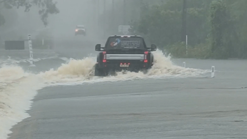
Residents and motorists should prepare for rapidly rising water, especially where recent downpours have left the ground unable to absorb much more rain.
Despite the damaging aspects of the thunderstorms, rainfall would be welcome across the north-central United States. The upper Missouri River Basin continues to suffer from an extreme to exceptional drought according to last Thursday’s report from the U.S. Drought Monitor.
Storms into Tuesday evening will have the potential to bring high winds, large hail and a few isolated tornadoes from southwestern Kansas to southwestern Minnesota.

Cities facing severe weather from late Tuesday into Tuesday evening include North Platte, Nebraska; Dodge City, Kansas; Cheyenne, Wyoming and Denver.
Severe storms that erupt into the evening will congeal into torrential downpours during the overnight hours.

Later Tuesday night and on Wednesday, while highly localized violent storms can occur farther to the east over the central Plains to the middle Mississippi Valley, the risk of torrential rain and flash flooding will take center stage.
More locally severe storms will erupt over an area stretching from southern Iowa to northwestern Texas on Wednesday.

The risk on Wednesday includes the potential for isolated tornadoes.
Drier and cooler air is expected to press across the north-central U.S. in the wake of this storm but is likely not to keep steamy air suppressed for long.
Humidity may quickly surge back to the north later in the week, fueling additional rounds of thunderstorms.
Report a Typo