Autumnlike storm to bring torrential rain and flood risk to Juneau, Alaska
A storm more typical of autumn will bring rounds of torrential rain and raise the risk of flash flooding Alaska's Inside Passage this week.
Alaska's southeastern arm is home to fjords, glaciers, towering mountains, the Alexander Archipelago and Juneau, the state capitol of Alaska.
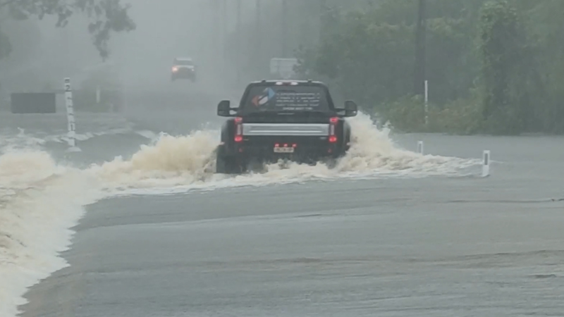
"The amount of rain on the way is enough to cause flash flooding and could lead to rock slides and other debris flows in the steep terrain in the region this week," according to AccuWeather Senior Meteorologist Brett Anderson.

"Accompanying the storm will be an atmospheric river that streams northeastward from the central Pacific," Anderson said.
The persistent rainfall, accompanied by gusty winds and rough sea conditions, could be a deterrent for cruises and outdoor interests in the region. The area is popular for viewing glaciers and wildlife.
"While rounds of rain are forecast across the region through the week, the heaviest rain is expected to occur through Thursday," according to AccuWeather Meteorologist Courtney Travis.
According to the Juneau Empire, City and Borough of Juneau Emergency Programs Director Tom Mattice reportedly spent Wednesday coordinating with local and federal agencies to prepare for the flood. The U.S. Forest Service prepared to evacuate campers at Mendenhall Campground, just north of the capital city.
A reasonable amount of rain would be a benefit as July rainfall was only about 50 percent of average.
Typically, the Juneau area receives just under 6 inches of rain during the entire month of August.
However, the setup may bring between 6 and 12 inches rain in about 48 hours.
Download the free AccuWeather app to stay aware of the latest flood watches and warnings.
Big rain events are not uncommon during the autumn and winter months, but the amount of rain anticipated with this storm may rival some of the wettest storms during September and October. Both of those months each bring 8-9 inches of rain on average.
Another storm may focus heavy rain in parts of southern Alaska and the Juneau area late in the weekend into early next week.
Beyond next week, there is a chance that moisture and the circulation from current Hurricane Hector could be drawn northward then flung toward southern Alaska prior to the end of August.
As a result, the risk of flooding may reemerge this month.
As storms begin to ramp up in southern Alaska and neighboring northern British Columbia, Canada, much of the western part of the lower 48 United States cannot buy a drop of rain.

There is a chance the same storm that brings heavy rain to southeastern Alaska this week may dip southward enough to bring spotty showers farther south along the Pacific coast on Friday and Saturday. Not enough rain is likely to fall to alleviate drought and wildfire conditions.
Conditions are likely to get worse before they get better in the Northwest and Southwest as far as fire weather is concerned. For example, temperatures may approach 100 F in Portland, Oregon, this week, where the average high is in the lower 80s. Gusty winds accompanying cooler air this weekend may play havoc with firefighting efforts.

Do you think Juneau will get flooding rainfall? Make your prediction and play Forecaster Challenge.