Storm system to bring much-needed rainfall to the Southwest and California at midweek
By
Brandon Buckingham, AccuWeather Meteorologist
Published Nov 17, 2019 12:12 PM EDT
A brewing storm system has the potential to bring locally heavy rain to portions of the southwestern United States, including California, this week.
After a delayed start to the wet season for both areas, moisture from former Tropical Storm Raymond combined with a separate storm system are forecast to join forces this week to supply much-needed rain.
Since July 26, Fresno has yet to receive a trace of rain in the 115-day span. According to the US Drought Monitor, the majority of Southern California is embroiled in an abnormally dry period with numerous areas reaching moderate drought phases.
Los Angeles has only experienced one day of traceable rain since Oct. 1. If the Fresno and Bakersfield areas receive rain by Wednesday, it will be the third latest start to the wet season on record.
The start of the wet season typically goes hand-in-hand with the conclusion of the fire season across the West. The wet season typically runs from October to April.
California alone has had just over 250,000 acres burned so far this year according to the California Department of Forestry and Fire Protection, which is about 150,000 acres less than the five-year running average across the state.
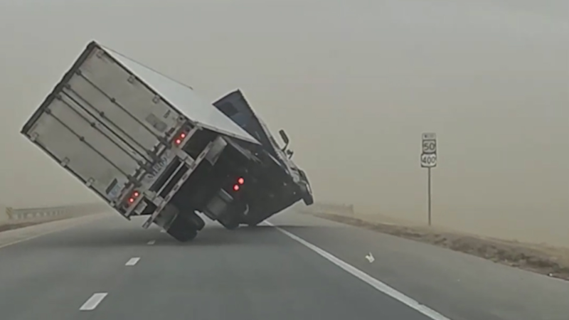
Portions of California will face a high fire risk early this week due to Santa Ana winds, warm air and low relative humidity levels, but there is relief in sight for Southern California.
The initial wave of wet weather will track into the Southwest beginning on Tuesday.
Rain will advance northward through Arizona and New Mexico into the Four Corners region, where moderate-to-severe drought is ongoing.
This first round of rain to track into the region will come from the remaining atmospheric energy left over from former Tropical Storm Raymond.
One area that will likely miss out on beneficial rainfall is portions of the San Joaquin Valley and much of northern California. A heightened fire risk is likely across central and northern California Tuesday night through Wednesday as dry and gusty Diablo winds develop.
This high fire danger midweek is in the same area where the destructive Kincade Fire burned from late October into early November.
Pacific Gas & Electric announced Sunday that it was monitoring the need for another Public Safety Power Shutoff (PSPS) ahead of the wind event.
"To reduce the risk of wildfire in these conditions, PG&E may turn off power to approximately 250,000 customers in portions of 19 counties in the Sierra Foothills, North Valley and North Bay," the utility said.
Customers that may lose power will be notified at least 48 hours before a potential shutoff.
A second wave of energy to track into the West Coast will spread rain across portions of central and Southern California, overnight Tuesday into Wednesday morning.
As rain falls across Southern California on Wednesday morning, motorists can expect a slow and possibly slick commute.
Oil and other liquids that have accumulated on area roadways over the summer months could turn some stretches of roadways into skating rinks for a time.
Both Los Angeles and San Diego average just over 1 inch of rainfall during the month of November and the incoming storm system at midweek has the potential to drop that amount in some locations.
"The last time Riverside, California, received more than a half inch of rain over the course of a week was the week of May 19. This week, Riverside and others may see that amount of rainfall," AccuWeather Meteorologist Mary Gilbert said.
The heaviest of the rain will begin to taper off on Thursday across Southern California, as the storm system centers itself over the Four Corners region.
Phoenix only averages 0.65 of an inch of rainfall during the month of November, and they could also expect an entire month's worth of rain or more as the expansive storm system tracks through.
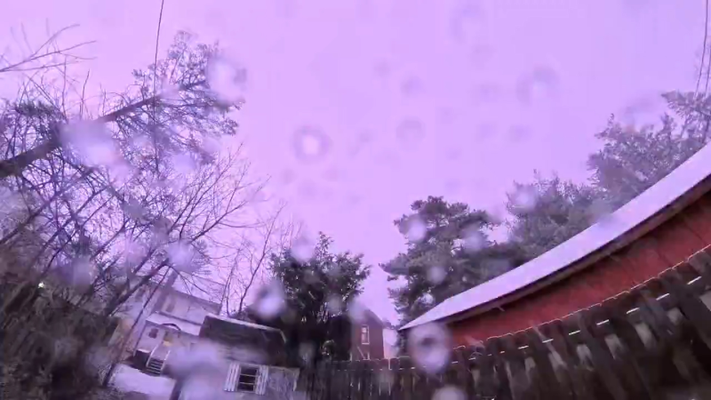
With plenty of cold air in place in the upper levels of the atmosphere, a cold rain will transition to snow across higher elevations.
In places like Flagstaff, Arizona, a cold rain is expected from Tuesday into Wednesday before enough cold air filters in to allow for a transition to snow overnight on Wednesday and possibly into Thursday.
The storm system will continue to track eastward out of the region by Friday.
Although the rain will be largely beneficial, it will likely lead to some issues.
Mudslides and debris flows will pose a threat to lives and property in areas where wildfires have charred the ground earlier this year.
The threat for these issues will increase dramatically in areas ravaged by the deadly Saddle Fire, the expansive Maria Fire or any of the other wildfires that have sparked up this fall.
Download the free AccuWeather app to check the forecast in your area. Keep checking back on AccuWeather.com and stay tuned to the AccuWeather Network on DirecTV, Frontier and Verizon Fios.
Report a Typo


News / Weather Forecasts
Storm system to bring much-needed rainfall to the Southwest and California at midweek
By Brandon Buckingham, AccuWeather Meteorologist
Published Nov 17, 2019 12:12 PM EDT
A brewing storm system has the potential to bring locally heavy rain to portions of the southwestern United States, including California, this week.
After a delayed start to the wet season for both areas, moisture from former Tropical Storm Raymond combined with a separate storm system are forecast to join forces this week to supply much-needed rain.
Since July 26, Fresno has yet to receive a trace of rain in the 115-day span. According to the US Drought Monitor, the majority of Southern California is embroiled in an abnormally dry period with numerous areas reaching moderate drought phases.
Los Angeles has only experienced one day of traceable rain since Oct. 1. If the Fresno and Bakersfield areas receive rain by Wednesday, it will be the third latest start to the wet season on record.
The start of the wet season typically goes hand-in-hand with the conclusion of the fire season across the West. The wet season typically runs from October to April.
California alone has had just over 250,000 acres burned so far this year according to the California Department of Forestry and Fire Protection, which is about 150,000 acres less than the five-year running average across the state.
Portions of California will face a high fire risk early this week due to Santa Ana winds, warm air and low relative humidity levels, but there is relief in sight for Southern California.
The initial wave of wet weather will track into the Southwest beginning on Tuesday.
Rain will advance northward through Arizona and New Mexico into the Four Corners region, where moderate-to-severe drought is ongoing.
This first round of rain to track into the region will come from the remaining atmospheric energy left over from former Tropical Storm Raymond.
One area that will likely miss out on beneficial rainfall is portions of the San Joaquin Valley and much of northern California. A heightened fire risk is likely across central and northern California Tuesday night through Wednesday as dry and gusty Diablo winds develop.
This high fire danger midweek is in the same area where the destructive Kincade Fire burned from late October into early November.
Pacific Gas & Electric announced Sunday that it was monitoring the need for another Public Safety Power Shutoff (PSPS) ahead of the wind event.
"To reduce the risk of wildfire in these conditions, PG&E may turn off power to approximately 250,000 customers in portions of 19 counties in the Sierra Foothills, North Valley and North Bay," the utility said.
Customers that may lose power will be notified at least 48 hours before a potential shutoff.
A second wave of energy to track into the West Coast will spread rain across portions of central and Southern California, overnight Tuesday into Wednesday morning.
As rain falls across Southern California on Wednesday morning, motorists can expect a slow and possibly slick commute.
Oil and other liquids that have accumulated on area roadways over the summer months could turn some stretches of roadways into skating rinks for a time.
Both Los Angeles and San Diego average just over 1 inch of rainfall during the month of November and the incoming storm system at midweek has the potential to drop that amount in some locations.
"The last time Riverside, California, received more than a half inch of rain over the course of a week was the week of May 19. This week, Riverside and others may see that amount of rainfall," AccuWeather Meteorologist Mary Gilbert said.
The heaviest of the rain will begin to taper off on Thursday across Southern California, as the storm system centers itself over the Four Corners region.
Phoenix only averages 0.65 of an inch of rainfall during the month of November, and they could also expect an entire month's worth of rain or more as the expansive storm system tracks through.
Related:
With plenty of cold air in place in the upper levels of the atmosphere, a cold rain will transition to snow across higher elevations.
In places like Flagstaff, Arizona, a cold rain is expected from Tuesday into Wednesday before enough cold air filters in to allow for a transition to snow overnight on Wednesday and possibly into Thursday.
The storm system will continue to track eastward out of the region by Friday.
Although the rain will be largely beneficial, it will likely lead to some issues.
Mudslides and debris flows will pose a threat to lives and property in areas where wildfires have charred the ground earlier this year.
The threat for these issues will increase dramatically in areas ravaged by the deadly Saddle Fire, the expansive Maria Fire or any of the other wildfires that have sparked up this fall.
Download the free AccuWeather app to check the forecast in your area. Keep checking back on AccuWeather.com and stay tuned to the AccuWeather Network on DirecTV, Frontier and Verizon Fios.
Report a Typo