Monsoon low to increase flood threat in India as country lifts more COVID-19 restrictions
By
Maura Kelly, AccuWeather meteorologist
Published Jun 9, 2020 4:02 PM EST
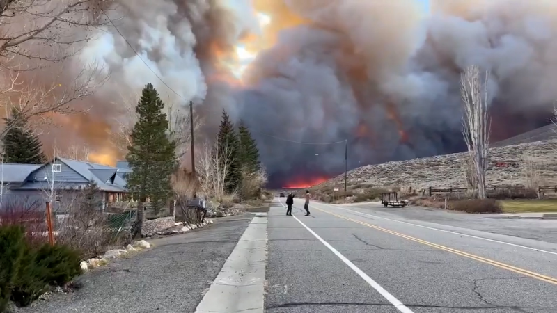
Powerful storms produced heavy rain and strong winds in New Delhi, India, on June 10.
A monsoon low that gradually developed this week helped to speed up the anticipated arrival of rain across parts of India as the wet season gets underway.
Since the second half of May, the leading edge of the monsoon, which brings a wet season to India each summer starting in June, has been gradually advancing across the Bay of Bengal.
In recent days, an area of low pressure developed along this leading edge of moisture as it sits over the bay. This type of low pressure area is typically called a monsoon low.
While a developing low over a body of warm water could lead to tropical development, increased wind shear in the upper levels of the atmosphere, common during the monsoon season, hindered how much this low was able to organize and strengthen.
The low ran out of time to develop into a tropical system as it approached the eastern coast of India through the end of the week.
Widespread areas of heavy rain and thunderstorms spread across parts of northern Andhra Pradesh, Maharashtra, Madhya Pradesh, Chhattisgarh and Odisha as the low moved over the area.
CLICK HERE FOR THE FREE ACCUWEATHER APP
As the low moves over central India through Monday, rainfall totals can climb to 100-200 mm (4-8 inches) where the heaviest thunderstorms and repeated rounds of downpours develop.
An AccuWeather Local StormMax™ of 250 mm (10 inches) will be possible in these areas, which can lead to flooding concerns.
In addition to an increased flood risk, the strongest storms will also threaten the area with gusty winds and frequent lightning strikes.
The monsoon season carries life-threatening risks of severe flooding and dangerous lightning, but the increase in wet weather is essential for crops and the country's water supply.
The monsoon low is occurring just days after India took another step in lifting its coronavirus lockdown. The Guardian reported that the Indian government has allowed places of worship, restaurants and shopping malls to reopen, despite a recent increase in cases. India has over 270,000 cases of COVID-19, the fifth highest total worldwide.
State-run hospitals in the large cities of Mumbai and New Delhi have reportedly run out of beds and are turning people away, according to The Guardian.
Unsettled weather is forecast to continue through Monday with heavy thunderstorms expected to return to western India - the same area recently hit by Severe Cyclonic Storm Nisarga.
AccuWeather Senior Meteorologist Dave Houk explains, "A broad southwesterly flow typical of this time of year will send deep moisture eastward across the Indian Ocean to the coast and coastal ranges of western India."
Houk expects rainfall along the west coast of India to be heavier than what falls across eastern or central parts of the country.
Rainfall through Monday across western Maharashtra, Goa, Karnataka and northwestern Kerala is expected to total 125-250 mm (5-10 inches), with an AccuWeather Local StormMax™ of 500 mm (20 inches).
"Heavy rain will mount and lead to flash flooding, mudslides, as well as infrastructure concerns including roads and bridges." Houk said.
The flash flooding and mudslides can wash out roads and cut off some villages.
The wet season kicked off earlier this month with the leading edge of the monsoon arriving in Kerala on June 1. Since then, the monsoon has expanded into Karnataka, Tamil Nadu and far southern Andhra Pradesh.
AccuWeather forecasters expect near-normal advancement of the monsoon with more widespread showers and thunderstorms expanding to the northwest across India and into Pakistan through the beginning of July.
Keep checking back on AccuWeather.com and stay tuned to the AccuWeather Network on DirecTV, Frontier and Verizon Fios.
Report a Typo


News / Weather Forecasts
Monsoon low to increase flood threat in India as country lifts more COVID-19 restrictions
By Maura Kelly, AccuWeather meteorologist
Published Jun 9, 2020 4:02 PM EST
Powerful storms produced heavy rain and strong winds in New Delhi, India, on June 10.
A monsoon low that gradually developed this week helped to speed up the anticipated arrival of rain across parts of India as the wet season gets underway.
Since the second half of May, the leading edge of the monsoon, which brings a wet season to India each summer starting in June, has been gradually advancing across the Bay of Bengal.
In recent days, an area of low pressure developed along this leading edge of moisture as it sits over the bay. This type of low pressure area is typically called a monsoon low.
While a developing low over a body of warm water could lead to tropical development, increased wind shear in the upper levels of the atmosphere, common during the monsoon season, hindered how much this low was able to organize and strengthen.
The low ran out of time to develop into a tropical system as it approached the eastern coast of India through the end of the week.
Widespread areas of heavy rain and thunderstorms spread across parts of northern Andhra Pradesh, Maharashtra, Madhya Pradesh, Chhattisgarh and Odisha as the low moved over the area.
CLICK HERE FOR THE FREE ACCUWEATHER APP
As the low moves over central India through Monday, rainfall totals can climb to 100-200 mm (4-8 inches) where the heaviest thunderstorms and repeated rounds of downpours develop.
An AccuWeather Local StormMax™ of 250 mm (10 inches) will be possible in these areas, which can lead to flooding concerns.
In addition to an increased flood risk, the strongest storms will also threaten the area with gusty winds and frequent lightning strikes.
The monsoon season carries life-threatening risks of severe flooding and dangerous lightning, but the increase in wet weather is essential for crops and the country's water supply.
The monsoon low is occurring just days after India took another step in lifting its coronavirus lockdown. The Guardian reported that the Indian government has allowed places of worship, restaurants and shopping malls to reopen, despite a recent increase in cases. India has over 270,000 cases of COVID-19, the fifth highest total worldwide.
State-run hospitals in the large cities of Mumbai and New Delhi have reportedly run out of beds and are turning people away, according to The Guardian.
Related:
Unsettled weather is forecast to continue through Monday with heavy thunderstorms expected to return to western India - the same area recently hit by Severe Cyclonic Storm Nisarga.
AccuWeather Senior Meteorologist Dave Houk explains, "A broad southwesterly flow typical of this time of year will send deep moisture eastward across the Indian Ocean to the coast and coastal ranges of western India."
Houk expects rainfall along the west coast of India to be heavier than what falls across eastern or central parts of the country.
Rainfall through Monday across western Maharashtra, Goa, Karnataka and northwestern Kerala is expected to total 125-250 mm (5-10 inches), with an AccuWeather Local StormMax™ of 500 mm (20 inches).
"Heavy rain will mount and lead to flash flooding, mudslides, as well as infrastructure concerns including roads and bridges." Houk said.
The flash flooding and mudslides can wash out roads and cut off some villages.
The wet season kicked off earlier this month with the leading edge of the monsoon arriving in Kerala on June 1. Since then, the monsoon has expanded into Karnataka, Tamil Nadu and far southern Andhra Pradesh.
AccuWeather forecasters expect near-normal advancement of the monsoon with more widespread showers and thunderstorms expanding to the northwest across India and into Pakistan through the beginning of July.
Keep checking back on AccuWeather.com and stay tuned to the AccuWeather Network on DirecTV, Frontier and Verizon Fios.
Report a Typo