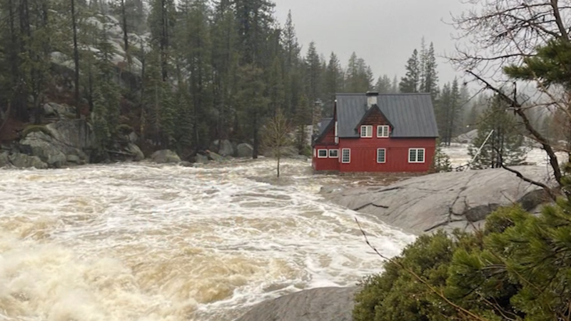
Flash flooding remains an ongoing concern in southern US
Rounds of downpours will persist across the Gulf Coast and Southeast through the start of the weekend, renewing flooding concerns for many.
Additional rain will fall across the lower Mississippi and Tennessee valleys this weekend, further inundating areas that have received plentiful amounts of rainfall since the middle of the week, AccuWeather forecasters say.
The feature responsible for the frequent downpours across the southern United States is a sluggish cold front tracking slowly along the Gulf Coast to the east. This front will gradually push eastward off the Carolina coast through Saturday night and spread additional heavy rain along its path.
Some parts of southwestern Louisiana reported 24-hour rainfall amounts ranging from 2–4 inches from Thursday morning to Friday morning. Totals soared even higher around Lake Charles, Louisiana, where a whopping 6.77 inches of rain was recorded in a day, while totals over 4 inches were observed in some of Houston's northern suburbs. Numerous flash flood watches also remain in place for portions of Louisiana and Mississippi.
“Heavy rain will continue to impact portions of southern Louisiana and Mississippi through Saturday with an additional 1–3 inches of rainfall possible on top of what has fallen in the previous days,” explained AccuWeather Meteorologist Nicole LoBiondo.

After the heavy rainfall that saturated parts of southwestern Louisiana into Friday, any additional rain through Saturday could quickly cause localized flash flooding.
On Thursday, a new daily maximum rainfall record was set for Shreveport, Louisiana, after the city recorded 3.07 inches. This broke the previous record of 3.04 inches set back in 1940. Another daily maximum rainfall record was set in Lufkin, Texas, on Thursday after it received 4.20 inches of rain, smashing the previous record from 1938 by 2 inches.
Some creek and river gauges in northeastern Texas and southern Louisiana have reached minor flood stages, including the Vermilion River near Lafayette, Louisiana, as well as Cypress Creek, Neches River and Angelina River near Lufkin, Texas. There are growing concerns that additional rivers and streams will climb to minor flood stage, with the potential for some elevated waterways to reach moderate flood stage.
Through Saturday, rainfall can become enhanced by the terrain of the southern Appalachian Mountains. This will be particularly true near locations along the border of Tennessee and North Carolina where the western slopes of the mountains can provide what meteorologists call “orographic lift” and heavier rain amounts can be observed.

Thunderstorms and heavy rainfall have already impacted the 87th Masters Tournament in Augusta, Georgia, this weekend, and more impacts are likely on Saturday. Periods of rain and even a thunderstorm are in the forecast, and delays are possible. Forecasters say that conditions will trend drier by the end of the weekend.
GET THE FREE ACCUWEATHER APP
•Have the app? Unlock AccuWeather Alerts™ with Premium+
Regardless of a rain or lightning delay, those attending the tournament will notice cooler conditions compared to what is typically observed in Georgia for mid-April.
After settling in the middle to upper 80s Fahrenheit on Wednesday and Thursday, temperatures fell Saturday in Augusta. As of 2 p.m. EDT Saturday, the temperature in Augusta was 47 degrees, roughly 20-25 degrees below the historical average, with an AccuWeather RealFeel® temperature of 34 degrees. Into early next week, however, temperatures will slowly rebound into the 70s F, closer to the typically observed temperatures this time of year.

As the slow-moving storm system shifts away from the coast of the Carolinas this weekend, there can be gusty winds, strong rip currents and rough surf from the central South Carolina coast to portions of Virginia Beach. Winds will predominately be out of the north-northeast and may gust to 30-50 mph at times as this feature shifts offshore.
The next feature forecasters are monitoring for the Southern states will be a zone of low pressure that is likely to develop off the Gulf Coast by the middle of next week. AccuWeather meteorologists say this system will bring increased rain activity and thunderstorms to the Gulf Coast region and southeastern U.S., as well as gusty winds.
“There is a chance this system could acquire some tropical characteristics as it drifts westward. Whether it becomes a subtropical system or not, it may trigger drenching showers and thunderstorms across the Gulf Coast and Florida Peninsula,” explained AccuWeather Senior Meteorologist Courtney Travis.

Want next-level safety, ad-free? Unlock advanced, hyperlocal severe weather alerts when you subscribe to Premium+ on the AccuWeather app. AccuWeather Alerts™ are prompted by our expert meteorologists who monitor and analyze dangerous weather risks 24/7 to keep you and your family safer.
Report a Typo


