Granada, CO Smoke Map
Near Surface Smoke
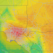
This interactive map helps you identify near surface smoke in your area. Near surface smoke is defined as smoke that will hover within eight meters from the ground. Activating the playbar displays the location of smoke in one-hour increments, in an animated loop. You can also manually drag the scrubber bar. To read more detailed information about how differing smoke levels may impact your health, click the (?) beneath the map. Help improve AccuWeather Maps by sending us feedback. →
Any exposure to the air, even for a few minutes, can lead to serious health effects for anyone. Avoid outdoor activities
Health effects will be immediately felt by sensitive groups and should avoid outdoor activity. Healthy individuals are likely to experience difficulty breathing and throat irritation; consider staying indoors and rescheduling outdoor activities
Health effects can be immediately felt by sensitive groups. Healthy individuals are likely to experience difficulty breathing and throat irritation with prolonged exposure. Limit outdoor activity
The air quality has reached a high level of pollution and is unhealthy for sensitive groups. Reduce time spent outside if you are feeling symptoms such as difficulty breathing or throat irritation
The air quality is generally acceptable for most individuals. However, sensitive groups may experience minor to moderate symptoms from long-term exposure
The air quality is unaffected for most individuals. Enjoy your normal outdoor activities
The air quality is unaffected for most individuals. Enjoy your normal outdoor activities
Top Stories
Winter Weather
Two coastal storms could deliver snow to parts of Northeast this week
13 hours ago

Winter Weather
Plunging temps, snow signal return of typical January winter weather
10 hours ago

Astronomy
NASA to bring Crew-11 astronauts home early after medical issue aboard...
2 days ago

Weather Forecasts
Heavy rain, snowmelt to raise flood risk from Alaska to Washington
13 hours ago

Winter Weather
Storm Goretti sweeps United Kingdom, France with winds over 120 mph
2 days ago
 More Stories
Featured Stories
Astronomy
Newly discovered asteroid spins at record-breaking speed
3 days ago

Astronomy
Meteor showers 2026: The best nights to see shooting stars
3 days ago

Waves in the sky? Rare clouds dazzle in California
LATEST ENTRY
Kelvin-Helmholtz wave clouds appear in California
2 days ago

Weather News
Families face complex challenges 1 year after Eaton, Palisades fires
4 days ago

Astronomy
Hubble telescope spots ‘failed’ starless galaxy known as Cloud 9
5 days ago


