Midweek severe storms in eastern US to pack damaging winds, flooding
The threat of damaging winds, flash flooding, tornadoes and travel disruptions to continue as severe thunderstorms sweep across the mid-Atlantic and the Southeast through midweek.
A driver in Youngstown, Ohio, caught a tornado in the side mirror as severe storms swept through the region with damaging winds, hail, flash flooding and tornado threats.
Dangerous thunderstorms are forecast to redevelop across part of the Atlantic Coast into Wednesday night, just one day after severe weather unleashed flooding, damaging winds and tornadoes from the Midwest to the mid-Atlantic region.
The severe weather situation Wednesday evening will be less intense when compared to Tuesday, with less concentration of powerful thunderstorms.
The severe weather threat will shift southward at midweek, focusing on southern Delaware and southeastern Maryland into central and southeastern Virginia and central and northeastern North Carolina.

The primary severe weather threats into Wednesday night will be damaging wind gusts, with an AccuWeather Local StormMax™ of 75 mph.
Despite the much lower threat for widespread severe weather, some of the strongest storms can still produce a tornado.
Disruptive flash flood risk to continue in parts of East
Midweek torrential downpours and frequent lightning will continue to affect a broad area along the Atlantic Coast after Tuesday's severe weather and significant rainfall. The flash flooding threat will focus from southeastern Virginia to northern Georgia. Pockets of heavy rain and isolated flash flooding will occur farther to the south, and especially in the vicinity of Bertha near the Gulf Coast.
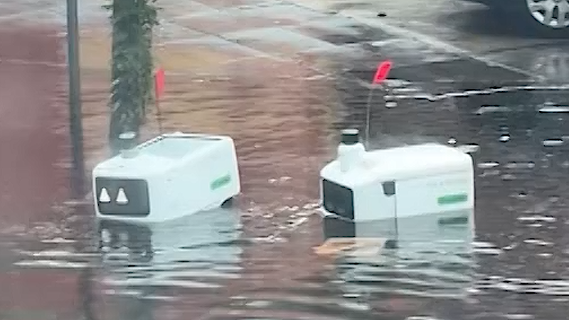
Rain may fall fast enough to overwhelm storm drains and trigger street flooding. In suburban and rural areas, rapidly rising water can quickly cause flash flooding along small streams. Rainfall rates of 2 inches per hour or more are possible in the most intense storms.

Motorists should never drive through flooded roads. Water is often deeper than it appears, road surfaces may be washed away, and conditions can worsen rapidly. Just 1-2 feet of moving water can sweep a vehicle away. Floodwater can also disable a vehicle's electrical system, trapping occupants inside.
"Remember the saying, 'turn around, don't drown,'" AccuWeather On-Air Reporter Anna Azallion said.
Lightning can strike well ahead of an approaching thunderstorm. Move indoors as soon as you hear thunder or see lightning. Trees, canopies, picnic pavilions and golf carts do not offer adequate protection from a lightning strike.
A midsummer's day filled with severe weather
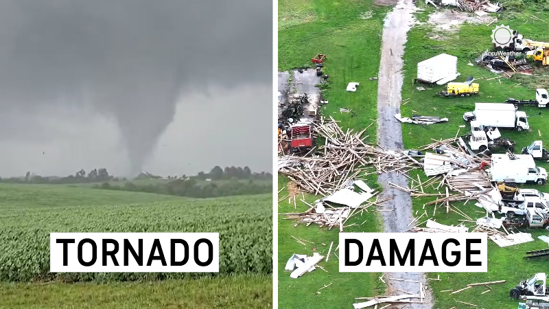
There were hundreds of reports of severe weather Tuesday, including close to a dozen reports of tornadoes from the Midwest to the Atlantic Coast.
Reports of damaging wind stretched from Kentucky into New York as severe thunderstorms raced eastward Tuesday and Tuesday night, with a handful of tornadoes also reported in Kentucky, West Virginia, Ohio, Pennsylvania and New Jersey.

In response to Tuesday's storms, West Virginia Gov. Patrick Morrisey declared a state of emergency for all 55 counties after communities were affected by flooding and storm damage. Overall, a swath of 3-6 inches of rain fell across north-central West Virginia over 12 hours.
Along Sand Run Creek near Buckhannon, West Virginia, the water level surged to 10.63 feet Tuesday evening, shattering the previous record crest of 8.3 feet and reaching major flood stage before receding into the minor flood stage. The Tygart Valley River at Philippi, West Virginia, is also expected to reach major flood stage at 25 feet.


Want next-level safety, ad-free? Unlock advanced, hyperlocal severe weather alerts when you subscribe to Premium+ on the AccuWeather app. AccuWeather Alerts™ are prompted by our expert meteorologists who monitor and analyze dangerous weather risks 24/7 to keep you and your family safer.
Report a Typo