Carina's moisture to bring lingering flooding fears for Taiwan, Japan
By
Maura Kelly, AccuWeather meteorologist
Published Jul 13, 2020 3:47 PM EDT
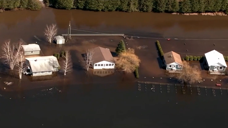
A man kayaked his way through the flooded streets of Oklahoma City, Oklahoma, against heavy rainfall on July 10.
Tropical Depression Carina spun to life just east of the Philippines on Monday, bringing with it rough sea and heavy downpours. The tropical system has since lost wind intensity and is no longer a discernable feature.
A disturbance that moved into the Philippine Sea and toward the Philippines over the weekend developed into a tropical depression east of Luzon in the northern Philippines early Monday morning, local time.
The depression was given the name Carina by the Philippine Atmospheric, Geophysical and Astronomical Services Administration (PAGASA).
On Monday, Carina tracked tracked to the northwest over the northern Philippines passing over the Batanes, bringing tropical downpours to Luzon, Batanes and Babuyan Islands.
This satellite image shows Tropical Depression Carina near the northern Philippines Monday night, local time. Strong wind aloft is pushing most of the showers and thunderstorms to the western side of the storm. (Photo/RAMMB)
Rainfall totals of 40-80 mm (1.60-3.15 inches) were common across this region to start the week. Laoag City, located along the northwestern coast of Luzon, reported the highest amount rainfall total of 244 mm (9.61 inches).
CLICK HERE FOR THE FREE ACCUWEATHER APP
Carina took a turn to the north Tuesday night, tracking towards Tawian. However, the depression came face-to-face with increased wind shear, which caused the system to lose wind intensity by 8 p.m. local time, according to PAGASA's facebook page.
In association with a stalled front over Japan, the leftover moisture from Carina will continue to enhance downpours near Tawian, and perhaps the southern most islands of Japan, through Wednesday night or Thursday.
Rough seas are also expected to persist in this region into Thursday.
According to AccuWeather Lead International Meteorologist Jason Nicholls, rainfall totals can reach 50-100 mm (2-4 inches) in scattered locations across Taiwan with an AccuWeather Local StormMax™ of around 150 mm (6 inches) possible in the highest elevations through Thursday.
"Mudslides will become an increasing concern for any areas trapped under repeated, heavy downpours," warned AccuWeather Meteorologist Mary Gilbert. This will be the case for not just Taiwan, but all the way through much of Japan, where widespread flooding has been the story so far this month.
Keep checking back on AccuWeather.com and stay tuned to the AccuWeather Network on DirecTV, Frontier and Verizon Fios.
Report a Typo


News / Hurricane
Carina's moisture to bring lingering flooding fears for Taiwan, Japan
By Maura Kelly, AccuWeather meteorologist
Published Jul 13, 2020 3:47 PM EDT
A man kayaked his way through the flooded streets of Oklahoma City, Oklahoma, against heavy rainfall on July 10.
Tropical Depression Carina spun to life just east of the Philippines on Monday, bringing with it rough sea and heavy downpours. The tropical system has since lost wind intensity and is no longer a discernable feature.
A disturbance that moved into the Philippine Sea and toward the Philippines over the weekend developed into a tropical depression east of Luzon in the northern Philippines early Monday morning, local time.
The depression was given the name Carina by the Philippine Atmospheric, Geophysical and Astronomical Services Administration (PAGASA).
On Monday, Carina tracked tracked to the northwest over the northern Philippines passing over the Batanes, bringing tropical downpours to Luzon, Batanes and Babuyan Islands.
This satellite image shows Tropical Depression Carina near the northern Philippines Monday night, local time. Strong wind aloft is pushing most of the showers and thunderstorms to the western side of the storm. (Photo/RAMMB)
Rainfall totals of 40-80 mm (1.60-3.15 inches) were common across this region to start the week. Laoag City, located along the northwestern coast of Luzon, reported the highest amount rainfall total of 244 mm (9.61 inches).
CLICK HERE FOR THE FREE ACCUWEATHER APP
Carina took a turn to the north Tuesday night, tracking towards Tawian. However, the depression came face-to-face with increased wind shear, which caused the system to lose wind intensity by 8 p.m. local time, according to PAGASA's facebook page.
In association with a stalled front over Japan, the leftover moisture from Carina will continue to enhance downpours near Tawian, and perhaps the southern most islands of Japan, through Wednesday night or Thursday.
Rough seas are also expected to persist in this region into Thursday.
According to AccuWeather Lead International Meteorologist Jason Nicholls, rainfall totals can reach 50-100 mm (2-4 inches) in scattered locations across Taiwan with an AccuWeather Local StormMax™ of around 150 mm (6 inches) possible in the highest elevations through Thursday.
Related:
"Mudslides will become an increasing concern for any areas trapped under repeated, heavy downpours," warned AccuWeather Meteorologist Mary Gilbert. This will be the case for not just Taiwan, but all the way through much of Japan, where widespread flooding has been the story so far this month.
Keep checking back on AccuWeather.com and stay tuned to the AccuWeather Network on DirecTV, Frontier and Verizon Fios.
Report a Typo